Property Record
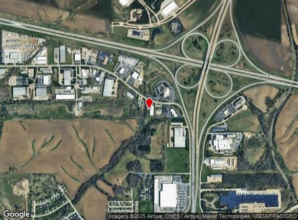
101 W 76Th St, Davenport, IA 52806


NEARBY LISTINGS FOR SALE OR LEASE
Property Detail
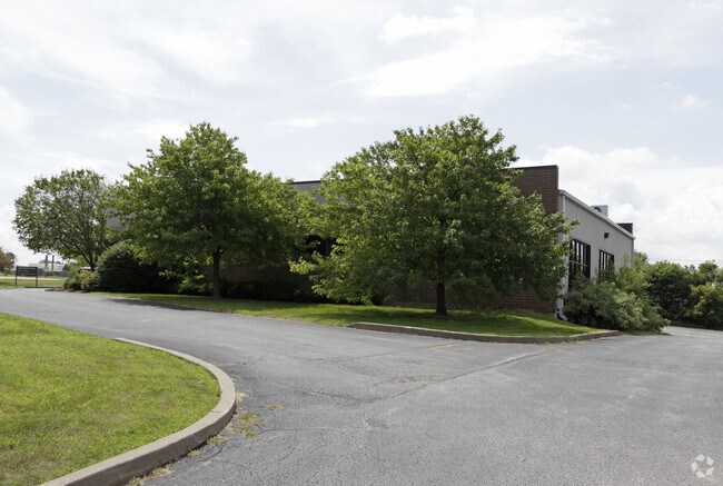
101 W 76Th St
Davenport-Moline-Rock Island, IA-IL
Steeplegate Plaza Condo
X0207-01G
STEEPLEGATE PLAZA CONDO LOT: 101 BLOCK: 103 STEEPLEGATE PLAZACONDOMINIUMS UNIT'S101-102-103
Officebuilding
Scott
X
Iowa
19163C0355H
101
2025
0.58 AC
2025
Greater Davenport
012801
Davenport/Moline/Rock Island
4,866 SF
DEMOGRAPHICS near 101 W 76Th St
1 Mile
3 Mile
5 Mile
2024 Total Population
2,085
36,007
113,299
2029 Population
2,133
35,853
112,729
Pop Growth 2024-2029
+ 2.30%
(0.43%)
(0.50%)
Average Age
35
40
39
2024 Total Households
793
15,287
46,925
HH Growth 2024-2029
+ 2.14%
(0.50%)
(0.49%)
Median Household Inc
$44,575
$59,341
$60,982
Avg Household Size
2.50
2.30
2.30
2024 Avg HH Vehicles
1.00
2.00
2.00
Median Home Value
$145,890
$188,348
$177,366
Median Year Built
1986
1979
1969
Nearby Places
Map Layers
Map Styles
 Street
 Aerial
- Restaurants
- Banks
- Shops
- Fitness
- Groceries
PUBLIC TRANSPORTATION
AIRPORT
Quad Cities International
DRIVE
WALK
Distance
Quad Cities International
30 min
15.4 mi
Freight Ports
Port Milwaukee
DRIVE
WALK
Distance
Port Milwaukee
239 min
211.6 mi
SALE & LEASE HISTORY
LISTING DATE
SALE/LEASE

Sep 25, 2016
For Lease
Nearby Properties
Address
Land Use
TOTAL SIZE
Lot Size
Zoning
Address
Land Use
TOTAL SIZE
Lot Size
Zoning
2,615,134 SF
120.68 AC
Address
Land Use
TOTAL SIZE
Lot Size
Zoning
2,545,300 SF
159.73 AC
Address
Land Use
TOTAL SIZE
Lot Size
Zoning
92,431 SF
40.01 AC
Address
Land Use
TOTAL SIZE
Lot Size
Zoning
3,360 SF
42.55 AC
Address
Land Use
TOTAL SIZE
Lot Size
Zoning
128,100 SF
14.65 AC
Address
Land Use
TOTAL SIZE
Lot Size
Zoning
45,602 SF
149.61 AC
Address
Land Use
TOTAL SIZE
Lot Size
Zoning
27,225 SF
40.34 AC
Address
Land Use
TOTAL SIZE
Lot Size
Zoning
27,306 SF
50.57 AC
Address
Land Use
TOTAL SIZE
Lot Size
Zoning
688 SF
56.76 AC
Address
Land Use
TOTAL SIZE
Lot Size
Zoning
300,718 SF
14.71 AC
Address
Land Use
TOTAL SIZE
Lot Size
Zoning
472,569 SF
47.24 AC
Address
Land Use
TOTAL SIZE
Lot Size
Zoning
12,500 SF
578.76 AC
Address
Land Use
TOTAL SIZE
Lot Size
Zoning
123,823 SF
6.46 AC
Address
Land Use
TOTAL SIZE
Lot Size
Zoning
4,804 SF
202 AC
Address
Land Use
TOTAL SIZE
Lot Size
Zoning
25,176 SF
13.85 AC
Address
Land Use
TOTAL SIZE
Lot Size
Zoning
27,312 SF
15.04 AC
Address
Land Use
TOTAL SIZE
Lot Size
Zoning
8,000 SF
4.59 AC
Address
Land Use
TOTAL SIZE
Lot Size
Zoning
156,632 SF
17.67 AC
Address
Land Use
TOTAL SIZE
Lot Size
Zoning
197,946 SF
18.64 AC
Address
Land Use
TOTAL SIZE
Lot Size
Zoning
4,800 SF
18.86 AC
Address
Land Use
TOTAL SIZE
Lot Size
Zoning
4,958 SF
15.49 AC
Address
Land Use
TOTAL SIZE
Lot Size
Zoning
99,540 SF
10.95 AC
Address
Land Use
TOTAL SIZE
Lot Size
Zoning
226,764 SF
23.52 AC
Address
Land Use
TOTAL SIZE
Lot Size
Zoning
111,452 SF
40 AC
Address
Land Use
TOTAL SIZE
Lot Size
Zoning
50,880 SF
11.36 AC
Address
Land Use
TOTAL SIZE
Lot Size
Zoning
422,688 SF
16.44 AC
Address
Land Use
TOTAL SIZE
Lot Size
Zoning
165,770 SF
13.77 AC
Address
Land Use
TOTAL SIZE
Lot Size
Zoning
348,893 SF
15.30 AC
Address
Land Use
TOTAL SIZE
Lot Size
Zoning
78,037 SF
17.06 AC
Address
Land Use
TOTAL SIZE
Lot Size
Zoning
105,195 SF
10.37 AC
The World's #1 Commercial Real Estate Marketplace
Connect with us
© 2025 CoStar Group
The information above has been obtained from sources believed reliable. While we do not doubt its accuracy we have not verified it and make no guarantee, warranty or representation about it. It is your responsibility to independently confirm its accuracy and completeness. Any projections, opinions, assumptions, or estimates used are for example only and do not represent the current or future performance of the property. The value of this transaction to you depends on tax and other factors which should be evaluated by your tax, financial, and legal advisors. You and your advisors should conduct a careful, independent investigation of the property to determine to your satisfaction the suitability of the property for your needs.