Property Record
101 Adams Dr, Demorest, GA 30535


Save to a Folder
{{folder.Name}}
{{folder.ListingIds.length}} Properties
{{folder.ListingIds.length}} Property
Create a New Folder
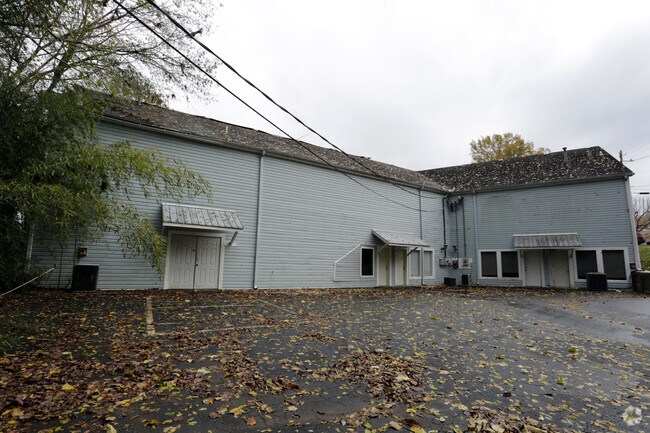
Property Detail
101 Adams Dr
075-049
10-39 PB 16-65 1220-62
Medicalbuilding
Habersham
HI
Georgia
B and X Area of moderate flood hazard, usually the area between the limits of the 100-year and 500-year floods.
39
2025
0.30 AC
2025
Georgia Northeast
000502
Other Market Areas
3,599 SF
Cornelia, GA
NEARBY LISTINGS FOR SALE OR LEASE
DEMOGRAPHICS near 101 Adams Dr
1 mile
3 mile
5 mile
2025 Total Population
1,190
10,602
25,966
2030 Population
1,286
11,431
27,983
Pop Growth 2025-2030
+ 8.07%
+ 7.82%
+ 7.77%
Average Age
40
41
40
2025 Total Households
421
3,918
9,603
HH Growth 2025-2030
+ 8.08%
+ 7.89%
+ 7.80%
Median Household Inc
$64,411
$67,327
$67,267
Avg Household Size
2.60
2.50
2.60
2025 Avg HH Vehicles
2.00
2.00
2.00
Median Home Value
$201,429
$240,933
$246,380
Median Year Built
1984
1990
1991
Nearby Places
Map Layers
Map Styles
 Street
 Aerial
Layers
 Traffic
 Biking
Places
Listings with unknown addresses are not visible on the map
- Restaurants
- Banks
- Shops
- Fitness
- Groceries
SALE & LEASE HISTORY
LISTING DATE
SALE/LEASE

Nov 29, 2017
For Sale
Nov 28, 2018
For Sale
Nearby Properties
Address
Land Use
TOTAL SIZE
Lot Size
Zoning
Address
Land Use
TOTAL SIZE
Lot Size
Zoning
216,507 SF
159.83 AC
MI
Address
Land Use
TOTAL SIZE
Lot Size
Zoning
253,404 SF
22 AC
HI
Address
Land Use
TOTAL SIZE
Lot Size
Zoning
97,985 SF
30 AC
LI
Address
Land Use
TOTAL SIZE
Lot Size
Zoning
144,690 SF
7.51 AC
HI
Address
Land Use
TOTAL SIZE
Lot Size
Zoning
57,800 SF
2.58 AC
SFR
Address
Land Use
TOTAL SIZE
Lot Size
Zoning
77,729 SF
69.23 AC
I
Address
Land Use
TOTAL SIZE
Lot Size
Zoning
55,608 SF
27.85 AC
I
Address
Land Use
TOTAL SIZE
Lot Size
Zoning
105,213 SF
8.49 AC
HI
Address
Land Use
TOTAL SIZE
Lot Size
Zoning
137,005 SF
20.74 AC
HI
Address
Land Use
TOTAL SIZE
Lot Size
Zoning
131,703 SF
15.25 AC
B1
Address
Land Use
TOTAL SIZE
Lot Size
Zoning
247,562 SF
26.58 AC
I
Address
Land Use
TOTAL SIZE
Lot Size
Zoning
66,865 SF
7.06 AC
R2
Address
Land Use
TOTAL SIZE
Lot Size
Zoning
175,337 SF
10.63 AC
I
Address
Land Use
TOTAL SIZE
Lot Size
Zoning
27,492 SF
25.58 AC
LI
Address
Land Use
TOTAL SIZE
Lot Size
Zoning
21,168 SF
5.32 AC
HI
Address
Land Use
TOTAL SIZE
Lot Size
Zoning
17,955 SF
12 AC
INS
Address
Land Use
TOTAL SIZE
Lot Size
Zoning
70,563 SF
9.66 AC
R1A
Address
Land Use
TOTAL SIZE
Lot Size
Zoning
8,725 SF
7.44 AC
LI
Address
Land Use
TOTAL SIZE
Lot Size
Zoning
183,619 SF
15.20 AC
MI
Address
Land Use
TOTAL SIZE
Lot Size
Zoning
30,632 SF
16.42 AC
LI
Address
Land Use
TOTAL SIZE
Lot Size
Zoning
44,885 SF
33.44 AC
LI
Address
Land Use
TOTAL SIZE
Lot Size
Zoning
72,402 SF
8.45 AC
HI
Address
Land Use
TOTAL SIZE
Lot Size
Zoning
50,890 SF
0.80 AC
CB
Address
Land Use
TOTAL SIZE
Lot Size
Zoning
87,830 SF
9.48 AC
B1
Address
Land Use
TOTAL SIZE
Lot Size
Zoning
32,210 SF
25.25 AC
HI
Address
Land Use
TOTAL SIZE
Lot Size
Zoning
66,994 SF
8 AC
I
Address
Land Use
TOTAL SIZE
Lot Size
Zoning
34,422 SF
1.50 AC
CB
Address
Land Use
TOTAL SIZE
Lot Size
Zoning
40,450 SF
2.20 AC
INS
Address
Land Use
TOTAL SIZE
Lot Size
Zoning
10,256 SF
1.35 AC
HB
Address
Land Use
TOTAL SIZE
Lot Size
Zoning
77,778 SF
18 AC
MI
The World's #1 Commercial Real Estate Marketplace
Connect with us
© 2026 CoStar Group
The information above has been obtained from sources believed reliable. While we do not doubt its accuracy we have not verified it and make no guarantee, warranty or representation about it. It is your responsibility to independently confirm its accuracy and completeness. Any projections, opinions, assumptions, or estimates used are for example only and do not represent the current or future performance of the property. The value of this transaction to you depends on tax and other factors which should be evaluated by your tax, financial, and legal advisors. You and your advisors should conduct a careful, independent investigation of the property to determine to your satisfaction the suitability of the property for your needs.