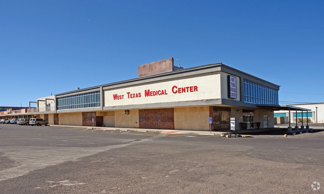
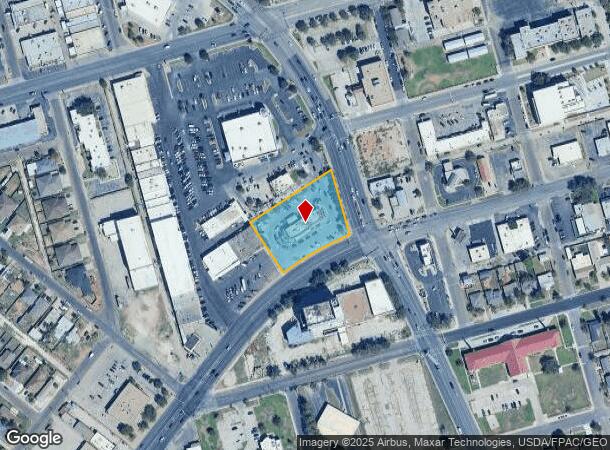
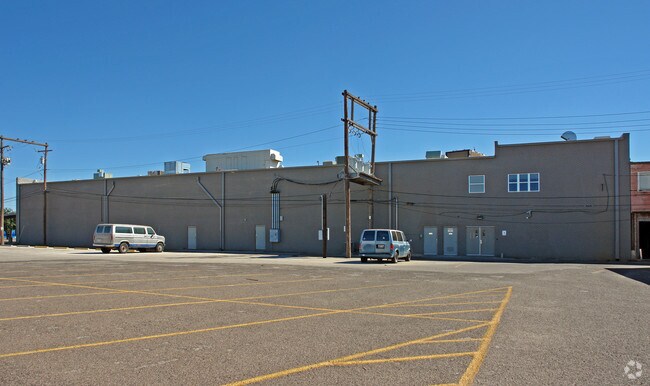
Property Record
101 Andrews Hwy, Midland, TX 79701
Property Detail
101 Andrews Hwy
Other Market Areas
The Village
Midland, TX
ACRES: 1.340 BLK: LOTS: 022 THRU 25 ADDN: THE VILLAGE SEC 4
R000049-786
Midland
Realpropertynec
Texas
2025
22-25
2025
1.34 AC
001100
Midland & Odessa
50,400 SF
NEARBY LISTINGS FOR SALE OR LEASE
DEMOGRAPHICS near 101 Andrews Hwy
1 mile
3 mile
5 mile
2024 Total Population
8,142
76,724
135,281
2029 Population
8,279
78,633
139,668
Pop Growth 2024-2029
+ 1.68%
+ 2.49%
+ 3.24%
Average Age
36
35
35
2024 Total Households
2,980
27,305
49,083
HH Growth 2024-2029
+ 1.98%
+ 2.82%
+ 3.59%
Median Household Inc
$66,863
$65,501
$81,187
Avg Household Size
2.60
2.70
2.70
2024 Avg HH Vehicles
2.00
2.00
2.00
Median Home Value
$226,899
$237,749
$271,834
Median Year Built
1956
1970
1985
Nearby Places
Map Layers
Map Styles
 Street
 Aerial
Transit
 Traffic
 Biking
Places
Listings with unknown addresses are not visible on the map
- Restaurants
- Banks
- Shops
- Fitness
- Groceries
PUBLIC TRANSPORTATION
AIRPORT
Midland International Air And Space Port
Drive
Walk
Distance
Midland International Air And Space Port
15 min
9.4 mi
Nearby Properties
Address
Land Use
TOTAL SIZE
Lot Size
Zoning
Address
Land Use
TOTAL SIZE
Lot Size
Zoning
56,157 SF
18.19 AC
PDOC
Address
Land Use
TOTAL SIZE
Lot Size
Zoning
15,052 SF
4.68 AC
C1
Address
Land Use
TOTAL SIZE
Lot Size
Zoning
245,203 SF
18.40 AC
Address
Land Use
TOTAL SIZE
Lot Size
Zoning
94,059 SF
15.95 AC
PDMX
Address
Land Use
TOTAL SIZE
Lot Size
Zoning
37,220 SF
7.95 AC
O2
Address
Land Use
TOTAL SIZE
Lot Size
Zoning
2,453 SF
13.68 AC
Address
Land Use
TOTAL SIZE
Lot Size
Zoning
29,645 SF
2.07 AC
C1
Address
Land Use
TOTAL SIZE
Lot Size
Zoning
10,228 SF
15.98 AC
Address
Land Use
TOTAL SIZE
Lot Size
Zoning
8,004 SF
3.58 AC
C1
Address
Land Use
TOTAL SIZE
Lot Size
Zoning
44,784 SF
11.97 AC
MF1
Address
Land Use
TOTAL SIZE
Lot Size
Zoning
133,056 SF
2.07 AC
C1
Address
Land Use
TOTAL SIZE
Lot Size
Zoning
7,526 SF
12 AC
MF1
Address
Land Use
TOTAL SIZE
Lot Size
Zoning
46,010 SF
13.02 AC
PDOC
Address
Land Use
TOTAL SIZE
Lot Size
Zoning
7,200 SF
2.07 AC
C1
Address
Land Use
TOTAL SIZE
Lot Size
Zoning
46,512 SF
0.96 AC
C1
Address
Land Use
TOTAL SIZE
Lot Size
Zoning
209,680 SF
6.16 AC
Address
Land Use
TOTAL SIZE
Lot Size
Zoning
96,390 SF
0.96 AC
C1
Address
Land Use
TOTAL SIZE
Lot Size
Zoning
7,008 SF
0.96 AC
C1
Address
Land Use
TOTAL SIZE
Lot Size
Zoning
13.73 AC
Address
Land Use
TOTAL SIZE
Lot Size
Zoning
41,790 SF
1.50 AC
C1
Address
Land Use
TOTAL SIZE
Lot Size
Zoning
5,600 SF
10.18 AC
PDMX
Address
Land Use
TOTAL SIZE
Lot Size
Zoning
12.91 AC
Address
Land Use
TOTAL SIZE
Lot Size
Zoning
276 SF
0.48 AC
C1
Address
Land Use
TOTAL SIZE
Lot Size
Zoning
1,868 SF
8.47 AC
MF1
Address
Land Use
TOTAL SIZE
Lot Size
Zoning
1,206 SF
4.08 AC
Address
Land Use
TOTAL SIZE
Lot Size
Zoning
111,354 SF
8.34 AC
Address
Land Use
TOTAL SIZE
Lot Size
Zoning
137,457 SF
8.73 AC
MF1
Address
Land Use
TOTAL SIZE
Lot Size
Zoning
97,700 SF
10.79 AC
Address
Land Use
TOTAL SIZE
Lot Size
Zoning
26,390 SF
1.01 AC
C1
The World's #1 Commercial Real Estate Marketplace
Connect with us
© 2026 CoStar Group
The information above has been obtained from sources believed reliable. While we do not doubt its accuracy we have not verified it and make no guarantee, warranty or representation about it. It is your responsibility to independently confirm its accuracy and completeness. Any projections, opinions, assumptions, or estimates used are for example only and do not represent the current or future performance of the property. The value of this transaction to you depends on tax and other factors which should be evaluated by your tax, financial, and legal advisors. You and your advisors should conduct a careful, independent investigation of the property to determine to your satisfaction the suitability of the property for your needs.