Property Record
101 Cherry St, Burlington, VT 05401

Property Detail
101 Cherry St
(035) 044-4-004-001
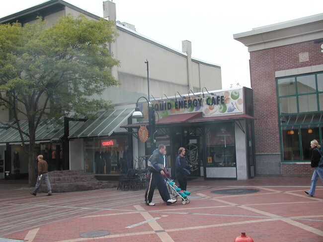
DBA- 1- ZINNIA CHICO`S CLOTHING
Commercialnec
Chittenden
FD6
Vermont
B and X Area of moderate flood hazard, usually the area between the limits of the 100-year and 500-year floods.
0.74 AC
2024
Downtown Burlington
2024
Other Market Areas
001000
Burlington-South Burlington, VT
65,918 SF
NEARBY LISTINGS FOR SALE OR LEASE
DEMOGRAPHICS near 101 Cherry St
1 mile
3 mile
5 mile
2025 Total Population
20,829
60,388
92,796
2030 Population
20,843
60,768
93,684
Pop Growth 2025-2030
+ 0.07%
+ 0.63%
+ 0.96%
Average Age
34
36
38
2025 Total Households
9,214
24,802
38,432
HH Growth 2025-2030
+ 0.22%
+ 0.72%
+ 1.07%
Median Household Inc
$60,149
$78,350
$89,132
Avg Household Size
2.00
2.10
2.10
2025 Avg HH Vehicles
1.00
1.00
2.00
Median Home Value
$551,877
$424,452
$424,317
Median Year Built
1948
1967
1975
Nearby Places
Map Layers
Map Styles
 Street
 Aerial
Layers
 Traffic
 Biking
Places
Listings with unknown addresses are not visible on the map
- Restaurants
- Banks
- Shops
- Fitness
- Groceries
PUBLIC TRANSPORTATION
COMMUTER RAIL
Burlington (Ethan Allen Express - Amtrak)
Drive
Walk
Distance
Burlington (Ethan Allen Express - Amtrak)
2 min
10 min
0.5 mi
Essex Junction-Burlington Amtrak Station (Vermonter - Amtrak)
Drive
Walk
Distance
Essex Junction-Burlington Amtrak Station (Vermonter - Amtrak)
17 min
6.4 mi
AIRPORT
Patrick Leahy Burlington International
Drive
Walk
Distance
Patrick Leahy Burlington International
18 min
5.0 mi
Plattsburgh International
Drive
Walk
Distance
Plattsburgh International
69 min
33.8 mi
Freight Ports
Montreal
Drive
Walk
Distance
Montreal
128 min
97.1 mi
Nearby Properties
Address
Land Use
TOTAL SIZE
Lot Size
Zoning
Address
Land Use
TOTAL SIZE
Lot Size
Zoning
2,542,351 SF
34.82 AC
I
Address
Land Use
TOTAL SIZE
Lot Size
Zoning
Address
Land Use
TOTAL SIZE
Lot Size
Zoning
168,175 SF
I
Address
Land Use
TOTAL SIZE
Lot Size
Zoning
2.96 AC
I
Address
Land Use
TOTAL SIZE
Lot Size
Zoning
12.26 AC
I
Address
Land Use
TOTAL SIZE
Lot Size
Zoning
Address
Land Use
TOTAL SIZE
Lot Size
Zoning
27.70 AC
Address
Land Use
TOTAL SIZE
Lot Size
Zoning
232,277 SF
17.20 AC
I
Address
Land Use
TOTAL SIZE
Lot Size
Zoning
Address
Land Use
TOTAL SIZE
Lot Size
Zoning
167,016 SF
2.30 AC
I
Address
Land Use
TOTAL SIZE
Lot Size
Zoning
32.43 AC
I
Address
Land Use
TOTAL SIZE
Lot Size
Zoning
1.70 AC
FD6
Address
Land Use
TOTAL SIZE
Lot Size
Zoning
19.86 AC
I
Address
Land Use
TOTAL SIZE
Lot Size
Zoning
Address
Land Use
TOTAL SIZE
Lot Size
Zoning
98,123 SF
I
Address
Land Use
TOTAL SIZE
Lot Size
Zoning
20.87 AC
RL
Address
Land Use
TOTAL SIZE
Lot Size
Zoning
Address
Land Use
TOTAL SIZE
Lot Size
Zoning
157,081 SF
I
Address
Land Use
TOTAL SIZE
Lot Size
Zoning
1.16 AC
FD6
Address
Land Use
TOTAL SIZE
Lot Size
Zoning
181,068 SF
I
Address
Land Use
TOTAL SIZE
Lot Size
Zoning
140,910 SF
2.72 AC
I
Address
Land Use
TOTAL SIZE
Lot Size
Zoning
2.06 AC
FD6
Address
Land Use
TOTAL SIZE
Lot Size
Zoning
11.82 AC
ELM
Address
Land Use
TOTAL SIZE
Lot Size
Zoning
Address
Land Use
TOTAL SIZE
Lot Size
Zoning
6.50 AC
I
Address
Land Use
TOTAL SIZE
Lot Size
Zoning
68,321 SF
4.60 AC
I
Address
Land Use
TOTAL SIZE
Lot Size
Zoning
Address
Land Use
TOTAL SIZE
Lot Size
Zoning
119,561 SF
1.86 AC
FD5
Address
Land Use
TOTAL SIZE
Lot Size
Zoning
8,680 SF
45.56 AC
EAE
Address
Land Use
TOTAL SIZE
Lot Size
Zoning
140.43 AC
I
The World's #1 Commercial Real Estate Marketplace
Connect with us
© 2026 CoStar Group
The information above has been obtained from sources believed reliable. While we do not doubt its accuracy we have not verified it and make no guarantee, warranty or representation about it. It is your responsibility to independently confirm its accuracy and completeness. Any projections, opinions, assumptions, or estimates used are for example only and do not represent the current or future performance of the property. The value of this transaction to you depends on tax and other factors which should be evaluated by your tax, financial, and legal advisors. You and your advisors should conduct a careful, independent investigation of the property to determine to your satisfaction the suitability of the property for your needs.