Property Record
101 Durand Rd, Lagrange, GA 30241
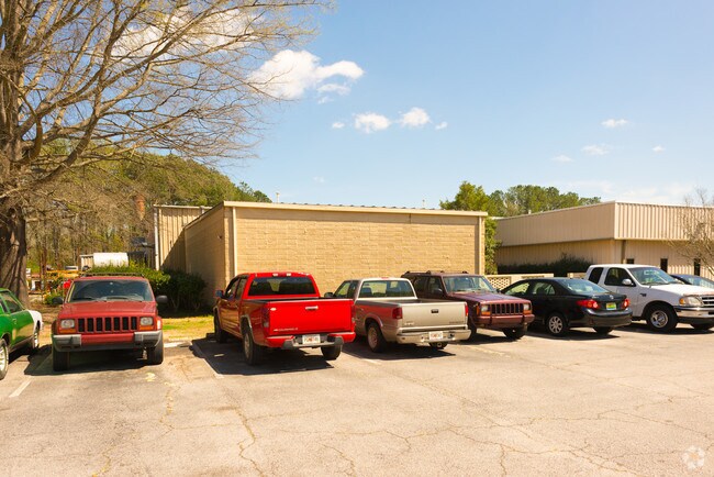

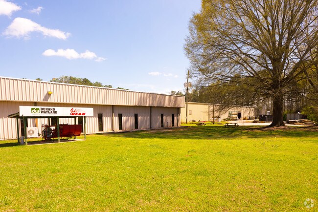
Property Detail
101 Durand Rd
050-4A-008-003
101 DURAND RD/PB-74 PG-226-230
Manufacturinglight
Troup
16- CP-GI
Georgia
B and X Area of moderate flood hazard, usually the area between the limits of the 100-year and 500-year floods.
120
2025
11.40 AC
2025
Troup County
960600
Columbus GA
90,000 SF
LaGrange, GA-AL
NEARBY LISTINGS FOR SALE OR LEASE
DEMOGRAPHICS near 101 Durand Rd
1 mile
3 mile
5 mile
2025 Total Population
1,808
24,820
39,053
2030 Population
1,907
25,850
40,474
Pop Growth 2025-2030
+ 5.48%
+ 4.15%
+ 3.64%
Average Age
40
38
38
2025 Total Households
664
9,777
15,043
HH Growth 2025-2030
+ 5.87%
+ 4.30%
+ 3.84%
Median Household Inc
$58,666
$39,868
$46,123
Avg Household Size
2.50
2.50
2.50
2025 Avg HH Vehicles
2.00
2.00
2.00
Median Home Value
$305,242
$182,433
$202,966
Median Year Built
1993
1983
1983
Nearby Places
Map Layers
Map Styles
 Street
 Aerial
Transit
 Traffic
 Biking
Places
Listings with unknown addresses are not visible on the map
- Restaurants
- Banks
- Shops
- Fitness
- Groceries
Nearby Properties
Address
Land Use
TOTAL SIZE
Lot Size
Zoning
Address
Land Use
TOTAL SIZE
Lot Size
Zoning
Address
Land Use
TOTAL SIZE
Lot Size
Zoning
20,096 SF
36.59 AC
16- AC-MX
Address
Land Use
TOTAL SIZE
Lot Size
Zoning
28,575 SF
45.67 AC
16- CR-MX
Address
Land Use
TOTAL SIZE
Lot Size
Zoning
109,533 SF
1.80 AC
16- DT-MX
Address
Land Use
TOTAL SIZE
Lot Size
Zoning
117,684 SF
12.61 AC
16- AC-MX
Address
Land Use
TOTAL SIZE
Lot Size
Zoning
277,964 SF
43.40 AC
16- CP-GI
Address
Land Use
TOTAL SIZE
Lot Size
Zoning
211,264 SF
57.40 AC
16- AC-MX
Address
Land Use
TOTAL SIZE
Lot Size
Zoning
174,899 SF
7.52 AC
16- TN-R
Address
Land Use
TOTAL SIZE
Lot Size
Zoning
25,314 SF
25.48 AC
16- AC-MR
Address
Land Use
TOTAL SIZE
Lot Size
Zoning
845,961 SF
214.16 AC
16- CP-GI
Address
Land Use
TOTAL SIZE
Lot Size
Zoning
Address
Land Use
TOTAL SIZE
Lot Size
Zoning
2,152 SF
21.70 AC
16- CR-MR
Address
Land Use
TOTAL SIZE
Lot Size
Zoning
92,907 SF
41.61 AC
16- CP-GI
Address
Land Use
TOTAL SIZE
Lot Size
Zoning
141,328 SF
7.18 AC
16- TN-MX
Address
Land Use
TOTAL SIZE
Lot Size
Zoning
136,640 SF
41.91 AC
16- CP-GI
Address
Land Use
TOTAL SIZE
Lot Size
Zoning
159,645 SF
2.98 AC
16- DT-MX
Address
Land Use
TOTAL SIZE
Lot Size
Zoning
29,520 SF
1.92 AC
16- CP-GB
Address
Land Use
TOTAL SIZE
Lot Size
Zoning
190,149 SF
20.67 AC
16- CP-GI
Address
Land Use
TOTAL SIZE
Lot Size
Zoning
121,889 SF
8.99 AC
16- CR-MX
Address
Land Use
TOTAL SIZE
Lot Size
Zoning
3,798 SF
22.81 AC
16- CR-MR
Address
Land Use
TOTAL SIZE
Lot Size
Zoning
8,448 SF
25.78 AC
16- CR-MX
Address
Land Use
TOTAL SIZE
Lot Size
Zoning
56,620 SF
5.22 AC
16- CR-MX
Address
Land Use
TOTAL SIZE
Lot Size
Zoning
82,725 SF
5.98 AC
16- TN-R
Address
Land Use
TOTAL SIZE
Lot Size
Zoning
Address
Land Use
TOTAL SIZE
Lot Size
Zoning
251,428 SF
10.80 AC
16- CP-GI
Address
Land Use
TOTAL SIZE
Lot Size
Zoning
22,600 SF
15.57 AC
16- CR-MX
Address
Land Use
TOTAL SIZE
Lot Size
Zoning
3,433 SF
19.65 AC
16- CR-MR
Address
Land Use
TOTAL SIZE
Lot Size
Zoning
4,428 SF
9.67 AC
16- CR-MR
Address
Land Use
TOTAL SIZE
Lot Size
Zoning
2,366 SF
8.70 AC
16- CR-MR
Address
Land Use
TOTAL SIZE
Lot Size
Zoning
8,752 SF
13.43 AC
16- CR-MR
The World's #1 Commercial Real Estate Marketplace
Connect with us
© 2026 CoStar Group
The information above has been obtained from sources believed reliable. While we do not doubt its accuracy we have not verified it and make no guarantee, warranty or representation about it. It is your responsibility to independently confirm its accuracy and completeness. Any projections, opinions, assumptions, or estimates used are for example only and do not represent the current or future performance of the property. The value of this transaction to you depends on tax and other factors which should be evaluated by your tax, financial, and legal advisors. You and your advisors should conduct a careful, independent investigation of the property to determine to your satisfaction the suitability of the property for your needs.