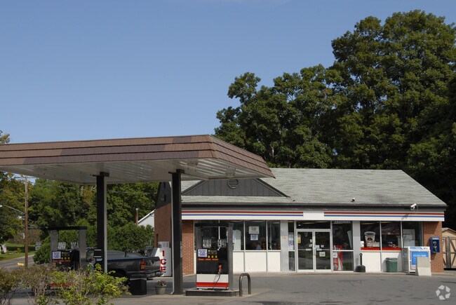
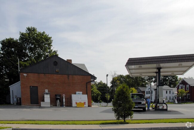
Property Record
101 E Main St, Elbridge, NY 13060
Property Detail
101 E Main St
312801-021-000-0004-024-000-0000
FL 83
Servicestationmarket
Onondaga
05 - COMME
New York
B and X Area of moderate flood hazard, usually the area between the limits of the 100-year and 500-year floods.
17.000
2025
0.35 AC
2024
W Outer Onondaga County
012000
Syracuse
1,260 SF
Syracuse, NY
NEARBY LISTINGS FOR SALE OR LEASE
-
-
View all Elbridge listings for sale on LoopNet.com
DEMOGRAPHICS near 101 E Main St
1 mile
3 mile
5 mile
2025 Total Population
1,043
6,199
10,235
2030 Population
1,016
6,195
10,198
Pop Growth 2025-2030
(2.59%)
(0.06%)
(0.36%)
Average Age
46
45
45
2025 Total Households
455
2,635
4,290
HH Growth 2025-2030
(2.64%)
(0.15%)
(0.42%)
Median Household Inc
$72,347
$70,340
$75,358
Avg Household Size
2.30
2.30
2.30
2025 Avg HH Vehicles
2.00
2.00
2.00
Median Home Value
$196,428
$158,420
$181,419
Median Year Built
1969
1973
1971
Nearby Places
Map Layers
Map Styles
 Street
 Aerial
Transit
 Traffic
 Biking
Places
Listings with unknown addresses are not visible on the map
- Restaurants
- Banks
- Shops
- Fitness
- Groceries
PUBLIC TRANSPORTATION
AIRPORT
Syracuse Hancock International
Drive
Walk
Distance
Syracuse Hancock International
33 min
22.7 mi
Nearby Properties
Address
Land Use
TOTAL SIZE
Lot Size
Zoning
Address
Land Use
TOTAL SIZE
Lot Size
Zoning
305,558 SF
28.34 AC
9
Address
Land Use
TOTAL SIZE
Lot Size
Zoning
107,558 SF
57.12 AC
08 - GOVER
Address
Land Use
TOTAL SIZE
Lot Size
Zoning
185,026 SF
16.72 AC
9
Address
Land Use
TOTAL SIZE
Lot Size
Zoning
60,794 SF
39.61 AC
02 - SINGL
Address
Land Use
TOTAL SIZE
Lot Size
Zoning
208 SF
46.88 AC
02 - SINGL
Address
Land Use
TOTAL SIZE
Lot Size
Zoning
52,922 SF
16.06 AC
07 - MIXED
Address
Land Use
TOTAL SIZE
Lot Size
Zoning
97,390 SF
31.92 AC
9
Address
Land Use
TOTAL SIZE
Lot Size
Zoning
10.90 AC
08 - GOVER
Address
Land Use
TOTAL SIZE
Lot Size
Zoning
Address
Land Use
TOTAL SIZE
Lot Size
Zoning
10,004 SF
4.03 AC
02 - SINGL
Address
Land Use
TOTAL SIZE
Lot Size
Zoning
4,000 SF
138.90 AC
HDR
Address
Land Use
TOTAL SIZE
Lot Size
Zoning
12,810 SF
8.32 AC
06 - INDUS
Address
Land Use
TOTAL SIZE
Lot Size
Zoning
5,740 SF
2.36 AC
05 - COMME
Address
Land Use
TOTAL SIZE
Lot Size
Zoning
924 SF
11.39 AC
05 - COMME
Address
Land Use
TOTAL SIZE
Lot Size
Zoning
3,960 SF
21.70 AC
14
Address
Land Use
TOTAL SIZE
Lot Size
Zoning
840 SF
15.65 AC
HDR
Address
Land Use
TOTAL SIZE
Lot Size
Zoning
Address
Land Use
TOTAL SIZE
Lot Size
Zoning
11,295 SF
4.46 AC
04 - FARM
Address
Land Use
TOTAL SIZE
Lot Size
Zoning
980 SF
21.10 AC
HDR
Address
Land Use
TOTAL SIZE
Lot Size
Zoning
910 SF
9.89 AC
HDR
Address
Land Use
TOTAL SIZE
Lot Size
Zoning
1,200 SF
12.70 AC
HDR
Address
Land Use
TOTAL SIZE
Lot Size
Zoning
5,440 SF
10.45 AC
06 - INDUS
Address
Land Use
TOTAL SIZE
Lot Size
Zoning
4,668 SF
157.53 AC
04 - FARM
Address
Land Use
TOTAL SIZE
Lot Size
Zoning
6,932 SF
2.29 AC
05 - COMME
Address
Land Use
TOTAL SIZE
Lot Size
Zoning
3,680 SF
7.01 AC
03 - MULTI
Address
Land Use
TOTAL SIZE
Lot Size
Zoning
123,710 SF
6.56 AC
06 - INDUS
Address
Land Use
TOTAL SIZE
Lot Size
Zoning
10,976 SF
2.14 AC
05 - COMME
Address
Land Use
TOTAL SIZE
Lot Size
Zoning
26,298 SF
1.31 AC
15
Address
Land Use
TOTAL SIZE
Lot Size
Zoning
Address
Land Use
TOTAL SIZE
Lot Size
Zoning
21,622 SF
5 AC
05 - COMME
The World's #1 Commercial Real Estate Marketplace
Connect with us
© 2026 CoStar Group
The information above has been obtained from sources believed reliable. While we do not doubt its accuracy we have not verified it and make no guarantee, warranty or representation about it. It is your responsibility to independently confirm its accuracy and completeness. Any projections, opinions, assumptions, or estimates used are for example only and do not represent the current or future performance of the property. The value of this transaction to you depends on tax and other factors which should be evaluated by your tax, financial, and legal advisors. You and your advisors should conduct a careful, independent investigation of the property to determine to your satisfaction the suitability of the property for your needs.