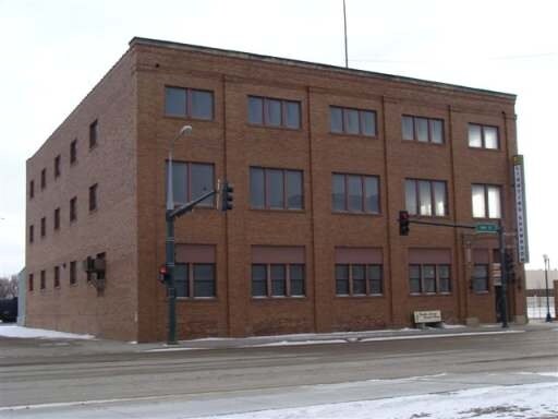
Property Record
101 E Main St, Mandan, ND 58554


Property Detail
101 E Main St
Bismarck, ND
TWN: 0 SCT: 0 RNG: 0 SUB: 654 BLK: 1 LOT: 9 & LOT 10 (LESS E 165.57' OF LOT 10 & LESS R/W PCL 6-4 15 SQ FT) (10871)
65-6104700
Morton
Residentialacreage
North Dakota
ETZ
9
C and X Area of minimal flood hazard, usually depicted on FIRMs as above the 500-year flood level.
1.05 AC
2025
Downtown Mandan
2025
Other Market Areas
020100
NEARBY LISTINGS FOR SALE OR LEASE
DEMOGRAPHICS near 101 E Main St
1 mile
3 mile
5 mile
2025 Total Population
9,687
20,663
53,796
2030 Population
9,830
21,034
55,132
Pop Growth 2025-2030
+ 1.48%
+ 1.80%
+ 2.48%
Average Age
40
39
40
2025 Total Households
4,364
8,640
22,604
HH Growth 2025-2030
+ 1.40%
+ 1.81%
+ 2.71%
Median Household Inc
$75,901
$81,690
$88,498
Avg Household Size
2.10
2.30
2.30
2025 Avg HH Vehicles
2.00
2.00
2.00
Median Home Value
$214,647
$252,723
$294,505
Median Year Built
1971
1977
1981
Nearby Places
Map Layers
Map Styles
 Street
 Aerial
Layers
 Traffic
 Biking
Places
Listings with unknown addresses are not visible on the map
- Restaurants
- Banks
- Shops
- Fitness
- Groceries
PUBLIC TRANSPORTATION
AIRPORT
Bismarck Municipal
Drive
Walk
Distance
Bismarck Municipal
23 min
9.9 mi
SALE & LEASE HISTORY
LISTING DATE
SALE/LEASE

Sep 25, 2016
For Lease
Nearby Properties
Address
Land Use
TOTAL SIZE
Lot Size
Zoning
Address
Land Use
TOTAL SIZE
Lot Size
Zoning
107.80 AC
ETZ
Address
Land Use
TOTAL SIZE
Lot Size
Zoning
126.70 AC
ETZ
Address
Land Use
TOTAL SIZE
Lot Size
Zoning
8.64 AC
ETZ
Address
Land Use
TOTAL SIZE
Lot Size
Zoning
2.08 AC
ETZ
Address
Land Use
TOTAL SIZE
Lot Size
Zoning
1.91 AC
ETZ
Address
Land Use
TOTAL SIZE
Lot Size
Zoning
0.86 AC
ETZ
Address
Land Use
TOTAL SIZE
Lot Size
Zoning
0.72 AC
ETZ
Address
Land Use
TOTAL SIZE
Lot Size
Zoning
Address
Land Use
TOTAL SIZE
Lot Size
Zoning
8.99 AC
ETZ
Address
Land Use
TOTAL SIZE
Lot Size
Zoning
Address
Land Use
TOTAL SIZE
Lot Size
Zoning
7.34 AC
ETZ
Address
Land Use
TOTAL SIZE
Lot Size
Zoning
1.20 AC
ETZ
Address
Land Use
TOTAL SIZE
Lot Size
Zoning
0.96 AC
ETZ
Address
Land Use
TOTAL SIZE
Lot Size
Zoning
18.45 AC
ETZ
Address
Land Use
TOTAL SIZE
Lot Size
Zoning
0.55 AC
ETZ
Address
Land Use
TOTAL SIZE
Lot Size
Zoning
2.17 AC
ETZ
Address
Land Use
TOTAL SIZE
Lot Size
Zoning
7.15 AC
ETZ
Address
Land Use
TOTAL SIZE
Lot Size
Zoning
0.67 AC
ETZ
Address
Land Use
TOTAL SIZE
Lot Size
Zoning
2.54 AC
ETZ
Address
Land Use
TOTAL SIZE
Lot Size
Zoning
0.16 AC
ETZ
Address
Land Use
TOTAL SIZE
Lot Size
Zoning
1.04 AC
ETZ
Address
Land Use
TOTAL SIZE
Lot Size
Zoning
2.71 AC
ETZ
Address
Land Use
TOTAL SIZE
Lot Size
Zoning
0.43 AC
ETZ
Address
Land Use
TOTAL SIZE
Lot Size
Zoning
3.10 AC
ETZ
Address
Land Use
TOTAL SIZE
Lot Size
Zoning
1.94 AC
ETZ
Address
Land Use
TOTAL SIZE
Lot Size
Zoning
14.40 AC
R
Address
Land Use
TOTAL SIZE
Lot Size
Zoning
7.07 AC
ETZ
Address
Land Use
TOTAL SIZE
Lot Size
Zoning
4.25 AC
ETZ
Address
Land Use
TOTAL SIZE
Lot Size
Zoning
3.36 AC
ETZ
The World's #1 Commercial Real Estate Marketplace
Connect with us
© 2026 CoStar Group
The information above has been obtained from sources believed reliable. While we do not doubt its accuracy we have not verified it and make no guarantee, warranty or representation about it. It is your responsibility to independently confirm its accuracy and completeness. Any projections, opinions, assumptions, or estimates used are for example only and do not represent the current or future performance of the property. The value of this transaction to you depends on tax and other factors which should be evaluated by your tax, financial, and legal advisors. You and your advisors should conduct a careful, independent investigation of the property to determine to your satisfaction the suitability of the property for your needs.