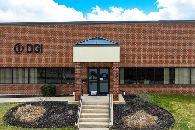
Property Record
101-F Billerica Ave, Billerica, MA 01821

NEARBY LISTINGS FOR SALE OR LEASE
Property Detail
101-F Billerica Ave
BILL-000003-000002-000009
Middlesex
Scientificpharmaceuticalmedicalresearchfacility
Massachusetts
X
9
25017C0256G
1.76 AC
2025
Lowell/Chelmsford
2025
Boston
316102
Boston-Cambridge-Newton, MA-NH
98,790 SF
DEMOGRAPHICS near 101-F Billerica Ave
1 Mile
3 Mile
5 Mile
2024 Total Population
4,543
72,977
207,991
2029 Population
4,469
72,011
205,006
Pop Growth 2024-2029
(1.63%)
(1.32%)
(1.44%)
Average Age
41
40
40
2024 Total Households
1,607
26,874
75,819
HH Growth 2024-2029
(1.74%)
(1.32%)
(1.48%)
Median Household Inc
$107,753
$88,859
$89,621
Avg Household Size
2.80
2.60
2.60
2024 Avg HH Vehicles
2.00
2.00
2.00
Median Home Value
$469,364
$426,541
$447,237
Median Year Built
1973
1962
1965
Nearby Places
Map Layers
Map Styles
 Street
 Aerial
- Restaurants
- Banks
- Shops
- Fitness
- Groceries
PUBLIC TRANSPORTATION
COMMUTER RAIL
North Billerica (Lowell Line - Massachusetts Bay Transportation Authority Commuter Rail (Purple Line))
DRIVE
WALK
Distance
North Billerica (Lowell Line - Massachusetts Bay Transportation Authority Commuter Rail (Purple Line))
3 min
1.4 mi
Lowell (Lowell Line - Massachusetts Bay Transportation Authority Commuter Rail (Purple Line))
DRIVE
WALK
Distance
Lowell (Lowell Line - Massachusetts Bay Transportation Authority Commuter Rail (Purple Line))
9 min
5.0 mi
AIRPORT
General Edward Lawrence Logan International
DRIVE
WALK
Distance
General Edward Lawrence Logan International
44 min
32.2 mi
Manchester Boston Regional
DRIVE
WALK
Distance
Manchester Boston Regional
48 min
32.8 mi
Freight Ports
Port of Boston
DRIVE
WALK
Distance
Port of Boston
44 min
32.0 mi
SALE & LEASE HISTORY
LISTING DATE
SALE/LEASE

Oct 16, 2017
For Lease
Nov 02, 2017
For Lease
Jun 06, 2023
For Lease
Feb 19, 2019
For Lease
Dec 06, 2017
For Lease
Nearby Properties
Address
Land Use
TOTAL SIZE
Lot Size
Zoning
Address
Land Use
TOTAL SIZE
Lot Size
Zoning
14.73 AC
HRC
Address
Land Use
TOTAL SIZE
Lot Size
Zoning
275,574 SF
6.66 AC
HRCO
Address
Land Use
TOTAL SIZE
Lot Size
Zoning
224,076 SF
1.15 AC
HCD
Address
Land Use
TOTAL SIZE
Lot Size
Zoning
Address
Land Use
TOTAL SIZE
Lot Size
Zoning
25 AC
MN
Address
Land Use
TOTAL SIZE
Lot Size
Zoning
189,960 SF
7.88 AC
4
Address
Land Use
TOTAL SIZE
Lot Size
Zoning
6.30 AC
UMU
Address
Land Use
TOTAL SIZE
Lot Size
Zoning
11.45 AC
TTF
Address
Land Use
TOTAL SIZE
Lot Size
Zoning
15.16 AC
SMF
Address
Land Use
TOTAL SIZE
Lot Size
Zoning
67.55 AC
OR
Address
Land Use
TOTAL SIZE
Lot Size
Zoning
174 SF
IA
Address
Land Use
TOTAL SIZE
Lot Size
Zoning
396,990 SF
48.84 AC
IH
Address
Land Use
TOTAL SIZE
Lot Size
Zoning
218,780 SF
55.49 AC
MN
Address
Land Use
TOTAL SIZE
Lot Size
Zoning
608,598 SF
21.08 AC
5
Address
Land Use
TOTAL SIZE
Lot Size
Zoning
380,132 SF
35.87 AC
5
Address
Land Use
TOTAL SIZE
Lot Size
Zoning
40.44 AC
MFD
Address
Land Use
TOTAL SIZE
Lot Size
Zoning
26.65 AC
IA
Address
Land Use
TOTAL SIZE
Lot Size
Zoning
4.85 AC
IA
Address
Land Use
TOTAL SIZE
Lot Size
Zoning
13.74 AC
SSF
Address
Land Use
TOTAL SIZE
Lot Size
Zoning
22.30 AC
IA
Address
Land Use
TOTAL SIZE
Lot Size
Zoning
3,954 SF
13.42 AC
IA
Address
Land Use
TOTAL SIZE
Lot Size
Zoning
95,745 SF
20.32 AC
TMF
Address
Land Use
TOTAL SIZE
Lot Size
Zoning
2,856 SF
11.82 AC
SMF
Address
Land Use
TOTAL SIZE
Lot Size
Zoning
355,104 SF
Address
Land Use
TOTAL SIZE
Lot Size
Zoning
241,545 SF
18.28 AC
CC
Address
Land Use
TOTAL SIZE
Lot Size
Zoning
13.23 AC
Address
Land Use
TOTAL SIZE
Lot Size
Zoning
182,135 SF
37.16 AC
2
Address
Land Use
TOTAL SIZE
Lot Size
Zoning
105,826 SF
2.27 AC
DMU
Address
Land Use
TOTAL SIZE
Lot Size
Zoning
101,618 SF
1.52 AC
UMU
Address
Land Use
TOTAL SIZE
Lot Size
Zoning
172,622 SF
22.32 AC
COM
The World's #1 Commercial Real Estate Marketplace
Connect with us
© 2025 CoStar Group
The information above has been obtained from sources believed reliable. While we do not doubt its accuracy we have not verified it and make no guarantee, warranty or representation about it. It is your responsibility to independently confirm its accuracy and completeness. Any projections, opinions, assumptions, or estimates used are for example only and do not represent the current or future performance of the property. The value of this transaction to you depends on tax and other factors which should be evaluated by your tax, financial, and legal advisors. You and your advisors should conduct a careful, independent investigation of the property to determine to your satisfaction the suitability of the property for your needs.