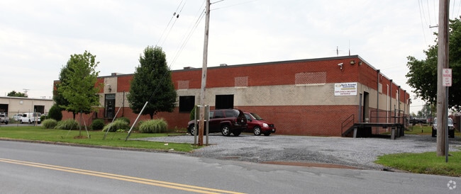
Property Record
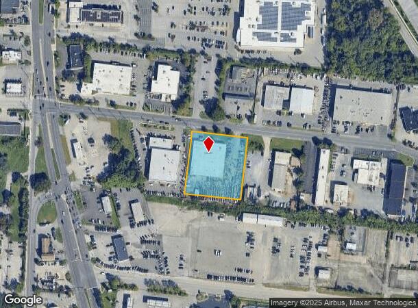
101 Holsum Way, Glen Burnie, MD 21060

NEARBY LISTINGS FOR SALE OR LEASE
Property Detail
101 Holsum Way
05-000-05527050
Glen Burnie
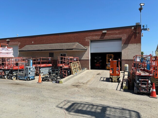
Officebuilding
1.93 ACRES GLEN BURNIE
X
Anne Arundel
2400100530H
Maryland
2024
1.93 AC
2025
Route 2 Corridor
751102
Baltimore
20,860 SF
Baltimore-Columbia-Towson, MD
DEMOGRAPHICS near 101 Holsum Way
1 Mile
3 Mile
5 Mile
2024 Total Population
11,803
81,821
185,691
2029 Population
12,073
83,329
187,920
Pop Growth 2024-2029
+ 2.29%
+ 1.84%
+ 1.20%
Average Age
39
39
38
2024 Total Households
4,729
30,260
69,463
HH Growth 2024-2029
+ 2.30%
+ 1.86%
+ 1.27%
Median Household Inc
$68,979
$82,345
$76,696
Avg Household Size
2.40
2.60
2.60
2024 Avg HH Vehicles
2.00
2.00
2.00
Median Home Value
$243,550
$289,475
$304,875
Median Year Built
1976
1964
1970
Nearby Places
Map Layers
Map Styles
 Street
 Aerial
- Restaurants
- Banks
- Shops
- Fitness
- Groceries
PUBLIC TRANSPORTATION
COMMUTER RAIL
BWI Airport (Penn Line - Maryland Area Regional Commuter Trains (The MARC))
DRIVE
WALK
Distance
BWI Airport (Penn Line - Maryland Area Regional Commuter Trains (The MARC))
14 min
5.6 mi
Halethorpe (Penn Line - Maryland Area Regional Commuter Trains (The MARC))
DRIVE
WALK
Distance
Halethorpe (Penn Line - Maryland Area Regional Commuter Trains (The MARC))
15 min
8.2 mi
AIRPORT
Baltimore/Washington International Thurgood Marshall
DRIVE
WALK
Distance
Baltimore/Washington International Thurgood Marshall
13 min
5.2 mi
Ronald Reagan Washington Ntl
DRIVE
WALK
Distance
Ronald Reagan Washington Ntl
62 min
42.3 mi
Freight Ports
Port of Baltimore
DRIVE
WALK
Distance
Port of Baltimore
17 min
7.8 mi
SALE & LEASE HISTORY
LISTING DATE
SALE/LEASE

Sep 16, 2018
For Lease
Apr 25, 2024
For Lease
Nearby Properties
Address
Land Use
TOTAL SIZE
Lot Size
Zoning
Address
Land Use
TOTAL SIZE
Lot Size
Zoning
467.03 AC
W2
Address
Land Use
TOTAL SIZE
Lot Size
Zoning
383,697 SF
68.35 AC
R5
Address
Land Use
TOTAL SIZE
Lot Size
Zoning
289,829 SF
24.56 AC
C3
Address
Land Use
TOTAL SIZE
Lot Size
Zoning
19.20 AC
R15
Address
Land Use
TOTAL SIZE
Lot Size
Zoning
252,911 SF
8.32 AC
R10
Address
Land Use
TOTAL SIZE
Lot Size
Zoning
12.90 AC
R15
Address
Land Use
TOTAL SIZE
Lot Size
Zoning
233,408 SF
24.73 AC
C3
Address
Land Use
TOTAL SIZE
Lot Size
Zoning
263,024 SF
6.87 AC
C3
Address
Land Use
TOTAL SIZE
Lot Size
Zoning
111.20 AC
W3
Address
Land Use
TOTAL SIZE
Lot Size
Zoning
277,203 SF
15.88 AC
R15
Address
Land Use
TOTAL SIZE
Lot Size
Zoning
9.45 AC
R22
Address
Land Use
TOTAL SIZE
Lot Size
Zoning
16.26 AC
R15
Address
Land Use
TOTAL SIZE
Lot Size
Zoning
15.05 AC
R15
Address
Land Use
TOTAL SIZE
Lot Size
Zoning
187,814 SF
38.47 AC
R5
Address
Land Use
TOTAL SIZE
Lot Size
Zoning
12 AC
C3
Address
Land Use
TOTAL SIZE
Lot Size
Zoning
119,220 SF
6.99 AC
W1
Address
Land Use
TOTAL SIZE
Lot Size
Zoning
10.92 AC
R15
Address
Land Use
TOTAL SIZE
Lot Size
Zoning
227,704 SF
23.52 AC
C4
Address
Land Use
TOTAL SIZE
Lot Size
Zoning
8.78 AC
R15
Address
Land Use
TOTAL SIZE
Lot Size
Zoning
13.03 AC
R15
Address
Land Use
TOTAL SIZE
Lot Size
Zoning
28,188 SF
6.51 AC
C3
Address
Land Use
TOTAL SIZE
Lot Size
Zoning
209,044 SF
17.28 AC
C3
Address
Land Use
TOTAL SIZE
Lot Size
Zoning
11.63 AC
R15
Address
Land Use
TOTAL SIZE
Lot Size
Zoning
155,608 SF
18.68 AC
C3
Address
Land Use
TOTAL SIZE
Lot Size
Zoning
482,600 SF
26.50 AC
I-2
Address
Land Use
TOTAL SIZE
Lot Size
Zoning
377,524 SF
31.04 AC
C3
Address
Land Use
TOTAL SIZE
Lot Size
Zoning
7.28 AC
R5
Address
Land Use
TOTAL SIZE
Lot Size
Zoning
5.98 AC
R15
Address
Land Use
TOTAL SIZE
Lot Size
Zoning
141,480 SF
2.01 AC
C4
Address
Land Use
TOTAL SIZE
Lot Size
Zoning
34 AC
R-5
The World's #1 Commercial Real Estate Marketplace
Connect with us
© 2025 CoStar Group
The information above has been obtained from sources believed reliable. While we do not doubt its accuracy we have not verified it and make no guarantee, warranty or representation about it. It is your responsibility to independently confirm its accuracy and completeness. Any projections, opinions, assumptions, or estimates used are for example only and do not represent the current or future performance of the property. The value of this transaction to you depends on tax and other factors which should be evaluated by your tax, financial, and legal advisors. You and your advisors should conduct a careful, independent investigation of the property to determine to your satisfaction the suitability of the property for your needs.