Property Record
101 John Rolfe Dr, Smithfield, VA 23430
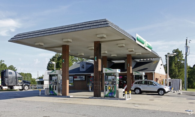

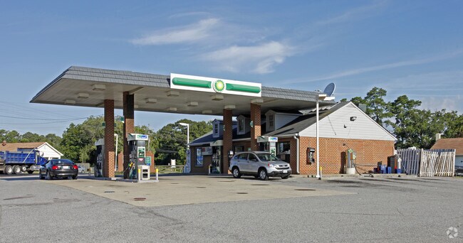
Property Detail
101 John Rolfe Dr
32-01-085
AT BENNS CHURCH
Commercialnec
Isle of Wight
01
Virginia
B and X Area of moderate flood hazard, usually the area between the limits of the 100-year and 500-year floods.
0.75 AC
2025
Smithfield
2025
Hampton Roads
280106
Virginia Beach-Chesapeake-Norfolk, VA-NC
1,896 SF
NEARBY LISTINGS FOR SALE OR LEASE
-
-
View all Smithfield listings for sale on LoopNet.com
DEMOGRAPHICS near 101 John Rolfe Dr
1 mile
3 mile
5 mile
2025 Total Population
1,830
10,277
25,960
2030 Population
1,960
10,709
27,176
Pop Growth 2025-2030
+ 7.10%
+ 4.20%
+ 4.68%
Average Age
42
42
43
2025 Total Households
675
3,979
10,155
HH Growth 2025-2030
+ 7.11%
+ 4.12%
+ 4.69%
Median Household Inc
$104,487
$114,888
$108,612
Avg Household Size
2.70
2.60
2.50
2025 Avg HH Vehicles
3.00
2.00
2.00
Median Home Value
$399,999
$390,607
$388,298
Median Year Built
1999
1996
1994
Nearby Places
Map Layers
Map Styles
 Street
 Aerial
Layers
 Traffic
 Biking
Places
Listings with unknown addresses are not visible on the map
- Restaurants
- Banks
- Shops
- Fitness
- Groceries
PUBLIC TRANSPORTATION
AIRPORT
Newport News/Williamsburg International
Drive
Walk
Distance
Newport News/Williamsburg International
40 min
22.1 mi
Norfolk International
Drive
Walk
Distance
Norfolk International
54 min
31.1 mi
Freight Ports
Virginia Port Authority - Newport News
Drive
Walk
Distance
Virginia Port Authority - Newport News
28 min
15.5 mi
Nearby Properties
Address
Land Use
TOTAL SIZE
Lot Size
Zoning
Address
Land Use
TOTAL SIZE
Lot Size
Zoning
79.87 AC
RAC
Address
Land Use
TOTAL SIZE
Lot Size
Zoning
111,208 SF
20.01 AC
RAC
Address
Land Use
TOTAL SIZE
Lot Size
Zoning
24.09 AC
TOWN
Address
Land Use
TOTAL SIZE
Lot Size
Zoning
35,102 SF
0.86 AC
TOWN
Address
Land Use
TOTAL SIZE
Lot Size
Zoning
33,611 SF
1.17 AC
TOWN
Address
Land Use
TOTAL SIZE
Lot Size
Zoning
21.42 AC
TOWN
Address
Land Use
TOTAL SIZE
Lot Size
Zoning
8.50 AC
02
Address
Land Use
TOTAL SIZE
Lot Size
Zoning
64,187 SF
13.11 AC
TOWN
Address
Land Use
TOTAL SIZE
Lot Size
Zoning
52,944 SF
9.67 AC
TOWN
Address
Land Use
TOTAL SIZE
Lot Size
Zoning
3,500 SF
16.98 AC
TOWN
Address
Land Use
TOTAL SIZE
Lot Size
Zoning
35.19 AC
01
Address
Land Use
TOTAL SIZE
Lot Size
Zoning
58,368 SF
2.51 AC
TOWN
Address
Land Use
TOTAL SIZE
Lot Size
Zoning
99.89 AC
01
Address
Land Use
TOTAL SIZE
Lot Size
Zoning
13,512 SF
8.07 AC
TOWN
Address
Land Use
TOTAL SIZE
Lot Size
Zoning
15,600 SF
5.09 AC
TOWN
Address
Land Use
TOTAL SIZE
Lot Size
Zoning
10,524 SF
3.87 AC
TOWN
Address
Land Use
TOTAL SIZE
Lot Size
Zoning
16,720 SF
0.39 AC
TOWN
Address
Land Use
TOTAL SIZE
Lot Size
Zoning
26,688 SF
0.63 AC
TOWN
Address
Land Use
TOTAL SIZE
Lot Size
Zoning
37,996 SF
8.74 AC
TOWN
Address
Land Use
TOTAL SIZE
Lot Size
Zoning
31,802 SF
5.22 AC
TOWN
Address
Land Use
TOTAL SIZE
Lot Size
Zoning
45,170 SF
3.05 AC
TOWN
Address
Land Use
TOTAL SIZE
Lot Size
Zoning
19,120 SF
3.65 AC
TOWN
Address
Land Use
TOTAL SIZE
Lot Size
Zoning
30,162 SF
0.30 AC
TOWN
Address
Land Use
TOTAL SIZE
Lot Size
Zoning
7,127 SF
22.64 AC
TOWN
Address
Land Use
TOTAL SIZE
Lot Size
Zoning
13,460 SF
3.47 AC
TOWN
Address
Land Use
TOTAL SIZE
Lot Size
Zoning
14,790 SF
3.28 AC
TOWN
Address
Land Use
TOTAL SIZE
Lot Size
Zoning
92,368 SF
4.82 AC
TOWN
Address
Land Use
TOTAL SIZE
Lot Size
Zoning
14,306 SF
3.62 AC
TOWN
Address
Land Use
TOTAL SIZE
Lot Size
Zoning
183.37 AC
RAC
Address
Land Use
TOTAL SIZE
Lot Size
Zoning
16,963 SF
2.36 AC
TOWN
The World's #1 Commercial Real Estate Marketplace
Connect with us
© 2026 CoStar Group
The information above has been obtained from sources believed reliable. While we do not doubt its accuracy we have not verified it and make no guarantee, warranty or representation about it. It is your responsibility to independently confirm its accuracy and completeness. Any projections, opinions, assumptions, or estimates used are for example only and do not represent the current or future performance of the property. The value of this transaction to you depends on tax and other factors which should be evaluated by your tax, financial, and legal advisors. You and your advisors should conduct a careful, independent investigation of the property to determine to your satisfaction the suitability of the property for your needs.