Property Record
101 Maple View Ct, Central, SC 29630
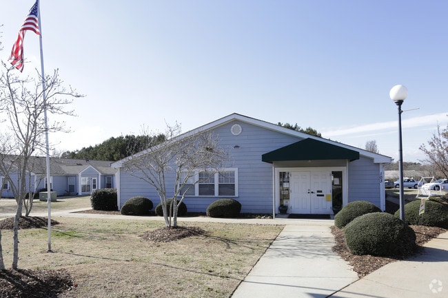

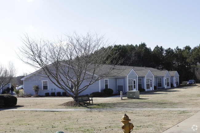
Property Detail
101 Maple View Ct
4065-11-66-3545
NW/SIDE TARRANT ST PLAT 281/5, PLAT 302/4, PLAT 379/9
Retirementnursinghomecombined
PICKENS
RM16
South Carolina
B and X Area of moderate flood hazard, usually the area between the limits of the 100-year and 500-year floods.
11.33 AC
0
Southwest Pickens County
2025
Greenville/Spartanburg
011105
Greenville-Anderson-Greer, SC
5,208 SF
NEARBY LISTINGS FOR SALE OR LEASE
-
-
View all Central listings for sale on LoopNet.com
DEMOGRAPHICS near 101 Maple View Ct
1 mile
3 mile
5 mile
2025 Total Population
3,067
14,360
35,833
2030 Population
3,192
14,947
37,250
Pop Growth 2025-2030
+ 4.08%
+ 4.09%
+ 3.95%
Average Age
37
35
36
2025 Total Households
1,275
6,103
14,468
HH Growth 2025-2030
+ 4.24%
+ 4.41%
+ 4.27%
Median Household Inc
$48,948
$52,017
$54,682
Avg Household Size
2.20
2.20
2.30
2025 Avg HH Vehicles
2.00
2.00
2.00
Median Home Value
$242,515
$274,628
$274,187
Median Year Built
1982
1992
1990
Nearby Places
Map Layers
Map Styles
 Street
 Aerial
Transit
 Traffic
 Biking
Places
Listings with unknown addresses are not visible on the map
- Restaurants
- Banks
- Shops
- Fitness
- Groceries
PUBLIC TRANSPORTATION
COMMUTER RAIL
Clemson Amtrak Station (Crescent - Amtrak)
Drive
Walk
Distance
Clemson Amtrak Station (Crescent - Amtrak)
9 min
4.8 mi
Freight Ports
Georgia Ports - Savannah
Drive
Walk
Distance
Georgia Ports - Savannah
322 min
279.5 mi
Nearby Properties
Address
Land Use
TOTAL SIZE
Lot Size
Zoning
Address
Land Use
TOTAL SIZE
Lot Size
Zoning
11,881 SF
2.02 AC
GENERAL CO
Address
Land Use
TOTAL SIZE
Lot Size
Zoning
61,130 SF
19.26 AC
PD
Address
Land Use
TOTAL SIZE
Lot Size
Zoning
7,692 SF
0.40 AC
RIL
Address
Land Use
TOTAL SIZE
Lot Size
Zoning
20,927 SF
2.66 AC
GC
Address
Land Use
TOTAL SIZE
Lot Size
Zoning
7,070 SF
2.59 AC
GENERAL CO
Address
Land Use
TOTAL SIZE
Lot Size
Zoning
9,112 SF
10.93 AC
RM 3 MULTI
Address
Land Use
TOTAL SIZE
Lot Size
Zoning
3,160 SF
2.30 AC
RM16 RESID
Address
Land Use
TOTAL SIZE
Lot Size
Zoning
103.43 AC
Address
Land Use
TOTAL SIZE
Lot Size
Zoning
17 AC
RIL RESEAR
Address
Land Use
TOTAL SIZE
Lot Size
Zoning
20,686 SF
15.84 AC
RM16
Address
Land Use
TOTAL SIZE
Lot Size
Zoning
2,498 SF
8.27 AC
CP2
Address
Land Use
TOTAL SIZE
Lot Size
Zoning
249,600 SF
12.61 AC
RM16
Address
Land Use
TOTAL SIZE
Lot Size
Zoning
3,542 SF
0.80 AC
GC
Address
Land Use
TOTAL SIZE
Lot Size
Zoning
6,377 SF
2.01 AC
GC
Address
Land Use
TOTAL SIZE
Lot Size
Zoning
22,722 SF
12.68 AC
PD
Address
Land Use
TOTAL SIZE
Lot Size
Zoning
10.09 AC
GC
Address
Land Use
TOTAL SIZE
Lot Size
Zoning
2,111 SF
10.67 AC
RM16 RESID
Address
Land Use
TOTAL SIZE
Lot Size
Zoning
36.40 AC
RM 1 TWO F
Address
Land Use
TOTAL SIZE
Lot Size
Zoning
42,049 SF
6.26 AC
PD
Address
Land Use
TOTAL SIZE
Lot Size
Zoning
54,244 SF
1.17 AC
RIL
Address
Land Use
TOTAL SIZE
Lot Size
Zoning
196,017 SF
25.24 AC
GC
Address
Land Use
TOTAL SIZE
Lot Size
Zoning
29,631 SF
5.22 AC
PDD
Address
Land Use
TOTAL SIZE
Lot Size
Zoning
1,141 SF
25.98 AC
RM 3 MULTI
Address
Land Use
TOTAL SIZE
Lot Size
Zoning
64,306 SF
0.96 AC
RIL
Address
Land Use
TOTAL SIZE
Lot Size
Zoning
121,807 SF
15.27 AC
PD
Address
Land Use
TOTAL SIZE
Lot Size
Zoning
14,865 SF
4.63 AC
PD
Address
Land Use
TOTAL SIZE
Lot Size
Zoning
68,705 SF
1.21 AC
UD
Address
Land Use
TOTAL SIZE
Lot Size
Zoning
5,000 SF
1.47 AC
GENERAL CO
The World's #1 Commercial Real Estate Marketplace
Connect with us
© 2026 CoStar Group
The information above has been obtained from sources believed reliable. While we do not doubt its accuracy we have not verified it and make no guarantee, warranty or representation about it. It is your responsibility to independently confirm its accuracy and completeness. Any projections, opinions, assumptions, or estimates used are for example only and do not represent the current or future performance of the property. The value of this transaction to you depends on tax and other factors which should be evaluated by your tax, financial, and legal advisors. You and your advisors should conduct a careful, independent investigation of the property to determine to your satisfaction the suitability of the property for your needs.