Property Record
101 Lincoln Ave, Toppenish, WA 98948

NEARBY LISTINGS FOR SALE OR LEASE
-
-
View all Toppenish listings for sale on LoopNet.com
Property Detail
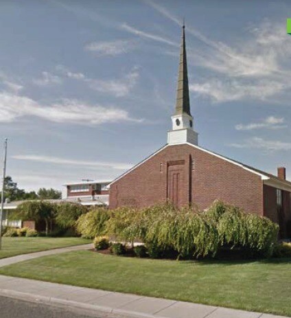
101 Lincoln Ave
201003-31413
Gilberts 2Nd Add To Toppenish
Commercialnec
GILBERTS 2ND ADD TO TOPPENISH: ALL BLK 3 ALSO VAC ALLEY
AE
Yakima
53077C1468D
Washington
2025
0.78 AC
2025
Outlying Yakima County
940006
Yakima
10,672 SF
Yakima, WA
DEMOGRAPHICS near 101 Lincoln Ave
1 Mile
3 Mile
5 Mile
2024 Total Population
8,863
13,015
18,021
2029 Population
8,822
12,878
17,760
Pop Growth 2024-2029
(0.46%)
(1.05%)
(1.45%)
Average Age
32
33
34
2024 Total Households
2,381
3,644
5,189
HH Growth 2024-2029
(0.63%)
(1.23%)
(1.62%)
Median Household Inc
$58,923
$60,136
$62,787
Avg Household Size
3.60
3.50
3.40
2024 Avg HH Vehicles
3.00
2.00
2.00
Median Home Value
$165,864
$194,360
$228,722
Median Year Built
1963
1967
1969
Nearby Places
Map Layers
Map Styles
 Street
 Aerial
- Restaurants
- Banks
- Shops
- Fitness
- Groceries
PUBLIC TRANSPORTATION
AIRPORT
Yakima Air Trml/McAllister Field
DRIVE
WALK
Distance
Yakima Air Trml/McAllister Field
29 min
20.6 mi
Freight Ports
Port of Tacoma
DRIVE
WALK
Distance
Port of Tacoma
205 min
174.8 mi
SALE & LEASE HISTORY
LISTING DATE
SALE/LEASE

Jan 11, 2021
For Sale
Nearby Properties
Address
Land Use
TOTAL SIZE
Lot Size
Zoning
Address
Land Use
TOTAL SIZE
Lot Size
Zoning
184,462 SF
38.17 AC
PUB
Address
Land Use
TOTAL SIZE
Lot Size
Zoning
324,769 SF
93.16 AC
M1
Address
Land Use
TOTAL SIZE
Lot Size
Zoning
121,029 SF
8.42 AC
M1
Address
Land Use
TOTAL SIZE
Lot Size
Zoning
54,446 SF
26.09 AC
PUB
Address
Land Use
TOTAL SIZE
Lot Size
Zoning
67,287 SF
5.17 AC
B2
Address
Land Use
TOTAL SIZE
Lot Size
Zoning
57,674 SF
31.43 AC
PC
Address
Land Use
TOTAL SIZE
Lot Size
Zoning
278,569 SF
75.58 AC
M1
Address
Land Use
TOTAL SIZE
Lot Size
Zoning
206,804 SF
10.74 AC
M1
Address
Land Use
TOTAL SIZE
Lot Size
Zoning
3.66 AC
PUB
Address
Land Use
TOTAL SIZE
Lot Size
Zoning
80,603 SF
28.65 AC
PUB
Address
Land Use
TOTAL SIZE
Lot Size
Zoning
226,202 SF
8.93 AC
M2
Address
Land Use
TOTAL SIZE
Lot Size
Zoning
115,209 SF
2.52 AC
PUB
Address
Land Use
TOTAL SIZE
Lot Size
Zoning
46,042 SF
5.97 AC
PC
Address
Land Use
TOTAL SIZE
Lot Size
Zoning
278,532 SF
21.25 AC
M2
Address
Land Use
TOTAL SIZE
Lot Size
Zoning
71,077 SF
3.77 AC
PUB
Address
Land Use
TOTAL SIZE
Lot Size
Zoning
22,980 SF
1.83 AC
B1
Address
Land Use
TOTAL SIZE
Lot Size
Zoning
36,868 SF
1.94 AC
B2
Address
Land Use
TOTAL SIZE
Lot Size
Zoning
2,414 SF
195.87 AC
CT
Address
Land Use
TOTAL SIZE
Lot Size
Zoning
44,649 SF
4.50 AC
B2
Address
Land Use
TOTAL SIZE
Lot Size
Zoning
43,044 SF
7.67 AC
TRIB
Address
Land Use
TOTAL SIZE
Lot Size
Zoning
51,985 SF
1.61 AC
CT
Address
Land Use
TOTAL SIZE
Lot Size
Zoning
209,841 SF
15.78 AC
M2
Address
Land Use
TOTAL SIZE
Lot Size
Zoning
21,187 SF
0.75 AC
B2
Address
Land Use
TOTAL SIZE
Lot Size
Zoning
28,008 SF
2.42 AC
R3
Address
Land Use
TOTAL SIZE
Lot Size
Zoning
8,000 SF
2.71 AC
CT
Address
Land Use
TOTAL SIZE
Lot Size
Zoning
34,523 SF
17.81 AC
R1
Address
Land Use
TOTAL SIZE
Lot Size
Zoning
14,106 SF
5.16 AC
PC
Address
Land Use
TOTAL SIZE
Lot Size
Zoning
4,009 SF
1.11 AC
COM
Address
Land Use
TOTAL SIZE
Lot Size
Zoning
9,100 SF
0.84 AC
C1
Address
Land Use
TOTAL SIZE
Lot Size
Zoning
19,848 SF
1.34 AC
M1
The World's #1 Commercial Real Estate Marketplace
Connect with us
© 2026 CoStar Group
The information above has been obtained from sources believed reliable. While we do not doubt its accuracy we have not verified it and make no guarantee, warranty or representation about it. It is your responsibility to independently confirm its accuracy and completeness. Any projections, opinions, assumptions, or estimates used are for example only and do not represent the current or future performance of the property. The value of this transaction to you depends on tax and other factors which should be evaluated by your tax, financial, and legal advisors. You and your advisors should conduct a careful, independent investigation of the property to determine to your satisfaction the suitability of the property for your needs.