Property Record
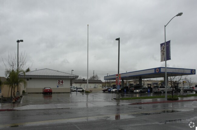
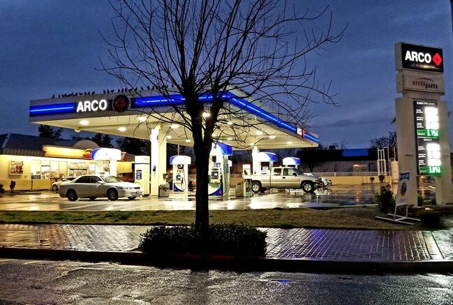
101 N Gateway Dr, Madera, CA 93637


Property Detail
101 N Gateway Dr
Fresno, CA
PARCEL 1 PARCEL MAP 30/116
007-101-018
MADERA
Servicestation
California
B and X Area of moderate flood hazard, usually the area between the limits of the 100-year and 500-year floods.
1
2024
0.60 AC
2025
Downtown/E St District
000802
Fresno
3,163 SF
NEARBY LISTINGS FOR SALE OR LEASE
DEMOGRAPHICS near 101 N Gateway Dr
1 mile
3 mile
5 mile
2025 Total Population
21,647
79,649
88,004
2030 Population
22,505
82,881
91,565
Pop Growth 2025-2030
+ 3.96%
+ 4.06%
+ 4.05%
Average Age
33
33
34
2025 Total Households
5,670
20,890
23,210
HH Growth 2025-2030
+ 3.86%
+ 3.91%
+ 3.91%
Median Household Inc
$38,238
$57,808
$59,761
Avg Household Size
3.60
3.70
3.70
2025 Avg HH Vehicles
2.00
2.00
2.00
Median Home Value
$284,409
$358,381
$361,383
Median Year Built
1976
1990
1989
Nearby Places
Map Layers
Map Styles
 Street
 Aerial
Layers
 Traffic
 Biking
Places
Listings with unknown addresses are not visible on the map
- Restaurants
- Banks
- Shops
- Fitness
- Groceries
PUBLIC TRANSPORTATION
AIRPORT
Fresno Yosemite International
Drive
Walk
Distance
Fresno Yosemite International
34 min
24.9 mi
SALE & LEASE HISTORY
LISTING DATE
SALE/LEASE

Oct 08, 2019
For Sale
Nearby Properties
Address
Land Use
TOTAL SIZE
Lot Size
Zoning
Address
Land Use
TOTAL SIZE
Lot Size
Zoning
Address
Land Use
TOTAL SIZE
Lot Size
Zoning
358,000 SF
32.82 AC
IH
Address
Land Use
TOTAL SIZE
Lot Size
Zoning
144,050 SF
7.61 AC
Address
Land Use
TOTAL SIZE
Lot Size
Zoning
20.26 AC
Address
Land Use
TOTAL SIZE
Lot Size
Zoning
13.06 AC
Address
Land Use
TOTAL SIZE
Lot Size
Zoning
2,830 SF
18.83 AC
ARE-20
Address
Land Use
TOTAL SIZE
Lot Size
Zoning
21.55 AC
Address
Land Use
TOTAL SIZE
Lot Size
Zoning
17,930 SF
4.24 AC
AR-5
Address
Land Use
TOTAL SIZE
Lot Size
Zoning
88,250 SF
11.24 AC
Address
Land Use
TOTAL SIZE
Lot Size
Zoning
12.76 AC
Address
Land Use
TOTAL SIZE
Lot Size
Zoning
33,180 SF
9.51 AC
Address
Land Use
TOTAL SIZE
Lot Size
Zoning
14,470 SF
21.28 AC
IL
Address
Land Use
TOTAL SIZE
Lot Size
Zoning
4.92 AC
Address
Land Use
TOTAL SIZE
Lot Size
Zoning
144,440 SF
12.63 AC
Address
Land Use
TOTAL SIZE
Lot Size
Zoning
56,075 SF
1.20 AC
Address
Land Use
TOTAL SIZE
Lot Size
Zoning
107,424 SF
12.05 AC
Address
Land Use
TOTAL SIZE
Lot Size
Zoning
1,836 SF
7.50 AC
Address
Land Use
TOTAL SIZE
Lot Size
Zoning
20,800 SF
3.82 AC
Address
Land Use
TOTAL SIZE
Lot Size
Zoning
87,739 SF
4.14 AC
Address
Land Use
TOTAL SIZE
Lot Size
Zoning
6.43 AC
Address
Land Use
TOTAL SIZE
Lot Size
Zoning
10.78 AC
Address
Land Use
TOTAL SIZE
Lot Size
Zoning
9,576 SF
3.42 AC
Address
Land Use
TOTAL SIZE
Lot Size
Zoning
8,604 SF
2.07 AC
Address
Land Use
TOTAL SIZE
Lot Size
Zoning
4.65 AC
RUM
Address
Land Use
TOTAL SIZE
Lot Size
Zoning
25,311 SF
0.77 AC
Address
Land Use
TOTAL SIZE
Lot Size
Zoning
42,475 SF
2.35 AC
Address
Land Use
TOTAL SIZE
Lot Size
Zoning
51,300 SF
11.59 AC
The World's #1 Commercial Real Estate Marketplace
Connect with us
© 2026 CoStar Group
The information above has been obtained from sources believed reliable. While we do not doubt its accuracy we have not verified it and make no guarantee, warranty or representation about it. It is your responsibility to independently confirm its accuracy and completeness. Any projections, opinions, assumptions, or estimates used are for example only and do not represent the current or future performance of the property. The value of this transaction to you depends on tax and other factors which should be evaluated by your tax, financial, and legal advisors. You and your advisors should conduct a careful, independent investigation of the property to determine to your satisfaction the suitability of the property for your needs.