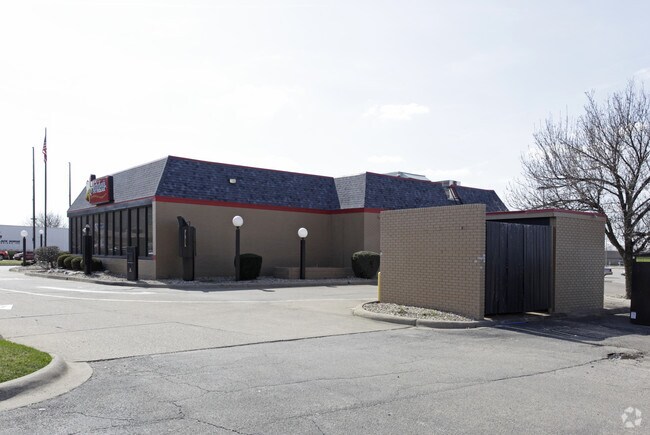
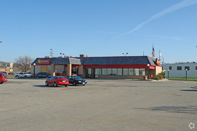
Property Record
101 N Main St, East Peoria, IL 61611
NEARBY LISTINGS FOR SALE OR LEASE
Property Detail
101 N Main St
Peoria, IL
Town Center 2 Resub
01-01-33-102-012
SEC 27 T26N R4W SAN FERNANDO HILLS LOT 9 NE 1/4
Storebuilding
Tazewell
X
Illinois
17179C0040E
9
2023
0.44 AC
2024
East Peoria
021202
Peoria
DEMOGRAPHICS near 101 N Main St
1 Mile
3 Mile
5 Mile
2024 Total Population
2,695
42,274
104,320
2029 Population
2,675
42,293
103,074
Pop Growth 2024-2029
(0.74%)
+ 0.04%
(1.19%)
Average Age
42
39
39
2024 Total Households
1,223
18,062
43,619
HH Growth 2024-2029
(0.82%)
(0.14%)
(1.40%)
Median Household Inc
$39,832
$38,715
$46,081
Avg Household Size
2.20
2.20
2.30
2024 Avg HH Vehicles
2.00
1.00
2.00
Median Home Value
$98,132
$95,403
$100,175
Median Year Built
1950
1952
1953
Nearby Places
Map Layers
Map Styles
 Street
 Aerial
- Restaurants
- Banks
- Shops
- Fitness
- Groceries
PUBLIC TRANSPORTATION
AIRPORT
General Downing - Peoria International
DRIVE
WALK
Distance
General Downing - Peoria International
16 min
7.5 mi
Central Il Regional/Bloomington-Normal
DRIVE
WALK
Distance
Central Il Regional/Bloomington-Normal
56 min
42.8 mi
SALE & LEASE HISTORY
LISTING DATE
SALE/LEASE

Jun 05, 2019
For Lease
Nearby Properties
Address
Land Use
TOTAL SIZE
Lot Size
Zoning
Address
Land Use
TOTAL SIZE
Lot Size
Zoning
22.13 AC
Address
Land Use
TOTAL SIZE
Lot Size
Zoning
232,535 SF
3.45 AC
Address
Land Use
TOTAL SIZE
Lot Size
Zoning
0.91 AC
Address
Land Use
TOTAL SIZE
Lot Size
Zoning
85,556 SF
8.46 AC
Address
Land Use
TOTAL SIZE
Lot Size
Zoning
Address
Land Use
TOTAL SIZE
Lot Size
Zoning
142,321 SF
15.92 AC
Address
Land Use
TOTAL SIZE
Lot Size
Zoning
Address
Land Use
TOTAL SIZE
Lot Size
Zoning
49.61 AC
Address
Land Use
TOTAL SIZE
Lot Size
Zoning
80 SF
14.30 AC
Address
Land Use
TOTAL SIZE
Lot Size
Zoning
196,582 SF
16.62 AC
Address
Land Use
TOTAL SIZE
Lot Size
Zoning
0.57 AC
Address
Land Use
TOTAL SIZE
Lot Size
Zoning
0.44 AC
Address
Land Use
TOTAL SIZE
Lot Size
Zoning
161,535 SF
4.76 AC
Address
Land Use
TOTAL SIZE
Lot Size
Zoning
186,472 SF
2.19 AC
Address
Land Use
TOTAL SIZE
Lot Size
Zoning
132.43 AC
Address
Land Use
TOTAL SIZE
Lot Size
Zoning
0.22 AC
Address
Land Use
TOTAL SIZE
Lot Size
Zoning
Address
Land Use
TOTAL SIZE
Lot Size
Zoning
51,190 SF
3.74 AC
Address
Land Use
TOTAL SIZE
Lot Size
Zoning
21.18 AC
Address
Land Use
TOTAL SIZE
Lot Size
Zoning
135,233 SF
9.85 AC
Address
Land Use
TOTAL SIZE
Lot Size
Zoning
12.12 AC
Address
Land Use
TOTAL SIZE
Lot Size
Zoning
137,853 SF
11.92 AC
Address
Land Use
TOTAL SIZE
Lot Size
Zoning
Address
Land Use
TOTAL SIZE
Lot Size
Zoning
0.89 AC
Address
Land Use
TOTAL SIZE
Lot Size
Zoning
28.18 AC
Address
Land Use
TOTAL SIZE
Lot Size
Zoning
24,318 SF
2.83 AC
Address
Land Use
TOTAL SIZE
Lot Size
Zoning
Address
Land Use
TOTAL SIZE
Lot Size
Zoning
2.32 AC
Address
Land Use
TOTAL SIZE
Lot Size
Zoning
Address
Land Use
TOTAL SIZE
Lot Size
Zoning
0.48 AC
The World's #1 Commercial Real Estate Marketplace
Connect with us
© 2025 CoStar Group
The information above has been obtained from sources believed reliable. While we do not doubt its accuracy we have not verified it and make no guarantee, warranty or representation about it. It is your responsibility to independently confirm its accuracy and completeness. Any projections, opinions, assumptions, or estimates used are for example only and do not represent the current or future performance of the property. The value of this transaction to you depends on tax and other factors which should be evaluated by your tax, financial, and legal advisors. You and your advisors should conduct a careful, independent investigation of the property to determine to your satisfaction the suitability of the property for your needs.