Property Record
101 N Sutherland Ave, Monroe, NC 28110
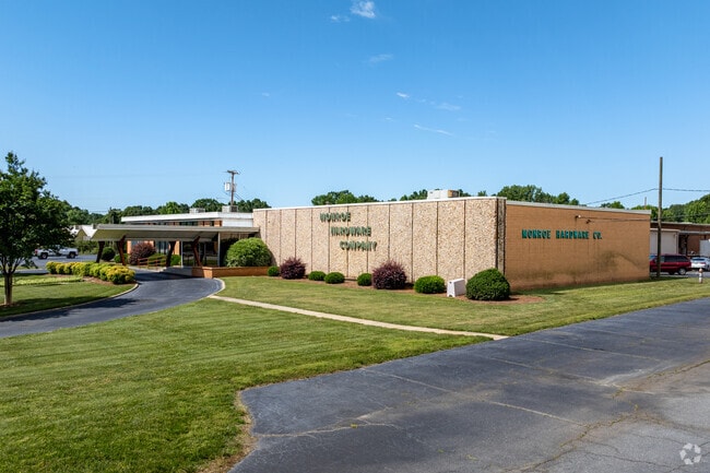

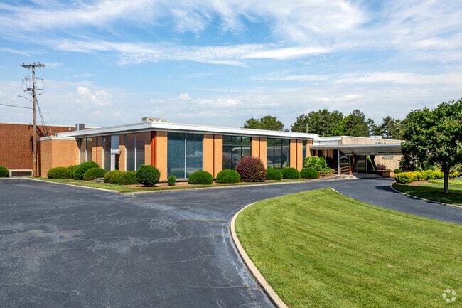
Property Detail
101 N Sutherland Ave
09-191-026
TRACT 2 OPCR523 LESS OPCR535
Publicstorage
UNION
G-I MONROE
North Carolina
B and X Area of moderate flood hazard, usually the area between the limits of the 100-year and 500-year floods.
20.47 AC
2025
Union County
2025
Charlotte
020601
Charlotte-Concord-Gastonia, NC-SC
194,706 SF
NEARBY LISTINGS FOR SALE OR LEASE
DEMOGRAPHICS near 101 N Sutherland Ave
1 mile
3 mile
5 mile
2025 Total Population
5,031
24,096
47,709
2030 Population
5,458
26,423
52,261
Pop Growth 2025-2030
+ 8.49%
+ 9.66%
+ 9.54%
Average Age
36
38
39
2025 Total Households
1,671
8,257
16,670
HH Growth 2025-2030
+ 8.56%
+ 9.74%
+ 9.72%
Median Household Inc
$47,857
$53,503
$65,033
Avg Household Size
2.90
2.80
2.70
2025 Avg HH Vehicles
2.00
2.00
2.00
Median Home Value
$250,833
$300,999
$335,028
Median Year Built
1976
1984
1989
Nearby Places
Map Layers
Map Styles
 Street
 Aerial
Layers
 Traffic
 Biking
Places
Listings with unknown addresses are not visible on the map
- Restaurants
- Banks
- Shops
- Fitness
- Groceries
PUBLIC TRANSPORTATION
AIRPORT
Charlotte/Douglas International
Drive
Walk
Distance
Charlotte/Douglas International
51 min
33.0 mi
Concord-Padgett Regional
Drive
Walk
Distance
Concord-Padgett Regional
49 min
37.2 mi
SALE & LEASE HISTORY
LISTING DATE
SALE/LEASE

Jul 16, 2024
For Lease
Jul 15, 2024
For Sale
Nearby Properties
Address
Land Use
TOTAL SIZE
Lot Size
Zoning
Address
Land Use
TOTAL SIZE
Lot Size
Zoning
82.26 AC
G-I MONROE
Address
Land Use
TOTAL SIZE
Lot Size
Zoning
148,145 SF
26.68 AC
G-I MONROE
Address
Land Use
TOTAL SIZE
Lot Size
Zoning
78.48 AC
Address
Land Use
TOTAL SIZE
Lot Size
Zoning
134,187 SF
32.44 AC
R-10 MONRO
Address
Land Use
TOTAL SIZE
Lot Size
Zoning
99,235 SF
1.92 AC
CBD MONROE
Address
Land Use
TOTAL SIZE
Lot Size
Zoning
18,208 SF
12.09 AC
R-MF MONRO
Address
Land Use
TOTAL SIZE
Lot Size
Zoning
71,831 SF
67.94 AC
CD MONROE
Address
Land Use
TOTAL SIZE
Lot Size
Zoning
54,712 SF
10.01 AC
GB MONROE
Address
Land Use
TOTAL SIZE
Lot Size
Zoning
5,376 SF
11.99 AC
R-MF MONRO
Address
Land Use
TOTAL SIZE
Lot Size
Zoning
5.89 AC
G-I MONROE
Address
Land Use
TOTAL SIZE
Lot Size
Zoning
104,837 SF
29.15 AC
CD MONROE
Address
Land Use
TOTAL SIZE
Lot Size
Zoning
14.77 AC
Address
Land Use
TOTAL SIZE
Lot Size
Zoning
6,672 SF
5.08 AC
OT MONROE
Address
Land Use
TOTAL SIZE
Lot Size
Zoning
101,035 SF
26.11 AC
G-I MONROE
Address
Land Use
TOTAL SIZE
Lot Size
Zoning
9,072 SF
15.23 AC
R-MF MONRO
Address
Land Use
TOTAL SIZE
Lot Size
Zoning
2,016 SF
6.20 AC
R-MF MONRO
Address
Land Use
TOTAL SIZE
Lot Size
Zoning
121,790 SF
52.36 AC
G-I MONROE
Address
Land Use
TOTAL SIZE
Lot Size
Zoning
79,493 SF
32.65 AC
RA-20 UNIO
Address
Land Use
TOTAL SIZE
Lot Size
Zoning
2,873 SF
55.59 AC
G-I MONROE
Address
Land Use
TOTAL SIZE
Lot Size
Zoning
65,122 SF
5.26 AC
R-10 MONRO
Address
Land Use
TOTAL SIZE
Lot Size
Zoning
32,872 SF
9.35 AC
Address
Land Use
TOTAL SIZE
Lot Size
Zoning
136,370 SF
10.22 AC
GB MONROE
Address
Land Use
TOTAL SIZE
Lot Size
Zoning
41,820 SF
6.23 AC
G-I MONROE
Address
Land Use
TOTAL SIZE
Lot Size
Zoning
32,670 SF
12.78 AC
GB MONROE
Address
Land Use
TOTAL SIZE
Lot Size
Zoning
32,815 SF
8.28 AC
R-20 MONRO
Address
Land Use
TOTAL SIZE
Lot Size
Zoning
72,444 SF
5.06 AC
GB MONROE
Address
Land Use
TOTAL SIZE
Lot Size
Zoning
214,256 SF
16.68 AC
G-I MONROE
Address
Land Use
TOTAL SIZE
Lot Size
Zoning
2,712 SF
7.11 AC
R-MH MONRO
Address
Land Use
TOTAL SIZE
Lot Size
Zoning
33,699 SF
2.55 AC
OT MONROE
Address
Land Use
TOTAL SIZE
Lot Size
Zoning
18,176 SF
10.24 AC
R-MF MONRO
The World's #1 Commercial Real Estate Marketplace
Connect with us
© 2026 CoStar Group
The information above has been obtained from sources believed reliable. While we do not doubt its accuracy we have not verified it and make no guarantee, warranty or representation about it. It is your responsibility to independently confirm its accuracy and completeness. Any projections, opinions, assumptions, or estimates used are for example only and do not represent the current or future performance of the property. The value of this transaction to you depends on tax and other factors which should be evaluated by your tax, financial, and legal advisors. You and your advisors should conduct a careful, independent investigation of the property to determine to your satisfaction the suitability of the property for your needs.