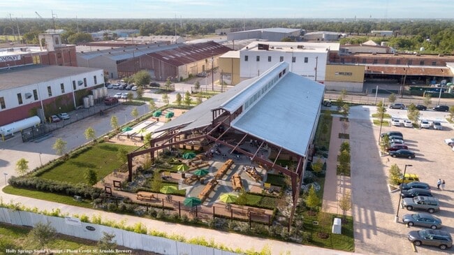
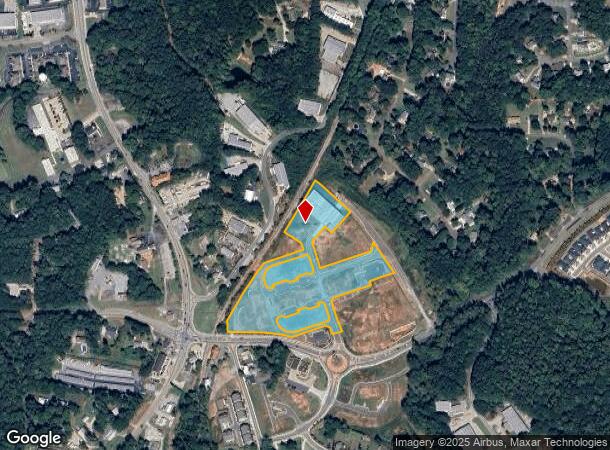
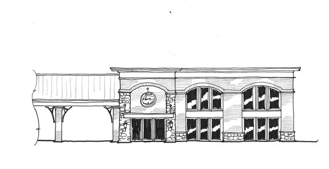
Property Record
101 Palm St, Canton, GA 30115
NEARBY LISTINGS FOR SALE OR LEASE
-
-
View all Canton listings for lease on LoopNet.com
Property Detail
101 Palm St
015N14-00000-103-000-0000
LL 306; 15TH D/TRACT 1PB 80 PG 47
Parkingstructure
Cherokee
X
Georgia
13057C0261E
306
0
8.61 AC
2025
Cherokee/Woodstock
090704
Atlanta
31,232 SF
Atlanta-Sandy Springs-Roswell, GA
DEMOGRAPHICS near 101 Palm St
1 Mile
3 Mile
5 Mile
2024 Total Population
4,979
50,079
115,166
2029 Population
5,721
56,824
130,544
Pop Growth 2024-2029
+ 14.90%
+ 13.47%
+ 13.35%
Average Age
38
38
39
2024 Total Households
1,939
17,630
40,225
HH Growth 2024-2029
+ 14.96%
+ 13.71%
+ 13.56%
Median Household Inc
$67,448
$98,366
$101,842
Avg Household Size
2.50
2.80
2.80
2024 Avg HH Vehicles
2.00
2.00
2.00
Median Home Value
$252,132
$338,303
$370,118
Median Year Built
1998
2003
2001
Nearby Places
Map Layers
Map Styles
 Street
 Aerial
- Restaurants
- Banks
- Shops
- Fitness
- Groceries
SALE & LEASE HISTORY
LISTING DATE
SALE/LEASE

Oct 29, 2024
For Lease
Nearby Properties
Address
Land Use
TOTAL SIZE
Lot Size
Zoning
Address
Land Use
TOTAL SIZE
Lot Size
Zoning
235,863 SF
18.96 AC
HDMFR
Address
Land Use
TOTAL SIZE
Lot Size
Zoning
275,118 SF
21.61 AC
R-40
Address
Land Use
TOTAL SIZE
Lot Size
Zoning
255,483 SF
138.30 AC
LI
Address
Land Use
TOTAL SIZE
Lot Size
Zoning
353,395 SF
29.15 AC
GC
Address
Land Use
TOTAL SIZE
Lot Size
Zoning
120,084 SF
25.15 AC
LI
Address
Land Use
TOTAL SIZE
Lot Size
Zoning
79,162 SF
8.54 AC
RM16
Address
Land Use
TOTAL SIZE
Lot Size
Zoning
103,620 SF
19.78 AC
R-5
Address
Land Use
TOTAL SIZE
Lot Size
Zoning
145,195 SF
14.47 AC
R-40
Address
Land Use
TOTAL SIZE
Lot Size
Zoning
302,757 SF
62.80 AC
PUD
Address
Land Use
TOTAL SIZE
Lot Size
Zoning
177,744 SF
23.73 AC
PUD
Address
Land Use
TOTAL SIZE
Lot Size
Zoning
155,341 SF
14.54 AC
R-5
Address
Land Use
TOTAL SIZE
Lot Size
Zoning
299,408 SF
15 AC
TND
Address
Land Use
TOTAL SIZE
Lot Size
Zoning
43,897 SF
8.45 AC
PUD
Address
Land Use
TOTAL SIZE
Lot Size
Zoning
149,713 SF
36.97 AC
R-80
Address
Land Use
TOTAL SIZE
Lot Size
Zoning
182,067 SF
23.83 AC
GC
Address
Land Use
TOTAL SIZE
Lot Size
Zoning
134,017 SF
42.78 AC
AG
Address
Land Use
TOTAL SIZE
Lot Size
Zoning
52,703 SF
37.65 AC
LI
Address
Land Use
TOTAL SIZE
Lot Size
Zoning
32,224 SF
2.89 AC
GC
Address
Land Use
TOTAL SIZE
Lot Size
Zoning
107,977 SF
17.26 AC
GC
Address
Land Use
TOTAL SIZE
Lot Size
Zoning
85,343 SF
2.46 AC
GC
Address
Land Use
TOTAL SIZE
Lot Size
Zoning
70,397 SF
13.24 AC
R-20
Address
Land Use
TOTAL SIZE
Lot Size
Zoning
78,987 SF
6.54 AC
GC
Address
Land Use
TOTAL SIZE
Lot Size
Zoning
44,397 SF
15.84 AC
GC
Address
Land Use
TOTAL SIZE
Lot Size
Zoning
33,071 SF
1.70 AC
TND
Address
Land Use
TOTAL SIZE
Lot Size
Zoning
69,360 SF
5.86 AC
R-80
Address
Land Use
TOTAL SIZE
Lot Size
Zoning
24,984 SF
2.16 AC
GC
Address
Land Use
TOTAL SIZE
Lot Size
Zoning
57,363 SF
19.68 AC
PUD
Address
Land Use
TOTAL SIZE
Lot Size
Zoning
78,503 SF
9.51 AC
PUD
Address
Land Use
TOTAL SIZE
Lot Size
Zoning
158,853 SF
33.73 AC
LI
The World's #1 Commercial Real Estate Marketplace
Connect with us
© 2025 CoStar Group
The information above has been obtained from sources believed reliable. While we do not doubt its accuracy we have not verified it and make no guarantee, warranty or representation about it. It is your responsibility to independently confirm its accuracy and completeness. Any projections, opinions, assumptions, or estimates used are for example only and do not represent the current or future performance of the property. The value of this transaction to you depends on tax and other factors which should be evaluated by your tax, financial, and legal advisors. You and your advisors should conduct a careful, independent investigation of the property to determine to your satisfaction the suitability of the property for your needs.