Property Record
101 River Pl, Monona, WI 53716
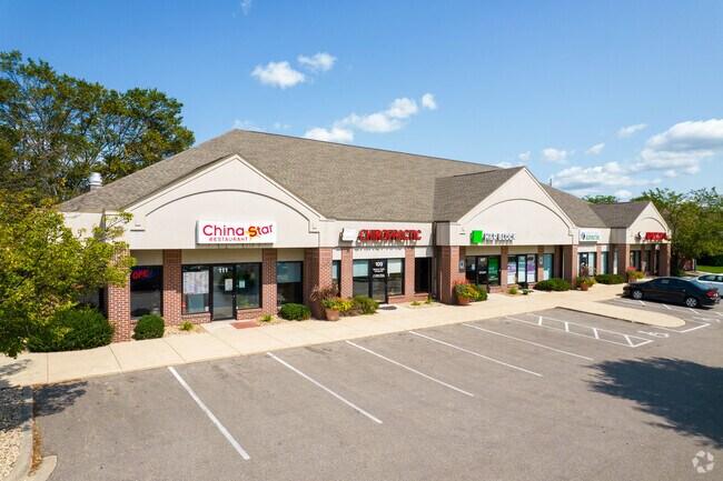


Property Detail
101 River Pl
Madison, WI
RIVER PLACE LOT 8
0710-291-0148-7
Dane
Commercialnec
Wisconsin
B and X Area of moderate flood hazard, usually the area between the limits of the 100-year and 500-year floods.
8
2025
1.02 AC
2025
Southeast Madison
010501
Milwaukee/Madison
NEARBY LISTINGS FOR SALE OR LEASE
DEMOGRAPHICS near 101 River Pl
1 mile
3 mile
5 mile
2025 Total Population
6,200
37,115
200,531
2030 Population
6,452
38,454
213,913
Pop Growth 2025-2030
+ 4.06%
+ 3.61%
+ 6.67%
Average Age
42
41
36
2025 Total Households
3,007
16,338
89,398
HH Growth 2025-2030
+ 4.39%
+ 3.94%
+ 7.02%
Median Household Inc
$73,795
$86,193
$67,847
Avg Household Size
2.00
2.20
2.10
2025 Avg HH Vehicles
2.00
2.00
1.00
Median Home Value
$347,034
$342,324
$366,059
Median Year Built
1971
1972
1984
Nearby Places
Map Layers
Map Styles
 Street
 Aerial
Layers
 Traffic
 Biking
Places
Listings with unknown addresses are not visible on the map
- Restaurants
- Banks
- Shops
- Fitness
- Groceries
PUBLIC TRANSPORTATION
AIRPORT
Dane County Regional/Truax Field
Drive
Walk
Distance
Dane County Regional/Truax Field
16 min
9.1 mi
SALE & LEASE HISTORY
LISTING DATE
SALE/LEASE

Oct 06, 2016
For Lease
May 21, 2019
For Lease
Nearby Properties
Address
Land Use
TOTAL SIZE
Lot Size
Zoning
Address
Land Use
TOTAL SIZE
Lot Size
Zoning
168,685 SF
14.05 AC
IL
Address
Land Use
TOTAL SIZE
Lot Size
Zoning
20,965 SF
10.98 AC
IL
Address
Land Use
TOTAL SIZE
Lot Size
Zoning
13.40 AC
Address
Land Use
TOTAL SIZE
Lot Size
Zoning
2.03 AC
Address
Land Use
TOTAL SIZE
Lot Size
Zoning
3.59 AC
Address
Land Use
TOTAL SIZE
Lot Size
Zoning
156,054 SF
9.40 AC
SE
Address
Land Use
TOTAL SIZE
Lot Size
Zoning
2.38 AC
Address
Land Use
TOTAL SIZE
Lot Size
Zoning
172,052 SF
4.09 AC
SE
Address
Land Use
TOTAL SIZE
Lot Size
Zoning
21.92 AC
Address
Land Use
TOTAL SIZE
Lot Size
Zoning
5.53 AC
Address
Land Use
TOTAL SIZE
Lot Size
Zoning
272,519 SF
16.40 AC
IL
Address
Land Use
TOTAL SIZE
Lot Size
Zoning
3.49 AC
Address
Land Use
TOTAL SIZE
Lot Size
Zoning
149,897 SF
17.72 AC
IL
Address
Land Use
TOTAL SIZE
Lot Size
Zoning
221,156 SF
21.31 AC
WP-30
Address
Land Use
TOTAL SIZE
Lot Size
Zoning
6,868 SF
18.35 AC
IL
Address
Land Use
TOTAL SIZE
Lot Size
Zoning
202,800 SF
13.05 AC
WP-31
Address
Land Use
TOTAL SIZE
Lot Size
Zoning
87,541 SF
1.85 AC
TR-U2
Address
Land Use
TOTAL SIZE
Lot Size
Zoning
131,874 SF
8.98 AC
IL
Address
Land Use
TOTAL SIZE
Lot Size
Zoning
108,164 SF
1.80 AC
SE
Address
Land Use
TOTAL SIZE
Lot Size
Zoning
86,831 SF
2.73 AC
SE
Address
Land Use
TOTAL SIZE
Lot Size
Zoning
202,323 SF
10.45 AC
IL
Address
Land Use
TOTAL SIZE
Lot Size
Zoning
95,909 SF
1 AC
TE
Address
Land Use
TOTAL SIZE
Lot Size
Zoning
281,400 SF
15.01 AC
IL
Address
Land Use
TOTAL SIZE
Lot Size
Zoning
62,684 SF
1.35 AC
SE
Address
Land Use
TOTAL SIZE
Lot Size
Zoning
94,440 SF
4.42 AC
SE
Address
Land Use
TOTAL SIZE
Lot Size
Zoning
145,002 SF
8.71 AC
SR-V2
Address
Land Use
TOTAL SIZE
Lot Size
Zoning
79,554 SF
6.59 AC
TR-P
Address
Land Use
TOTAL SIZE
Lot Size
Zoning
1.99 AC
Address
Land Use
TOTAL SIZE
Lot Size
Zoning
110,792 SF
5.25 AC
SR-V2
Address
Land Use
TOTAL SIZE
Lot Size
Zoning
100,161 SF
27.20 AC
SE
The World's #1 Commercial Real Estate Marketplace
Connect with us
© 2026 CoStar Group
The information above has been obtained from sources believed reliable. While we do not doubt its accuracy we have not verified it and make no guarantee, warranty or representation about it. It is your responsibility to independently confirm its accuracy and completeness. Any projections, opinions, assumptions, or estimates used are for example only and do not represent the current or future performance of the property. The value of this transaction to you depends on tax and other factors which should be evaluated by your tax, financial, and legal advisors. You and your advisors should conduct a careful, independent investigation of the property to determine to your satisfaction the suitability of the property for your needs.