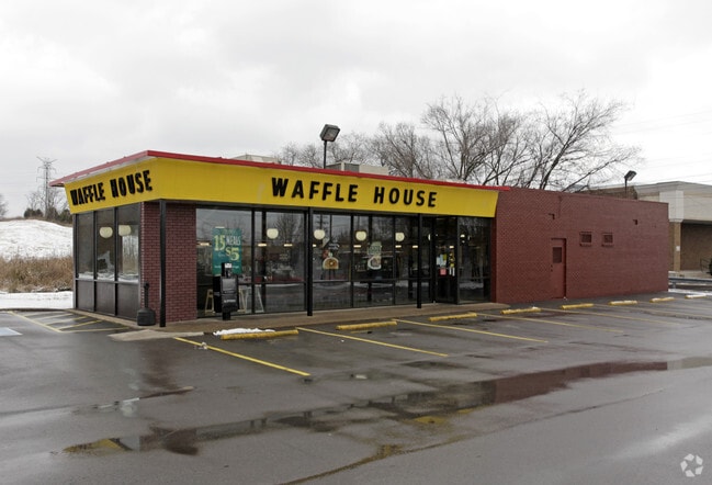
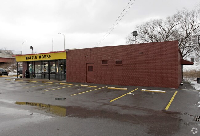
Property Record
600 Wade Cir, Goodlettsville, TN 37072

NEARBY LISTINGS FOR SALE OR LEASE
Property Detail
600 Wade Cir
Nashville-Davidson--Murfreesboro--Franklin, TN
Plan Of Rivergate Vantage
026-14-0-036
LOT 1 RIVERGATE VANTAGE SEC 1
Restaurantdrivein
Davidson
X
Tennessee
47037C0137K
1
2025
0.27 AC
2025
North Nashville
010303
Nashville
1,606 SF
DEMOGRAPHICS near 600 Wade Cir
1 Mile
3 Mile
5 Mile
2024 Total Population
5,137
38,799
95,385
2029 Population
4,967
39,339
98,147
Pop Growth 2024-2029
(3.31%)
+ 1.39%
+ 2.90%
Average Age
39
39
40
2024 Total Households
2,292
16,043
39,655
HH Growth 2024-2029
(3.84%)
+ 0.87%
+ 2.59%
Median Household Inc
$50,146
$58,184
$60,014
Avg Household Size
2.20
2.40
2.30
2024 Avg HH Vehicles
2.00
2.00
2.00
Median Home Value
$253,999
$278,375
$285,010
Median Year Built
1987
1987
1984
Nearby Places
Map Layers
Map Styles
 Street
 Aerial
- Restaurants
- Banks
- Shops
- Fitness
- Groceries
PUBLIC TRANSPORTATION
AIRPORT
Nashville International
DRIVE
WALK
Distance
Nashville International
28 min
20.8 mi
SALE & LEASE HISTORY
LISTING DATE
SALE/LEASE

Dec 14, 2017
For Lease
Dec 14, 2017
For Sale
Nearby Properties
Address
Land Use
TOTAL SIZE
Lot Size
Zoning
Address
Land Use
TOTAL SIZE
Lot Size
Zoning
26,434 SF
12.86 AC
RM20
Address
Land Use
TOTAL SIZE
Lot Size
Zoning
11,088 SF
21.28 AC
RS7.5
Address
Land Use
TOTAL SIZE
Lot Size
Zoning
30,534 SF
19.77 AC
SP
Address
Land Use
TOTAL SIZE
Lot Size
Zoning
102,431 SF
19.59 AC
6ZZ
Address
Land Use
TOTAL SIZE
Lot Size
Zoning
336,784 SF
41.54 AC
IR
Address
Land Use
TOTAL SIZE
Lot Size
Zoning
16,770 SF
76.79 AC
RM4
Address
Land Use
TOTAL SIZE
Lot Size
Zoning
17,214 SF
40.52 AC
RM9
Address
Land Use
TOTAL SIZE
Lot Size
Zoning
25,212 SF
31.56 AC
Address
Land Use
TOTAL SIZE
Lot Size
Zoning
31,528 SF
17.61 AC
6ZZ
Address
Land Use
TOTAL SIZE
Lot Size
Zoning
26,872 SF
24.16 AC
6ZZ
Address
Land Use
TOTAL SIZE
Lot Size
Zoning
72,951 SF
5.31 AC
6ZZ
Address
Land Use
TOTAL SIZE
Lot Size
Zoning
3,993 SF
21.86 AC
6ZZ
Address
Land Use
TOTAL SIZE
Lot Size
Zoning
42,840 SF
21.43 AC
CS
Address
Land Use
TOTAL SIZE
Lot Size
Zoning
3,312 SF
33.03 AC
IR
Address
Land Use
TOTAL SIZE
Lot Size
Zoning
12,576 SF
16.09 AC
6ZZ
Address
Land Use
TOTAL SIZE
Lot Size
Zoning
34,752 SF
19.09 AC
CS
Address
Land Use
TOTAL SIZE
Lot Size
Zoning
93,000 SF
16.44 AC
IR
Address
Land Use
TOTAL SIZE
Lot Size
Zoning
112,056 SF
40.15 AC
MULTIZONE
Address
Land Use
TOTAL SIZE
Lot Size
Zoning
26,610 SF
6.66 AC
RS20
Address
Land Use
TOTAL SIZE
Lot Size
Zoning
21,356 SF
11.25 AC
6ZZ
Address
Land Use
TOTAL SIZE
Lot Size
Zoning
28,000 SF
38.86 AC
6ZZ
Address
Land Use
TOTAL SIZE
Lot Size
Zoning
10,312 SF
15.03 AC
6ZZ
Address
Land Use
TOTAL SIZE
Lot Size
Zoning
17,500 SF
17.56 AC
SCR
Address
Land Use
TOTAL SIZE
Lot Size
Zoning
10,336 SF
17.70 AC
6ZZ
Address
Land Use
TOTAL SIZE
Lot Size
Zoning
15,600 SF
23.88 AC
RM9
Address
Land Use
TOTAL SIZE
Lot Size
Zoning
6,948 SF
12.62 AC
6ZZ
Address
Land Use
TOTAL SIZE
Lot Size
Zoning
25,200 SF
20.36 AC
RM2
Address
Land Use
TOTAL SIZE
Lot Size
Zoning
44,394 SF
2.49 AC
Address
Land Use
TOTAL SIZE
Lot Size
Zoning
10,378 SF
15.33 AC
6ZZ
Address
Land Use
TOTAL SIZE
Lot Size
Zoning
93,232 SF
5.40 AC
RM20
The World's #1 Commercial Real Estate Marketplace
Connect with us
© 2025 CoStar Group
The information above has been obtained from sources believed reliable. While we do not doubt its accuracy we have not verified it and make no guarantee, warranty or representation about it. It is your responsibility to independently confirm its accuracy and completeness. Any projections, opinions, assumptions, or estimates used are for example only and do not represent the current or future performance of the property. The value of this transaction to you depends on tax and other factors which should be evaluated by your tax, financial, and legal advisors. You and your advisors should conduct a careful, independent investigation of the property to determine to your satisfaction the suitability of the property for your needs.