Property Record
101 Route Us 9 S, Marmora, NJ 08223

NEARBY LISTINGS FOR SALE OR LEASE
-
-
View all Marmora listings for sale on LoopNet.com
Property Detail
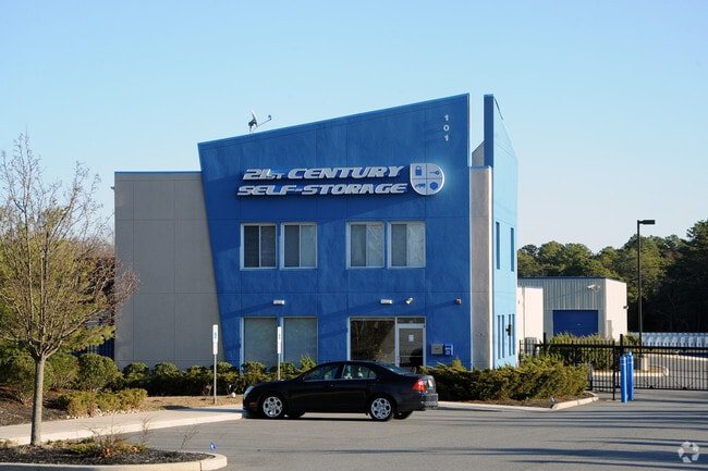
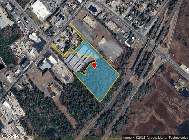
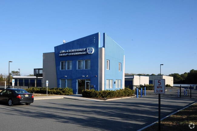
101 Route Us 9 S
Ocean City, NJ
FACILITY NAME: STORAGE
11-00599-0000-00037
Cape May
Warehouse
New Jersey
AE
37
34009C0069F
14.47 AC
2024
South Shore/Vineland
2025
Other Market Areas
020301
DEMOGRAPHICS near 101 Route Us 9 S
1 Mile
3 Mile
5 Mile
2024 Total Population
1,057
10,809
27,234
2029 Population
878
11,121
27,427
Pop Growth 2024-2029
(16.93%)
+ 2.89%
+ 0.71%
Average Age
42
50
47
2024 Total Households
389
4,832
12,132
HH Growth 2024-2029
(19.02%)
+ 3.02%
+ 0.73%
Median Household Inc
$93,509
$92,762
$83,702
Avg Household Size
2.60
2.10
2.20
2024 Avg HH Vehicles
2.00
2.00
2.00
Median Home Value
$285,832
$437,899
$381,039
Median Year Built
1980
1985
1982
Nearby Places
Map Layers
Map Styles
 Street
 Aerial
- Restaurants
- Banks
- Shops
- Fitness
- Groceries
PUBLIC TRANSPORTATION
AIRPORT
Atlantic City International
DRIVE
WALK
Distance
Atlantic City International
45 min
19.6 mi
Freight Ports
Broadway Terminal - Pier 5
DRIVE
WALK
Distance
Broadway Terminal - Pier 5
76 min
61.5 mi
Nearby Properties
Address
Land Use
TOTAL SIZE
Lot Size
Zoning
Address
Land Use
TOTAL SIZE
Lot Size
Zoning
6.37 AC
Address
Land Use
TOTAL SIZE
Lot Size
Zoning
127.44 AC
Address
Land Use
TOTAL SIZE
Lot Size
Zoning
3.38 AC
Address
Land Use
TOTAL SIZE
Lot Size
Zoning
14.24 AC
MTCD
Address
Land Use
TOTAL SIZE
Lot Size
Zoning
12.80 AC
R
Address
Land Use
TOTAL SIZE
Lot Size
Zoning
1.08 AC
Address
Land Use
TOTAL SIZE
Lot Size
Zoning
Address
Land Use
TOTAL SIZE
Lot Size
Zoning
1.15 AC
Address
Land Use
TOTAL SIZE
Lot Size
Zoning
1.03 AC
Address
Land Use
TOTAL SIZE
Lot Size
Zoning
0.49 AC
Address
Land Use
TOTAL SIZE
Lot Size
Zoning
3.38 AC
Address
Land Use
TOTAL SIZE
Lot Size
Zoning
3.12 AC
Address
Land Use
TOTAL SIZE
Lot Size
Zoning
29.50 AC
R
Address
Land Use
TOTAL SIZE
Lot Size
Zoning
1.59 AC
Address
Land Use
TOTAL SIZE
Lot Size
Zoning
0.83 AC
Address
Land Use
TOTAL SIZE
Lot Size
Zoning
Address
Land Use
TOTAL SIZE
Lot Size
Zoning
1.55 AC
Address
Land Use
TOTAL SIZE
Lot Size
Zoning
5 AC
CCM2
Address
Land Use
TOTAL SIZE
Lot Size
Zoning
100 SF
1.65 AC
MTCD
Address
Land Use
TOTAL SIZE
Lot Size
Zoning
0.39 AC
Address
Land Use
TOTAL SIZE
Lot Size
Zoning
0.57 AC
Address
Land Use
TOTAL SIZE
Lot Size
Zoning
14.59 AC
MTCD
Address
Land Use
TOTAL SIZE
Lot Size
Zoning
0.66 AC
Address
Land Use
TOTAL SIZE
Lot Size
Zoning
11,149 SF
0.16 AC
Address
Land Use
TOTAL SIZE
Lot Size
Zoning
3,584 SF
0.13 AC
Address
Land Use
TOTAL SIZE
Lot Size
Zoning
0.45 AC
Address
Land Use
TOTAL SIZE
Lot Size
Zoning
6.02 AC
MTCD
Address
Land Use
TOTAL SIZE
Lot Size
Zoning
4.94 AC
MTCD
Address
Land Use
TOTAL SIZE
Lot Size
Zoning
840 SF
6.96 AC
MTCD
The World's #1 Commercial Real Estate Marketplace
Connect with us
© 2025 CoStar Group
The information above has been obtained from sources believed reliable. While we do not doubt its accuracy we have not verified it and make no guarantee, warranty or representation about it. It is your responsibility to independently confirm its accuracy and completeness. Any projections, opinions, assumptions, or estimates used are for example only and do not represent the current or future performance of the property. The value of this transaction to you depends on tax and other factors which should be evaluated by your tax, financial, and legal advisors. You and your advisors should conduct a careful, independent investigation of the property to determine to your satisfaction the suitability of the property for your needs.