Property Record
101 S 7Th St, Akron, PA 17501


NEARBY LISTINGS FOR SALE OR LEASE
Property Detail
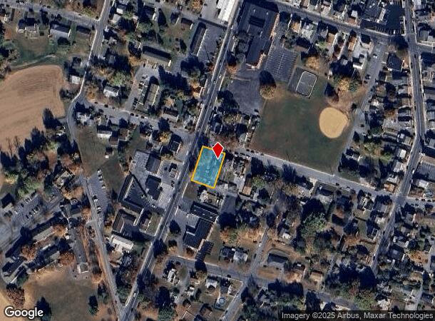
101 S 7Th St
Officebuilding
Lancaster
X
Pennsylvania
42071C0189F
0.34 AC
2024
Lancaster County
2025
Philadelphia
012402
Lancaster, PA
3,378 SF
020-24900-0-0000
DEMOGRAPHICS near 101 S 7Th St
1 Mile
3 Mile
5 Mile
2024 Total Population
6,730
33,459
63,749
2029 Population
6,778
33,683
64,093
Pop Growth 2024-2029
+ 0.71%
+ 0.67%
+ 0.54%
Average Age
41
40
41
2024 Total Households
2,736
13,092
24,203
HH Growth 2024-2029
+ 0.77%
+ 0.75%
+ 0.59%
Median Household Inc
$66,361
$68,861
$74,608
Avg Household Size
2.40
2.50
2.60
2024 Avg HH Vehicles
2.00
2.00
2.00
Median Home Value
$202,767
$223,001
$250,032
Median Year Built
1975
1978
1980
Nearby Places
Map Layers
Map Styles
 Street
 Aerial
- Restaurants
- Banks
- Shops
- Fitness
- Groceries
PUBLIC TRANSPORTATION
AIRPORT
Harrisburg International
DRIVE
WALK
Distance
Harrisburg International
51 min
39.5 mi
Freight Ports
Port Newark Container Terminal
DRIVE
WALK
Distance
Port Newark Container Terminal
91 min
56.1 mi
SALE & LEASE HISTORY
LISTING DATE
SALE/LEASE

Sep 23, 2016
For Sale
May 18, 2017
For Sale
Jun 09, 2025
For Sale
Jul 22, 2017
For Sale
Nearby Properties
Address
Land Use
TOTAL SIZE
Lot Size
Zoning
Address
Land Use
TOTAL SIZE
Lot Size
Zoning
251,634 SF
16.28 AC
Address
Land Use
TOTAL SIZE
Lot Size
Zoning
226,686 SF
28 AC
RLD
Address
Land Use
TOTAL SIZE
Lot Size
Zoning
229,049 SF
26.80 AC
RLD
Address
Land Use
TOTAL SIZE
Lot Size
Zoning
166,771 SF
10.76 AC
Address
Land Use
TOTAL SIZE
Lot Size
Zoning
155,373 SF
4.50 AC
Address
Land Use
TOTAL SIZE
Lot Size
Zoning
198,400 SF
36.90 AC
C-2
Address
Land Use
TOTAL SIZE
Lot Size
Zoning
90,600 SF
6.98 AC
Address
Land Use
TOTAL SIZE
Lot Size
Zoning
135,900 SF
11.79 AC
Address
Land Use
TOTAL SIZE
Lot Size
Zoning
69,993 SF
Address
Land Use
TOTAL SIZE
Lot Size
Zoning
103,448 SF
79.90 AC
A
Address
Land Use
TOTAL SIZE
Lot Size
Zoning
152,537 SF
17.20 AC
HC
Address
Land Use
TOTAL SIZE
Lot Size
Zoning
122,512 SF
22.36 AC
I
Address
Land Use
TOTAL SIZE
Lot Size
Zoning
88,413 SF
5.30 AC
RMD
Address
Land Use
TOTAL SIZE
Lot Size
Zoning
85,104 SF
24.20 AC
Address
Land Use
TOTAL SIZE
Lot Size
Zoning
123,018 SF
14.30 AC
HC
Address
Land Use
TOTAL SIZE
Lot Size
Zoning
75,760 SF
4.85 AC
RMD
Address
Land Use
TOTAL SIZE
Lot Size
Zoning
73,648 SF
10.20 AC
R-1
Address
Land Use
TOTAL SIZE
Lot Size
Zoning
92,217 SF
11.50 AC
C
Address
Land Use
TOTAL SIZE
Lot Size
Zoning
33,134 SF
0.42 AC
NC-2
Address
Land Use
TOTAL SIZE
Lot Size
Zoning
59,996 SF
6 AC
Address
Land Use
TOTAL SIZE
Lot Size
Zoning
55,896 SF
3.49 AC
Address
Land Use
TOTAL SIZE
Lot Size
Zoning
44,302 SF
9.58 AC
RLD
Address
Land Use
TOTAL SIZE
Lot Size
Zoning
51,954 SF
11.80 AC
R-1
Address
Land Use
TOTAL SIZE
Lot Size
Zoning
81,044 SF
4.67 AC
Address
Land Use
TOTAL SIZE
Lot Size
Zoning
104,828 SF
5.94 AC
I
Address
Land Use
TOTAL SIZE
Lot Size
Zoning
50,888 SF
5.70 AC
RLD
Address
Land Use
TOTAL SIZE
Lot Size
Zoning
64,500 SF
19.60 AC
RLD
Address
Land Use
TOTAL SIZE
Lot Size
Zoning
220,374 SF
20.62 AC
I
Address
Land Use
TOTAL SIZE
Lot Size
Zoning
16,054 SF
4.50 AC
HC
Address
Land Use
TOTAL SIZE
Lot Size
Zoning
41,648 SF
5.82 AC
The World's #1 Commercial Real Estate Marketplace
Connect with us
© 2026 CoStar Group
The information above has been obtained from sources believed reliable. While we do not doubt its accuracy we have not verified it and make no guarantee, warranty or representation about it. It is your responsibility to independently confirm its accuracy and completeness. Any projections, opinions, assumptions, or estimates used are for example only and do not represent the current or future performance of the property. The value of this transaction to you depends on tax and other factors which should be evaluated by your tax, financial, and legal advisors. You and your advisors should conduct a careful, independent investigation of the property to determine to your satisfaction the suitability of the property for your needs.