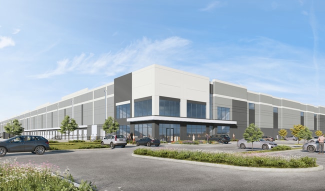
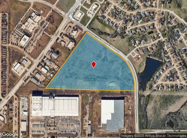
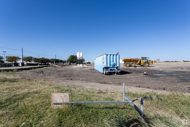
Property Record
101 S Clay Rd, Sunnyvale, TX 75182
NEARBY LISTINGS FOR SALE OR LEASE
Property Detail
101 S Clay Rd
Dallas-Fort Worth-Arlington, TX
Thomas D Coats
65033150510040100
THOMAS D COATS ABST 331 PG 505 TR 4.1 ACS 32.466 INT202400164611 DD08152024 CO-DC 0331505100401 3TS03315051
Commercialacreage
Dallas
X
Texas
48257C0025E
32.47 AC
2024
East Dallas/Mesquite
2025
Dallas/Ft Worth
018159
DEMOGRAPHICS near 101 S Clay Rd
1 Mile
3 Mile
5 Mile
2024 Total Population
3,118
56,292
156,576
2029 Population
3,033
55,420
158,699
Pop Growth 2024-2029
(2.73%)
(1.55%)
+ 1.36%
Average Age
36
37
36
2024 Total Households
1,031
17,855
50,642
HH Growth 2024-2029
(3.10%)
(1.87%)
+ 1.08%
Median Household Inc
$64,963
$71,842
$66,258
Avg Household Size
3.00
3.10
3.00
2024 Avg HH Vehicles
2.00
2.00
2.00
Median Home Value
$176,059
$219,357
$214,921
Median Year Built
1986
1985
1985
Nearby Places
Map Layers
Map Styles
 Street
 Aerial
- Restaurants
- Banks
- Shops
- Fitness
- Groceries
PUBLIC TRANSPORTATION
AIRPORT
Dallas Love Field
DRIVE
WALK
Distance
Dallas Love Field
31 min
19.9 mi
Dallas-Fort Worth International
DRIVE
WALK
Distance
Dallas-Fort Worth International
46 min
38.9 mi
Freight Ports
Port of Shreveport
DRIVE
WALK
Distance
Port of Shreveport
196 min
182.6 mi
Nearby Properties
Address
Land Use
TOTAL SIZE
Lot Size
Zoning
Address
Land Use
TOTAL SIZE
Lot Size
Zoning
256,600 SF
80.73 AC
Z265
Address
Land Use
TOTAL SIZE
Lot Size
Zoning
877,230 SF
102.36 AC
Z05
Address
Land Use
TOTAL SIZE
Lot Size
Zoning
649,398 SF
42.19 AC
Address
Land Use
TOTAL SIZE
Lot Size
Zoning
592,958 SF
32.34 AC
Address
Land Use
TOTAL SIZE
Lot Size
Zoning
643,200 SF
30.02 AC
Z109
Address
Land Use
TOTAL SIZE
Lot Size
Zoning
144,858 SF
9.69 AC
Z206
Address
Land Use
TOTAL SIZE
Lot Size
Zoning
296,370 SF
17.15 AC
Z16
Address
Land Use
TOTAL SIZE
Lot Size
Zoning
100 SF
0.01 AC
Z268
Address
Land Use
TOTAL SIZE
Lot Size
Zoning
0.03 AC
Z63
Address
Land Use
TOTAL SIZE
Lot Size
Zoning
1,229,138 SF
115.08 AC
Z117
Address
Land Use
TOTAL SIZE
Lot Size
Zoning
622,615 SF
35 AC
Z104
Address
Land Use
TOTAL SIZE
Lot Size
Zoning
223,216 SF
17.17 AC
Z31
Address
Land Use
TOTAL SIZE
Lot Size
Zoning
214,853 SF
6.60 AC
Z372
Address
Land Use
TOTAL SIZE
Lot Size
Zoning
87,104 SF
18.31 AC
Z87
Address
Land Use
TOTAL SIZE
Lot Size
Zoning
407,195 SF
31.32 AC
Z109
Address
Land Use
TOTAL SIZE
Lot Size
Zoning
379,619 SF
24.68 AC
Z376
Address
Land Use
TOTAL SIZE
Lot Size
Zoning
320,390 SF
21.50 AC
Z267
Address
Land Use
TOTAL SIZE
Lot Size
Zoning
349,440 SF
20.07 AC
Z104
Address
Land Use
TOTAL SIZE
Lot Size
Zoning
333,000 SF
17.04 AC
Address
Land Use
TOTAL SIZE
Lot Size
Zoning
217,606 SF
10.01 AC
Z237
Address
Land Use
TOTAL SIZE
Lot Size
Zoning
295,916 SF
16.52 AC
Z104
Address
Land Use
TOTAL SIZE
Lot Size
Zoning
310,900 SF
18.01 AC
Address
Land Use
TOTAL SIZE
Lot Size
Zoning
107,376 SF
38.55 AC
Z372
Address
Land Use
TOTAL SIZE
Lot Size
Zoning
174,200 SF
1 AC
Z372
Address
Land Use
TOTAL SIZE
Lot Size
Zoning
110,668 SF
8.05 AC
Z372
Address
Land Use
TOTAL SIZE
Lot Size
Zoning
56,325 SF
3.84 AC
Z28
Address
Land Use
TOTAL SIZE
Lot Size
Zoning
197,526 SF
12 AC
Z237
Address
Land Use
TOTAL SIZE
Lot Size
Zoning
342,000 SF
26.44 AC
Address
Land Use
TOTAL SIZE
Lot Size
Zoning
117,715 SF
13.18 AC
Z87
Address
Land Use
TOTAL SIZE
Lot Size
Zoning
328,530 SF
17.37 AC
Z109
The World's #1 Commercial Real Estate Marketplace
Connect with us
© 2026 CoStar Group
The information above has been obtained from sources believed reliable. While we do not doubt its accuracy we have not verified it and make no guarantee, warranty or representation about it. It is your responsibility to independently confirm its accuracy and completeness. Any projections, opinions, assumptions, or estimates used are for example only and do not represent the current or future performance of the property. The value of this transaction to you depends on tax and other factors which should be evaluated by your tax, financial, and legal advisors. You and your advisors should conduct a careful, independent investigation of the property to determine to your satisfaction the suitability of the property for your needs.