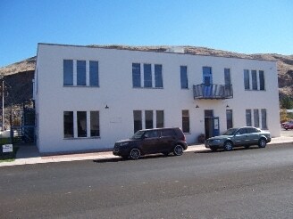
Property Record
101 S Main St, Hurricane, UT 84737
NEARBY LISTINGS FOR SALE OR LEASE
Property Detail
101 S Main St
St. George, UT
Hurricane Townsite Srvy
0067713
SUBDIVISION: HURRICANE TOWN SUR PLAT A BLK 12 (H) LOT: 3
Commercialnec
Washington
X
Utah
49053C0845G
3
2024
1.23 AC
2025
Cedar City & St George
270901
Other Market Areas
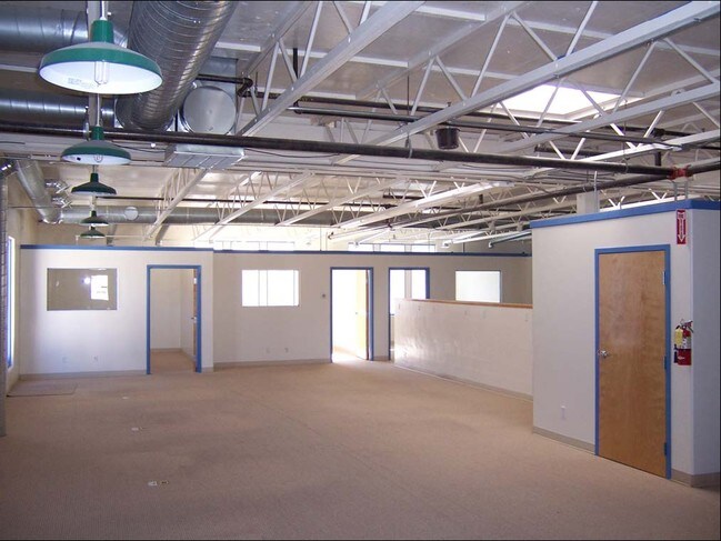
14,184 SF
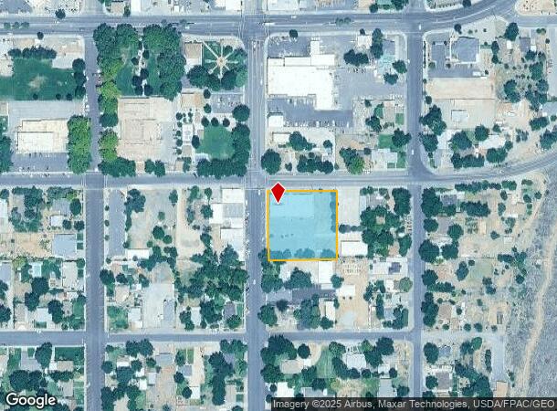
DEMOGRAPHICS near 101 S Main St
1 Mile
3 Mile
5 Mile
2024 Total Population
5,276
16,854
23,028
2029 Population
6,433
20,724
28,415
Pop Growth 2024-2029
+ 21.93%
+ 22.96%
+ 23.39%
Average Age
38
40
41
2024 Total Households
1,626
5,630
7,860
HH Growth 2024-2029
+ 22.57%
+ 23.77%
+ 24.20%
Median Household Inc
$59,850
$53,697
$54,789
Avg Household Size
3.10
2.90
2.90
2024 Avg HH Vehicles
3.00
2.00
2.00
Median Home Value
$367,968
$364,387
$364,173
Median Year Built
1988
1998
2000
Nearby Places
Map Layers
Map Styles
 Street
 Aerial
- Restaurants
- Banks
- Shops
- Fitness
- Groceries
PUBLIC TRANSPORTATION
AIRPORT
St George Regional
DRIVE
WALK
Distance
St George Regional
32 min
20.5 mi
Nearby Properties
Address
Land Use
TOTAL SIZE
Lot Size
Zoning
Address
Land Use
TOTAL SIZE
Lot Size
Zoning
500.58 AC
Address
Land Use
TOTAL SIZE
Lot Size
Zoning
48,529 SF
26.71 AC
M1
Address
Land Use
TOTAL SIZE
Lot Size
Zoning
93,494 SF
23.97 AC
PF
Address
Land Use
TOTAL SIZE
Lot Size
Zoning
70,194 SF
2.79 AC
Address
Land Use
TOTAL SIZE
Lot Size
Zoning
55,676 SF
8.90 AC
PF
Address
Land Use
TOTAL SIZE
Lot Size
Zoning
50,591 SF
2.27 AC
Address
Land Use
TOTAL SIZE
Lot Size
Zoning
57,202 SF
2.50 AC
Address
Land Use
TOTAL SIZE
Lot Size
Zoning
48,863 SF
1.72 AC
HC
Address
Land Use
TOTAL SIZE
Lot Size
Zoning
13,516 SF
11.45 AC
Address
Land Use
TOTAL SIZE
Lot Size
Zoning
38,940 SF
1.03 AC
Address
Land Use
TOTAL SIZE
Lot Size
Zoning
40,650 SF
2.99 AC
Address
Land Use
TOTAL SIZE
Lot Size
Zoning
1,155 SF
68.88 AC
APO
Address
Land Use
TOTAL SIZE
Lot Size
Zoning
20,139 SF
6.46 AC
HC
Address
Land Use
TOTAL SIZE
Lot Size
Zoning
30,643 SF
26.13 AC
PDO
Address
Land Use
TOTAL SIZE
Lot Size
Zoning
33,657 SF
12.90 AC
Address
Land Use
TOTAL SIZE
Lot Size
Zoning
7,254 SF
6.15 AC
HC
Address
Land Use
TOTAL SIZE
Lot Size
Zoning
134,714 SF
14.80 AC
M-1
Address
Land Use
TOTAL SIZE
Lot Size
Zoning
42,267 SF
3.09 AC
HC
Address
Land Use
TOTAL SIZE
Lot Size
Zoning
22,080 SF
6.82 AC
HC
Address
Land Use
TOTAL SIZE
Lot Size
Zoning
49,953 SF
1.83 AC
HC
Address
Land Use
TOTAL SIZE
Lot Size
Zoning
1,708 SF
47.04 AC
RA1
Address
Land Use
TOTAL SIZE
Lot Size
Zoning
30,519 SF
5.76 AC
HC
Address
Land Use
TOTAL SIZE
Lot Size
Zoning
22,576 SF
5.35 AC
Address
Land Use
TOTAL SIZE
Lot Size
Zoning
23,586 SF
3.52 AC
HC
Address
Land Use
TOTAL SIZE
Lot Size
Zoning
48,990 SF
24.69 AC
PF
Address
Land Use
TOTAL SIZE
Lot Size
Zoning
34,486 SF
3.03 AC
HC
Address
Land Use
TOTAL SIZE
Lot Size
Zoning
41,124 SF
4.83 AC
Address
Land Use
TOTAL SIZE
Lot Size
Zoning
14,739 SF
1.48 AC
HC
Address
Land Use
TOTAL SIZE
Lot Size
Zoning
31,760 SF
2.17 AC
HC
The World's #1 Commercial Real Estate Marketplace
Connect with us
© 2026 CoStar Group
The information above has been obtained from sources believed reliable. While we do not doubt its accuracy we have not verified it and make no guarantee, warranty or representation about it. It is your responsibility to independently confirm its accuracy and completeness. Any projections, opinions, assumptions, or estimates used are for example only and do not represent the current or future performance of the property. The value of this transaction to you depends on tax and other factors which should be evaluated by your tax, financial, and legal advisors. You and your advisors should conduct a careful, independent investigation of the property to determine to your satisfaction the suitability of the property for your needs.