Property Record
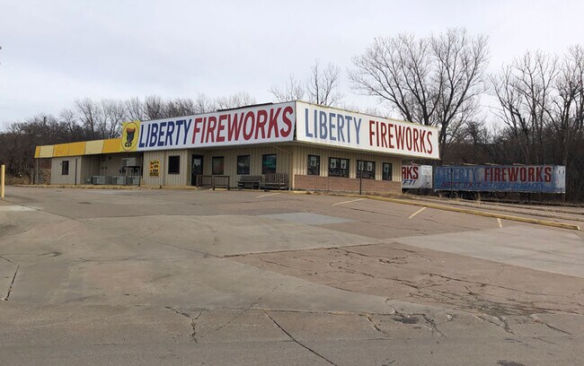
101 Speedys Dr, Rock Port, MO 64482

Property Detail
101 Speedys Dr
Other Market Areas
COM 289.66' S AND 686.93' E OF NW COR SEC 32; TH NE 362.38'; THSE 307.25'; TH SW 270.58'; TH NW 500' TO POB EXC PUB RD R /W
5100-16-000260
ATCHISON
Commercialnec
Missouri
2025
0.92 AC
2025
Missouri North Area
950200
NEARBY LISTINGS FOR SALE OR LEASE
-
-
View all Rock Port listings for sale on LoopNet.com
DEMOGRAPHICS near 101 Speedys Dr
1 mile
3 mile
5 mile
2025 Total Population
30
1,598
1,814
2030 Population
30
1,597
1,812
Pop Growth 2025-2030
0.00%
(0.06%)
(0.11%)
Average Age
43
44
44
2025 Total Households
13
688
781
HH Growth 2025-2030
0.00%
(0.15%)
(0.13%)
Median Household Inc
$42,500
$53,088
$53,974
Avg Household Size
1.80
2.30
2.20
2025 Avg HH Vehicles
2.00
2.00
2.00
Median Home Value
$125,000
$137,784
$138,944
Median Year Built
1952
1961
1961
Nearby Places
Map Layers
Map Styles
 Street
 Aerial
Layers
 Traffic
 Biking
Places
Listings with unknown addresses are not visible on the map
- Restaurants
- Banks
- Shops
- Fitness
- Groceries
SALE & LEASE HISTORY
LISTING DATE
SALE/LEASE

Jan 23, 2023
For Sale
Nearby Properties
Address
Land Use
TOTAL SIZE
Lot Size
Zoning
Address
Land Use
TOTAL SIZE
Lot Size
Zoning
37.52 AC
Address
Land Use
TOTAL SIZE
Lot Size
Zoning
11,070 SF
3.58 AC
Address
Land Use
TOTAL SIZE
Lot Size
Zoning
Address
Land Use
TOTAL SIZE
Lot Size
Zoning
Address
Land Use
TOTAL SIZE
Lot Size
Zoning
1 AC
Address
Land Use
TOTAL SIZE
Lot Size
Zoning
1 AC
Address
Land Use
TOTAL SIZE
Lot Size
Zoning
Address
Land Use
TOTAL SIZE
Lot Size
Zoning
6,480 SF
6.61 AC
Address
Land Use
TOTAL SIZE
Lot Size
Zoning
9,774 SF
0.50 AC
Address
Land Use
TOTAL SIZE
Lot Size
Zoning
1,500 SF
2 AC
Address
Land Use
TOTAL SIZE
Lot Size
Zoning
Address
Land Use
TOTAL SIZE
Lot Size
Zoning
Address
Land Use
TOTAL SIZE
Lot Size
Zoning
Address
Land Use
TOTAL SIZE
Lot Size
Zoning
Address
Land Use
TOTAL SIZE
Lot Size
Zoning
Address
Land Use
TOTAL SIZE
Lot Size
Zoning
Address
Land Use
TOTAL SIZE
Lot Size
Zoning
Address
Land Use
TOTAL SIZE
Lot Size
Zoning
Address
Land Use
TOTAL SIZE
Lot Size
Zoning
Address
Land Use
TOTAL SIZE
Lot Size
Zoning
Address
Land Use
TOTAL SIZE
Lot Size
Zoning
Address
Land Use
TOTAL SIZE
Lot Size
Zoning
7,840 SF
1.72 AC
Address
Land Use
TOTAL SIZE
Lot Size
Zoning
Address
Land Use
TOTAL SIZE
Lot Size
Zoning
2.43 AC
Address
Land Use
TOTAL SIZE
Lot Size
Zoning
400 SF
17.53 AC
Address
Land Use
TOTAL SIZE
Lot Size
Zoning
12,000 SF
41.30 AC
Address
Land Use
TOTAL SIZE
Lot Size
Zoning
9,100 SF
1.95 AC
Address
Land Use
TOTAL SIZE
Lot Size
Zoning
11,636 SF
5.05 AC
Address
Land Use
TOTAL SIZE
Lot Size
Zoning
3,914 SF
1.10 AC
Address
Land Use
TOTAL SIZE
Lot Size
Zoning
The World's #1 Commercial Real Estate Marketplace
Connect with us
© 2026 CoStar Group
The information above has been obtained from sources believed reliable. While we do not doubt its accuracy we have not verified it and make no guarantee, warranty or representation about it. It is your responsibility to independently confirm its accuracy and completeness. Any projections, opinions, assumptions, or estimates used are for example only and do not represent the current or future performance of the property. The value of this transaction to you depends on tax and other factors which should be evaluated by your tax, financial, and legal advisors. You and your advisors should conduct a careful, independent investigation of the property to determine to your satisfaction the suitability of the property for your needs.