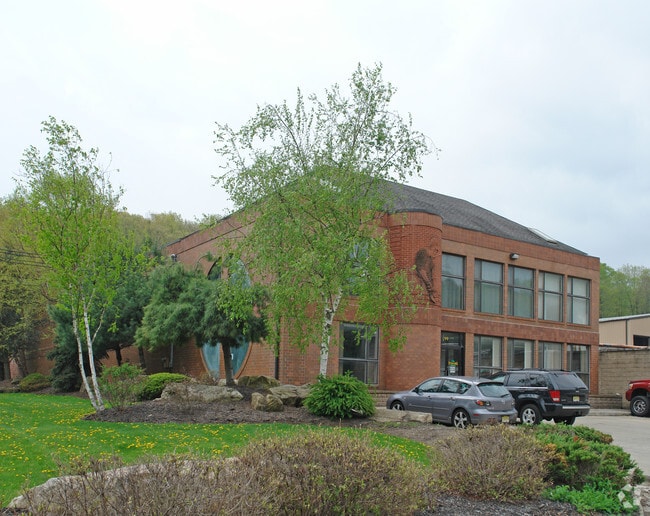
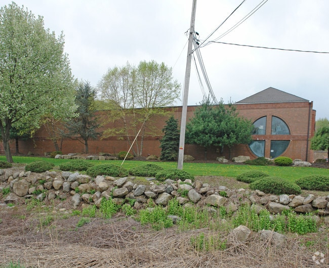
Property Record
101 Sterling Mine Rd, Sloatsburg, NY 10974
NEARBY LISTINGS FOR SALE OR LEASE
Property Detail
101 Sterling Mine Rd
392603-038-049-0001-002-000-0000
Sterling Mine Industrial Park Sub
Warehouse
Rockland
X
New York
34003C0014H
2.0
2023
2.19 AC
2024
Rockland County
011700
Northern New Jersey
15,552 SF
New York-Jersey City-White Plains, NY-NJ
DEMOGRAPHICS near 101 Sterling Mine Rd
1 Mile
3 Mile
5 Mile
2024 Total Population
1,486
7,670
27,325
2029 Population
1,495
7,854
27,458
Pop Growth 2024-2029
+ 0.61%
+ 2.40%
+ 0.49%
Average Age
41
42
42
2024 Total Households
531
2,772
9,865
HH Growth 2024-2029
+ 0.56%
+ 2.71%
+ 0.55%
Median Household Inc
$91,113
$112,545
$114,379
Avg Household Size
2.80
2.70
2.70
2024 Avg HH Vehicles
2.00
2.00
2.00
Median Home Value
$506,024
$501,564
$439,921
Median Year Built
1954
1968
1964
Nearby Places
- Restaurants
- Banks
- Shops
- Fitness
- Groceries
PUBLIC TRANSPORTATION
COMMUTER RAIL
Sloatsburg (Bergen County/Port Jervis Line - NJ Transit Commuter Rail (NJ Transit), Main/Port Jervis Line - NJ Transit Commuter Rail (NJ Transit))
DRIVE
WALK
Distance
Sloatsburg (Bergen County/Port Jervis Line - NJ Transit Commuter Rail (NJ Transit), Main/Port Jervis Line - NJ Transit Commuter Rail (NJ Transit))
5 min
1.5 mi
Tuxedo (Bergen County/Port Jervis Line - NJ Transit Commuter Rail (NJ Transit), Main/Port Jervis Line - NJ Transit Commuter Rail (NJ Transit))
DRIVE
WALK
Distance
Tuxedo (Bergen County/Port Jervis Line - NJ Transit Commuter Rail (NJ Transit), Main/Port Jervis Line - NJ Transit Commuter Rail (NJ Transit))
11 min
4.1 mi
AIRPORT
Westchester County
DRIVE
WALK
Distance
Westchester County
49 min
34.8 mi
New York Stewart International
DRIVE
WALK
Distance
New York Stewart International
49 min
35.9 mi
LaGuardia
DRIVE
WALK
Distance
LaGuardia
59 min
38.2 mi
Freight Ports
Maher Terminal
DRIVE
WALK
Distance
Maher Terminal
60 min
40.7 mi
Nearby Properties
Address
Land Use
TOTAL SIZE
Lot Size
Zoning
Address
Land Use
TOTAL SIZE
Lot Size
Zoning
426,876 SF
171.60 AC
00799
Address
Land Use
TOTAL SIZE
Lot Size
Zoning
3,716 SF
981.20 AC
Address
Land Use
TOTAL SIZE
Lot Size
Zoning
928 AC
POS
Address
Land Use
TOTAL SIZE
Lot Size
Zoning
17,780 SF
461.10 AC
Address
Land Use
TOTAL SIZE
Lot Size
Zoning
460.70 AC
Address
Land Use
TOTAL SIZE
Lot Size
Zoning
4,686 SF
33.17 AC
03
Address
Land Use
TOTAL SIZE
Lot Size
Zoning
2,016 SF
92 AC
Address
Land Use
TOTAL SIZE
Lot Size
Zoning
491,759 SF
70.30 AC
00799
Address
Land Use
TOTAL SIZE
Lot Size
Zoning
343.02 AC
Address
Land Use
TOTAL SIZE
Lot Size
Zoning
548.90 AC
Address
Land Use
TOTAL SIZE
Lot Size
Zoning
1,389.23 AC
Address
Land Use
TOTAL SIZE
Lot Size
Zoning
237.20 AC
POS
Address
Land Use
TOTAL SIZE
Lot Size
Zoning
Address
Land Use
TOTAL SIZE
Lot Size
Zoning
22,292 SF
170.28 AC
RR-80
Address
Land Use
TOTAL SIZE
Lot Size
Zoning
123.39 AC
911
Address
Land Use
TOTAL SIZE
Lot Size
Zoning
Address
Land Use
TOTAL SIZE
Lot Size
Zoning
41,237 SF
10.69 AC
Address
Land Use
TOTAL SIZE
Lot Size
Zoning
105.41 AC
POS
Address
Land Use
TOTAL SIZE
Lot Size
Zoning
40.90 AC
911
Address
Land Use
TOTAL SIZE
Lot Size
Zoning
Address
Land Use
TOTAL SIZE
Lot Size
Zoning
169.10 AC
Address
Land Use
TOTAL SIZE
Lot Size
Zoning
19 AC
911
Address
Land Use
TOTAL SIZE
Lot Size
Zoning
13.30 AC
911
Address
Land Use
TOTAL SIZE
Lot Size
Zoning
12.60 AC
911
Address
Land Use
TOTAL SIZE
Lot Size
Zoning
Address
Land Use
TOTAL SIZE
Lot Size
Zoning
10 AC
911
Address
Land Use
TOTAL SIZE
Lot Size
Zoning
9.40 AC
911
Address
Land Use
TOTAL SIZE
Lot Size
Zoning
56.17 AC
R-40
Address
Land Use
TOTAL SIZE
Lot Size
Zoning
90,622 SF
9.86 AC
R10
Address
Land Use
TOTAL SIZE
Lot Size
Zoning
The World's #1 Commercial Real Estate Marketplace
Connect with us
© 2025 CoStar Group
The information above has been obtained from sources believed reliable. While we do not doubt its accuracy we have not verified it and make no guarantee, warranty or representation about it. It is your responsibility to independently confirm its accuracy and completeness. Any projections, opinions, assumptions, or estimates used are for example only and do not represent the current or future performance of the property. The value of this transaction to you depends on tax and other factors which should be evaluated by your tax, financial, and legal advisors. You and your advisors should conduct a careful, independent investigation of the property to determine to your satisfaction the suitability of the property for your needs.