Property Record
101 Village Way, Chalfont, PA 18914


NEARBY LISTINGS FOR SALE OR LEASE
-
-
View all Chalfont listings for sale on LoopNet.com
Property Detail
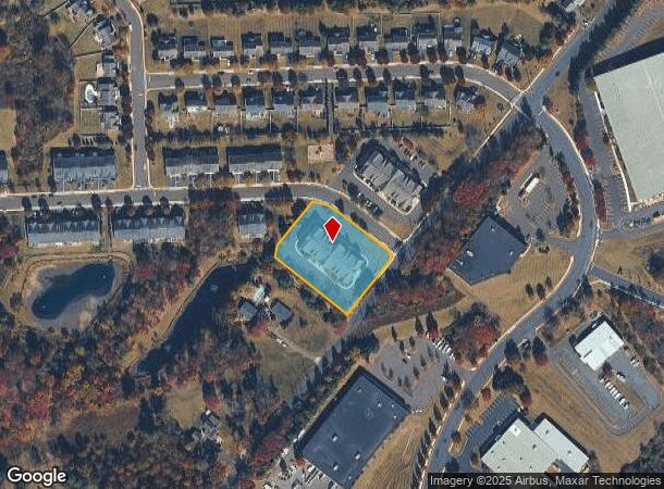
101 Village Way
Philadelphia-Camden-Wilmington, PA-NJ-DE-MD
Reserve/New Britain Final Plan
26-001-024
1.252AC LOT A RESERVE AT NEW BRITAIN
Apartment
Bucks
X
Pennsylvania
42017C0286K
a
2024
1.25 AC
2025
Central Bucks County
102003
Philadelphia
11,316 SF
DEMOGRAPHICS near 101 Village Way
1 Mile
3 Mile
5 Mile
2024 Total Population
1,805
47,293
138,398
2029 Population
1,807
47,820
139,910
Pop Growth 2024-2029
+ 0.11%
+ 1.11%
+ 1.09%
Average Age
42
42
42
2024 Total Households
616
17,451
52,375
HH Growth 2024-2029
0.00%
+ 1.05%
+ 1.04%
Median Household Inc
$140,686
$107,434
$103,634
Avg Household Size
2.90
2.60
2.50
2024 Avg HH Vehicles
2.00
2.00
2.00
Median Home Value
$399,421
$398,654
$379,604
Median Year Built
1977
1979
1980
Nearby Places
Map Layers
Map Styles
 Street
 Aerial
- Restaurants
- Banks
- Shops
- Fitness
- Groceries
PUBLIC TRANSPORTATION
AIRPORT
Lehigh Valley International
DRIVE
WALK
Distance
Lehigh Valley International
48 min
32.5 mi
Philadelphia International
DRIVE
WALK
Distance
Philadelphia International
56 min
43.8 mi
Freight Ports
Port of Philadelphia
DRIVE
WALK
Distance
Port of Philadelphia
1 min
22.7 mi
Nearby Properties
Address
Land Use
TOTAL SIZE
Lot Size
Zoning
Address
Land Use
TOTAL SIZE
Lot Size
Zoning
258,179 SF
65.34 AC
IN
Address
Land Use
TOTAL SIZE
Lot Size
Zoning
977,439 SF
70.93 AC
GA
Address
Land Use
TOTAL SIZE
Lot Size
Zoning
517,834 SF
31.33 AC
GA
Address
Land Use
TOTAL SIZE
Lot Size
Zoning
245,104 SF
31.21 AC
C
Address
Land Use
TOTAL SIZE
Lot Size
Zoning
767,474 SF
64.82 AC
RC
Address
Land Use
TOTAL SIZE
Lot Size
Zoning
334,450 SF
18.86 AC
GA
Address
Land Use
TOTAL SIZE
Lot Size
Zoning
131,631 SF
18.12 AC
SC
Address
Land Use
TOTAL SIZE
Lot Size
Zoning
444,718 SF
46.51 AC
LI
Address
Land Use
TOTAL SIZE
Lot Size
Zoning
89,349 SF
18.11 AC
R1
Address
Land Use
TOTAL SIZE
Lot Size
Zoning
502,169 SF
83.16 AC
LI
Address
Land Use
TOTAL SIZE
Lot Size
Zoning
87,819 SF
1.82 AC
S
Address
Land Use
TOTAL SIZE
Lot Size
Zoning
35.37 AC
LI
Address
Land Use
TOTAL SIZE
Lot Size
Zoning
119,740 SF
9.80 AC
BP
Address
Land Use
TOTAL SIZE
Lot Size
Zoning
213,542 SF
26.53 AC
LI
Address
Land Use
TOTAL SIZE
Lot Size
Zoning
77,805 SF
21.18 AC
R2
Address
Land Use
TOTAL SIZE
Lot Size
Zoning
134,272 SF
3.11 AC
S
Address
Land Use
TOTAL SIZE
Lot Size
Zoning
301,131 SF
18.98 AC
LI
Address
Land Use
TOTAL SIZE
Lot Size
Zoning
230,016 SF
11.27 AC
LI
Address
Land Use
TOTAL SIZE
Lot Size
Zoning
182,010 SF
12.25 AC
LI
Address
Land Use
TOTAL SIZE
Lot Size
Zoning
57,420 SF
2 AC
IN
Address
Land Use
TOTAL SIZE
Lot Size
Zoning
380,875 SF
40.10 AC
LI
Address
Land Use
TOTAL SIZE
Lot Size
Zoning
40,754 SF
6.23 AC
LI
Address
Land Use
TOTAL SIZE
Lot Size
Zoning
71,153 SF
20.48 AC
A1
Address
Land Use
TOTAL SIZE
Lot Size
Zoning
121,762 SF
16.66 AC
LI
Address
Land Use
TOTAL SIZE
Lot Size
Zoning
45,457 SF
6.32 AC
C
Address
Land Use
TOTAL SIZE
Lot Size
Zoning
79,335 SF
11.50 AC
LI
Address
Land Use
TOTAL SIZE
Lot Size
Zoning
128,619 SF
7.61 AC
LI
Address
Land Use
TOTAL SIZE
Lot Size
Zoning
361,858 SF
27.82 AC
LI
Address
Land Use
TOTAL SIZE
Lot Size
Zoning
68,854 SF
7.24 AC
C
Address
Land Use
TOTAL SIZE
Lot Size
Zoning
86,930 SF
1.76 AC
LI
The World's #1 Commercial Real Estate Marketplace
Connect with us
© 2025 CoStar Group
The information above has been obtained from sources believed reliable. While we do not doubt its accuracy we have not verified it and make no guarantee, warranty or representation about it. It is your responsibility to independently confirm its accuracy and completeness. Any projections, opinions, assumptions, or estimates used are for example only and do not represent the current or future performance of the property. The value of this transaction to you depends on tax and other factors which should be evaluated by your tax, financial, and legal advisors. You and your advisors should conduct a careful, independent investigation of the property to determine to your satisfaction the suitability of the property for your needs.