Property Record
101 W 20Th St, Hialeah, FL 33010


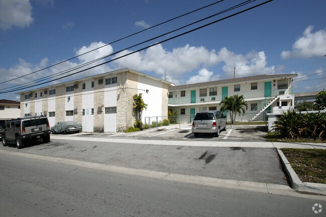
Property Detail
101 W 20Th St
04-3107-013-1150
7 53 41 HIALEAH 17TH ADD PB 23-9 LOTS 41 & 42 BLK 126 LOT SIZE 21560 SQUARE FEET OR 18289-3755-56 0998 5
Multifamilydwelling
Miami-Dade
4600
Florida
B and X Area of moderate flood hazard, usually the area between the limits of the 100-year and 500-year floods.
41,42
2024
0.50 AC
2025
Hialeah Acres
000808
South Florida
14,568 SF
Miami-Miami Beach-Kendall, FL
NEARBY LISTINGS FOR SALE OR LEASE
DEMOGRAPHICS near 101 W 20Th St
1 mile
3 mile
5 mile
2025 Total Population
31,565
171,263
489,421
2030 Population
33,361
180,947
521,665
Pop Growth 2025-2030
+ 5.69%
+ 5.65%
+ 6.59%
Average Age
46
45
43
2025 Total Households
11,067
56,976
167,908
HH Growth 2025-2030
+ 5.48%
+ 5.58%
+ 6.58%
Median Household Inc
$43,911
$54,881
$53,604
Avg Household Size
2.70
2.90
2.80
2025 Avg HH Vehicles
1.00
2.00
2.00
Median Home Value
$429,820
$436,402
$414,635
Median Year Built
1964
1964
1971
Nearby Places
Map Layers
Map Styles
 Street
 Aerial
Layers
 Traffic
 Biking
Places
Listings with unknown addresses are not visible on the map
- Restaurants
- Banks
- Shops
- Fitness
- Groceries
PUBLIC TRANSPORTATION
COMMUTER RAIL
Hialeah (Metrorail Green Line - Miami-Dade Transit (Metrorail/Metromover))
Drive
Walk
Distance
Hialeah (Metrorail Green Line - Miami-Dade Transit (Metrorail/Metromover))
1 min
8 min
0.4 mi
Okeechobee (Metrorail Green Line - Miami-Dade Transit (Metrorail/Metromover))
Drive
Walk
Distance
Okeechobee (Metrorail Green Line - Miami-Dade Transit (Metrorail/Metromover))
4 min
1.3 mi
AIRPORT
Miami International
Drive
Walk
Distance
Miami International
15 min
5.8 mi
Fort Lauderdale/Hollywood International
Drive
Walk
Distance
Fort Lauderdale/Hollywood International
37 min
21.9 mi
Freight Ports
Port of Miami
Drive
Walk
Distance
Port of Miami
21 min
10.9 mi
Nearby Properties
Address
Land Use
TOTAL SIZE
Lot Size
Zoning
Address
Land Use
TOTAL SIZE
Lot Size
Zoning
7.62 AC
7200
Address
Land Use
TOTAL SIZE
Lot Size
Zoning
418,532 SF
17.95 AC
7300
Address
Land Use
TOTAL SIZE
Lot Size
Zoning
328,554 SF
668.26 AC
8900
Address
Land Use
TOTAL SIZE
Lot Size
Zoning
1,700 SF
7.24 AC
7100
Address
Land Use
TOTAL SIZE
Lot Size
Zoning
301,593 SF
16 AC
7100
Address
Land Use
TOTAL SIZE
Lot Size
Zoning
451,817 SF
6400
Address
Land Use
TOTAL SIZE
Lot Size
Zoning
322,084 SF
6.60 AC
7100
Address
Land Use
TOTAL SIZE
Lot Size
Zoning
344,465 SF
5.03 AC
6400
Address
Land Use
TOTAL SIZE
Lot Size
Zoning
603,504 SF
27.15 AC
7100
Address
Land Use
TOTAL SIZE
Lot Size
Zoning
393,093 SF
3.61 AC
6400
Address
Land Use
TOTAL SIZE
Lot Size
Zoning
207,475 SF
51.47 AC
7100
Address
Land Use
TOTAL SIZE
Lot Size
Zoning
225,137 SF
80.89 AC
7600
Address
Land Use
TOTAL SIZE
Lot Size
Zoning
510,373 SF
154.10 AC
8900
Address
Land Use
TOTAL SIZE
Lot Size
Zoning
419,656 SF
8.61 AC
6400
Address
Land Use
TOTAL SIZE
Lot Size
Zoning
530,479 SF
10.13 AC
6400
Address
Land Use
TOTAL SIZE
Lot Size
Zoning
445,429 SF
4.45 AC
6400
Address
Land Use
TOTAL SIZE
Lot Size
Zoning
252,698 SF
13.22 AC
7100
Address
Land Use
TOTAL SIZE
Lot Size
Zoning
293,962 SF
9.99 AC
4400
Address
Land Use
TOTAL SIZE
Lot Size
Zoning
249,486 SF
11.84 AC
7100
Address
Land Use
TOTAL SIZE
Lot Size
Zoning
680,945 SF
35.56 AC
6400
Address
Land Use
TOTAL SIZE
Lot Size
Zoning
478,031 SF
1.72 AC
6600
Address
Land Use
TOTAL SIZE
Lot Size
Zoning
314,441 SF
16.99 AC
7600
Address
Land Use
TOTAL SIZE
Lot Size
Zoning
366,063 SF
57.35 AC
7100
Address
Land Use
TOTAL SIZE
Lot Size
Zoning
412,149 SF
19.40 AC
7100
Address
Land Use
TOTAL SIZE
Lot Size
Zoning
330,082 SF
7.02 AC
8000
Address
Land Use
TOTAL SIZE
Lot Size
Zoning
335,221 SF
21.51 AC
6400
Address
Land Use
TOTAL SIZE
Lot Size
Zoning
325,380 SF
24.86 AC
7100
Address
Land Use
TOTAL SIZE
Lot Size
Zoning
195,483 SF
4.95 AC
6600
Address
Land Use
TOTAL SIZE
Lot Size
Zoning
398,600 SF
29.11 AC
7100
Address
Land Use
TOTAL SIZE
Lot Size
Zoning
203,234 SF
28.88 AC
8000
The World's #1 Commercial Real Estate Marketplace
Connect with us
© 2026 CoStar Group
The information above has been obtained from sources believed reliable. While we do not doubt its accuracy we have not verified it and make no guarantee, warranty or representation about it. It is your responsibility to independently confirm its accuracy and completeness. Any projections, opinions, assumptions, or estimates used are for example only and do not represent the current or future performance of the property. The value of this transaction to you depends on tax and other factors which should be evaluated by your tax, financial, and legal advisors. You and your advisors should conduct a careful, independent investigation of the property to determine to your satisfaction the suitability of the property for your needs.