Property Record
101 W Caldwell Dr, Lenoir, NC 28645

NEARBY LISTINGS FOR SALE OR LEASE
Property Detail
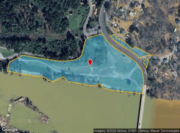
101 W Caldwell Dr
Hickory-Lenoir-Morganton, NC
Estates Nc Llc
08-6R-1-2
BK 2096 PG 523 YR 2023 ST 1000.00
Residentialacreage
Caldwell
AE
North Carolina
3710277400K
11 AC
0
Caldwell County
2025
Charlotte
030200
DEMOGRAPHICS near 101 W Caldwell Dr
1 Mile
3 Mile
5 Mile
2024 Total Population
897
12,271
40,042
2029 Population
890
12,237
40,288
Pop Growth 2024-2029
(0.78%)
(0.28%)
+ 0.61%
Average Age
42
43
43
2024 Total Households
362
4,829
16,183
HH Growth 2024-2029
(0.55%)
(0.29%)
+ 0.65%
Median Household Inc
$44,740
$53,876
$55,045
Avg Household Size
2.40
2.40
2.40
2024 Avg HH Vehicles
2.00
2.00
2.00
Median Home Value
$134,536
$159,611
$173,885
Median Year Built
1985
1983
1979
Nearby Places
Map Layers
Map Styles
 Street
 Aerial
- Restaurants
- Banks
- Shops
- Fitness
- Groceries
SALE & LEASE HISTORY
LISTING DATE
SALE/LEASE

Aug 26, 2019
For Sale
Nearby Properties
Address
Land Use
TOTAL SIZE
Lot Size
Zoning
Address
Land Use
TOTAL SIZE
Lot Size
Zoning
534,243 SF
285.78 AC
Address
Land Use
TOTAL SIZE
Lot Size
Zoning
187,241 SF
25.01 AC
Address
Land Use
TOTAL SIZE
Lot Size
Zoning
26,955 SF
16.44 AC
Address
Land Use
TOTAL SIZE
Lot Size
Zoning
73,872 SF
NO ZONING
Address
Land Use
TOTAL SIZE
Lot Size
Zoning
57,198 SF
16.07 AC
Address
Land Use
TOTAL SIZE
Lot Size
Zoning
39,738 SF
11.80 AC
Address
Land Use
TOTAL SIZE
Lot Size
Zoning
99,512 SF
6.04 AC
Address
Land Use
TOTAL SIZE
Lot Size
Zoning
24,496 SF
2.48 AC
Address
Land Use
TOTAL SIZE
Lot Size
Zoning
42,672 SF
7.51 AC
Address
Land Use
TOTAL SIZE
Lot Size
Zoning
69,240 SF
19.79 AC
Address
Land Use
TOTAL SIZE
Lot Size
Zoning
38,384 SF
348 AC
Address
Land Use
TOTAL SIZE
Lot Size
Zoning
48,697 SF
7.25 AC
Address
Land Use
TOTAL SIZE
Lot Size
Zoning
67,247 SF
39.60 AC
Address
Land Use
TOTAL SIZE
Lot Size
Zoning
35,808 SF
7.31 AC
Address
Land Use
TOTAL SIZE
Lot Size
Zoning
14,488 SF
2.07 AC
Address
Land Use
TOTAL SIZE
Lot Size
Zoning
76,720 SF
36.13 AC
Address
Land Use
TOTAL SIZE
Lot Size
Zoning
9,147 SF
633 AC
Address
Land Use
TOTAL SIZE
Lot Size
Zoning
6,148 SF
6.70 AC
Address
Land Use
TOTAL SIZE
Lot Size
Zoning
11,261 SF
15.98 AC
Address
Land Use
TOTAL SIZE
Lot Size
Zoning
21,505 SF
3.64 AC
Address
Land Use
TOTAL SIZE
Lot Size
Zoning
2,188 SF
7.86 AC
Address
Land Use
TOTAL SIZE
Lot Size
Zoning
9,119 SF
4.23 AC
Address
Land Use
TOTAL SIZE
Lot Size
Zoning
16,602 SF
5.46 AC
Address
Land Use
TOTAL SIZE
Lot Size
Zoning
24,240 SF
18.90 AC
Address
Land Use
TOTAL SIZE
Lot Size
Zoning
10,500 SF
RESIDENTIA
Address
Land Use
TOTAL SIZE
Lot Size
Zoning
10,368 SF
16.47 AC
Address
Land Use
TOTAL SIZE
Lot Size
Zoning
15,920 SF
LOW DENSIT
Address
Land Use
TOTAL SIZE
Lot Size
Zoning
4,554 SF
1.55 AC
Address
Land Use
TOTAL SIZE
Lot Size
Zoning
25,976 SF
425 AC
The World's #1 Commercial Real Estate Marketplace
Connect with us
© 2025 CoStar Group
The information above has been obtained from sources believed reliable. While we do not doubt its accuracy we have not verified it and make no guarantee, warranty or representation about it. It is your responsibility to independently confirm its accuracy and completeness. Any projections, opinions, assumptions, or estimates used are for example only and do not represent the current or future performance of the property. The value of this transaction to you depends on tax and other factors which should be evaluated by your tax, financial, and legal advisors. You and your advisors should conduct a careful, independent investigation of the property to determine to your satisfaction the suitability of the property for your needs.