Property Record
101 W Evans St, Florence, SC 29501

Property Detail
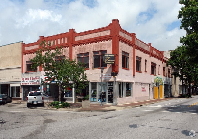
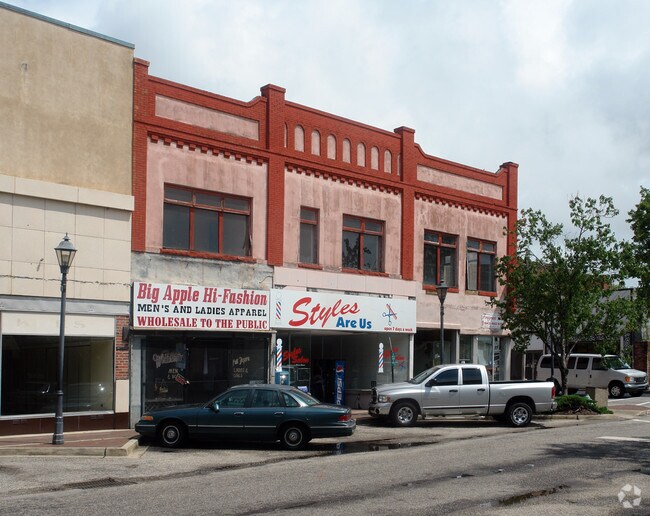
101 W Evans St
Storebuilding
W EVANS ST
B4
Florence
B and X Area of moderate flood hazard, usually the area between the limits of the 100-year and 500-year floods.
South Carolina
2025
0.15 AC
2025
Other Market Areas
001000
Florence, SC
22,242 SF
90167-02-011
NEARBY LISTINGS FOR SALE OR LEASE
DEMOGRAPHICS near 101 W Evans St
1 mile
3 mile
5 mile
2025 Total Population
8,254
31,614
70,137
2030 Population
8,585
32,192
70,976
Pop Growth 2025-2030
+ 4.01%
+ 1.83%
+ 1.20%
Average Age
41
41
40
2025 Total Households
3,533
13,205
28,884
HH Growth 2025-2030
+ 4.27%
+ 1.89%
+ 1.18%
Median Household Inc
$34,057
$46,043
$56,014
Avg Household Size
2.20
2.30
2.30
2025 Avg HH Vehicles
1.00
2.00
2.00
Median Home Value
$103,776
$168,098
$186,614
Median Year Built
1968
1972
1982
Nearby Places
Map Layers
Map Styles
 Street
 Aerial
Transit
 Traffic
 Biking
Places
Listings with unknown addresses are not visible on the map
- Restaurants
- Banks
- Shops
- Fitness
- Groceries
PUBLIC TRANSPORTATION
COMMUTER RAIL
Drive
Walk
Distance
3 min
12 min
0.6 mi
Nearby Properties
Address
Land Use
TOTAL SIZE
Lot Size
Zoning
Address
Land Use
TOTAL SIZE
Lot Size
Zoning
194,083 SF
27.70 AC
B3
Address
Land Use
TOTAL SIZE
Lot Size
Zoning
8,416 SF
2.10 AC
B4
Address
Land Use
TOTAL SIZE
Lot Size
Zoning
125,000 SF
6.84 AC
B1
Address
Land Use
TOTAL SIZE
Lot Size
Zoning
1,347.68 AC
Address
Land Use
TOTAL SIZE
Lot Size
Zoning
86,950 SF
6.82 AC
B2
Address
Land Use
TOTAL SIZE
Lot Size
Zoning
Address
Land Use
TOTAL SIZE
Lot Size
Zoning
66,715 SF
0.52 AC
Address
Land Use
TOTAL SIZE
Lot Size
Zoning
55,536 SF
0.02 AC
Address
Land Use
TOTAL SIZE
Lot Size
Zoning
55,536 SF
0.02 AC
Address
Land Use
TOTAL SIZE
Lot Size
Zoning
Address
Land Use
TOTAL SIZE
Lot Size
Zoning
19,617 SF
0.31 AC
B2
Address
Land Use
TOTAL SIZE
Lot Size
Zoning
108,700 SF
8.15 AC
R5
Address
Land Use
TOTAL SIZE
Lot Size
Zoning
133,616 SF
10.98 AC
Address
Land Use
TOTAL SIZE
Lot Size
Zoning
26.36 AC
B1
Address
Land Use
TOTAL SIZE
Lot Size
Zoning
79,263 SF
1.34 AC
B4
Address
Land Use
TOTAL SIZE
Lot Size
Zoning
4,000 SF
6.22 AC
Address
Land Use
TOTAL SIZE
Lot Size
Zoning
72,270 SF
3.80 AC
PDD
Address
Land Use
TOTAL SIZE
Lot Size
Zoning
35,770 SF
6.40 AC
B3
Address
Land Use
TOTAL SIZE
Lot Size
Zoning
29,521 SF
7.84 AC
Address
Land Use
TOTAL SIZE
Lot Size
Zoning
18,500 SF
3.55 AC
Address
Land Use
TOTAL SIZE
Lot Size
Zoning
134,869 SF
20.08 AC
Address
Land Use
TOTAL SIZE
Lot Size
Zoning
60,000 SF
0.02 AC
Address
Land Use
TOTAL SIZE
Lot Size
Zoning
71,400 SF
3.71 AC
B3
Address
Land Use
TOTAL SIZE
Lot Size
Zoning
14,820 SF
0.88 AC
B3
Address
Land Use
TOTAL SIZE
Lot Size
Zoning
14,438 SF
1.88 AC
Address
Land Use
TOTAL SIZE
Lot Size
Zoning
47,600 SF
4.57 AC
R4
Address
Land Use
TOTAL SIZE
Lot Size
Zoning
112,056 SF
18.96 AC
Address
Land Use
TOTAL SIZE
Lot Size
Zoning
25,560 SF
1.40 AC
B3
The World's #1 Commercial Real Estate Marketplace
Connect with us
© 2026 CoStar Group
The information above has been obtained from sources believed reliable. While we do not doubt its accuracy we have not verified it and make no guarantee, warranty or representation about it. It is your responsibility to independently confirm its accuracy and completeness. Any projections, opinions, assumptions, or estimates used are for example only and do not represent the current or future performance of the property. The value of this transaction to you depends on tax and other factors which should be evaluated by your tax, financial, and legal advisors. You and your advisors should conduct a careful, independent investigation of the property to determine to your satisfaction the suitability of the property for your needs.