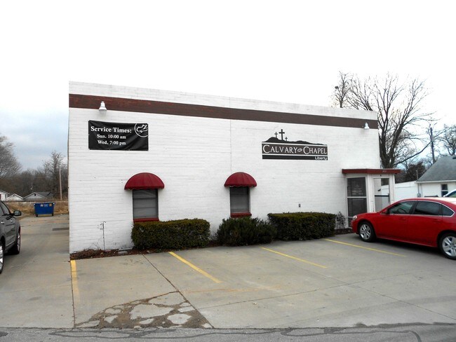
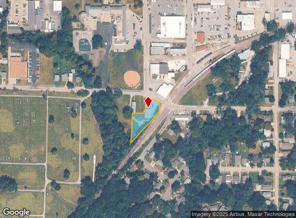
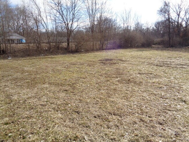
Property Record
101 W Shrader St, Liberty, MO 64068
NEARBY LISTINGS FOR SALE OR LEASE
Property Detail
101 W Shrader St
Kansas City, MO-KS
New Liberia Addition
15-118-00-04-001.00
NEW LIBERIA ADDITION LTS 5-15 & VAC ALLEY W OF LTS 8-12 & VAC ALLEY N OF LT 14
Commercialnec
Clay
AE
Missouri
29095C0156G
5-15
2024
0.53 AC
2025
Liberty
021403
Kansas City
DEMOGRAPHICS near 101 W Shrader St
1 Mile
3 Mile
5 Mile
2024 Total Population
10,417
39,125
68,843
2029 Population
10,923
40,913
72,184
Pop Growth 2024-2029
+ 4.86%
+ 4.57%
+ 4.85%
Average Age
37
39
38
2024 Total Households
4,026
14,701
25,222
HH Growth 2024-2029
+ 4.94%
+ 4.65%
+ 4.94%
Median Household Inc
$64,196
$83,349
$90,419
Avg Household Size
2.40
2.50
2.60
2024 Avg HH Vehicles
2.00
2.00
2.00
Median Home Value
$197,683
$276,532
$275,959
Median Year Built
1972
1989
1995
Nearby Places
Map Layers
Map Styles
 Street
 Aerial
- Restaurants
- Banks
- Shops
- Fitness
- Groceries
PUBLIC TRANSPORTATION
AIRPORT
Kansas City International
DRIVE
WALK
Distance
Kansas City International
29 min
20.0 mi
SALE & LEASE HISTORY
LISTING DATE
SALE/LEASE

Feb 07, 2019
For Lease
Apr 20, 2018
For Lease
Apr 16, 2018
For Sale
Nearby Properties
Address
Land Use
TOTAL SIZE
Lot Size
Zoning
Address
Land Use
TOTAL SIZE
Lot Size
Zoning
58.76 AC
Address
Land Use
TOTAL SIZE
Lot Size
Zoning
82.81 AC
Address
Land Use
TOTAL SIZE
Lot Size
Zoning
36.93 AC
Address
Land Use
TOTAL SIZE
Lot Size
Zoning
5,644 SF
90.18 AC
Address
Land Use
TOTAL SIZE
Lot Size
Zoning
64.34 AC
Address
Land Use
TOTAL SIZE
Lot Size
Zoning
50.52 AC
Address
Land Use
TOTAL SIZE
Lot Size
Zoning
Address
Land Use
TOTAL SIZE
Lot Size
Zoning
524.98 AC
Address
Land Use
TOTAL SIZE
Lot Size
Zoning
9.72 AC
Address
Land Use
TOTAL SIZE
Lot Size
Zoning
18.03 AC
Address
Land Use
TOTAL SIZE
Lot Size
Zoning
26.52 AC
Address
Land Use
TOTAL SIZE
Lot Size
Zoning
1.02 AC
Address
Land Use
TOTAL SIZE
Lot Size
Zoning
14.90 AC
Address
Land Use
TOTAL SIZE
Lot Size
Zoning
1.56 AC
Address
Land Use
TOTAL SIZE
Lot Size
Zoning
0.46 AC
Address
Land Use
TOTAL SIZE
Lot Size
Zoning
Address
Land Use
TOTAL SIZE
Lot Size
Zoning
10.90 AC
Address
Land Use
TOTAL SIZE
Lot Size
Zoning
21.19 AC
Address
Land Use
TOTAL SIZE
Lot Size
Zoning
16.84 AC
Address
Land Use
TOTAL SIZE
Lot Size
Zoning
Address
Land Use
TOTAL SIZE
Lot Size
Zoning
921 SF
20.16 AC
Address
Land Use
TOTAL SIZE
Lot Size
Zoning
4.94 AC
Address
Land Use
TOTAL SIZE
Lot Size
Zoning
0.67 AC
Address
Land Use
TOTAL SIZE
Lot Size
Zoning
20.04 AC
Address
Land Use
TOTAL SIZE
Lot Size
Zoning
1.44 AC
Address
Land Use
TOTAL SIZE
Lot Size
Zoning
5.96 AC
Address
Land Use
TOTAL SIZE
Lot Size
Zoning
15.48 AC
Address
Land Use
TOTAL SIZE
Lot Size
Zoning
Address
Land Use
TOTAL SIZE
Lot Size
Zoning
8.79 AC
Address
Land Use
TOTAL SIZE
Lot Size
Zoning
11.66 AC
The World's #1 Commercial Real Estate Marketplace
Connect with us
© 2025 CoStar Group
The information above has been obtained from sources believed reliable. While we do not doubt its accuracy we have not verified it and make no guarantee, warranty or representation about it. It is your responsibility to independently confirm its accuracy and completeness. Any projections, opinions, assumptions, or estimates used are for example only and do not represent the current or future performance of the property. The value of this transaction to you depends on tax and other factors which should be evaluated by your tax, financial, and legal advisors. You and your advisors should conduct a careful, independent investigation of the property to determine to your satisfaction the suitability of the property for your needs.