Property Record
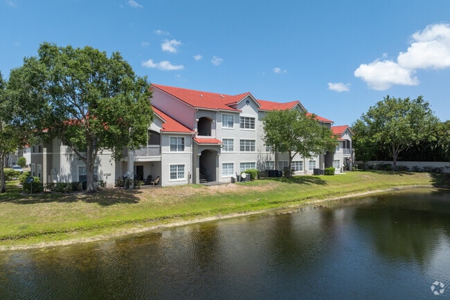
101 Waterway Village Ct, Greenacres, FL 33413


NEARBY LISTINGS FOR SALE OR LEASE
-
-
View all Greenacres listings for sale on LoopNet.com
Property Detail
101 Waterway Village Ct
West Palm Beach-Boca Raton-Delray Beach, FL
River Bridge Par 4B
18-42-44-15-45-000-0000
RIVER BRIDGE PAR 4B PAR 4B
Multifamilydwelling
Palm Beach
AE
Florida
12099C0569F
4b
2024
12.61 AC
2025
River Bridge
004815
South Florida
273,023 SF
DEMOGRAPHICS near 101 Waterway Village Ct
1 Mile
3 Mile
5 Mile
2024 Total Population
20,511
135,489
298,185
2029 Population
20,839
139,372
306,125
Pop Growth 2024-2029
+ 1.60%
+ 2.87%
+ 2.66%
Average Age
41
40
39
2024 Total Households
8,076
48,970
104,508
HH Growth 2024-2029
+ 1.25%
+ 2.69%
+ 2.33%
Median Household Inc
$47,544
$53,044
$59,922
Avg Household Size
2.40
2.60
2.70
2024 Avg HH Vehicles
1.00
2.00
2.00
Median Home Value
$179,420
$210,888
$281,085
Median Year Built
1985
1984
1985
Nearby Places
Map Layers
Map Styles
 Street
 Aerial
- Restaurants
- Banks
- Shops
- Fitness
- Groceries
PUBLIC TRANSPORTATION
COMMUTER RAIL
Lake Worth (Mangonia Park - Miami Airport - Tri-Rail, Tri-County Commuter - Tri-Rail)
DRIVE
WALK
Distance
Lake Worth (Mangonia Park - Miami Airport - Tri-Rail, Tri-County Commuter - Tri-Rail)
12 min
6.4 mi
AIRPORT
Palm Beach International
DRIVE
WALK
Distance
Palm Beach International
13 min
6.3 mi
Freight Ports
Port of Palm Beach
DRIVE
WALK
Distance
Port of Palm Beach
28 min
14.5 mi
Nearby Properties
Address
Land Use
TOTAL SIZE
Lot Size
Zoning
Address
Land Use
TOTAL SIZE
Lot Size
Zoning
644,690 SF
44.88 AC
MUPD
Address
Land Use
TOTAL SIZE
Lot Size
Zoning
466,497 SF
21.05 AC
PUD
Address
Land Use
TOTAL SIZE
Lot Size
Zoning
199,032 SF
769.86 AC
PO
Address
Land Use
TOTAL SIZE
Lot Size
Zoning
371,130 SF
19.90 AC
PUD
Address
Land Use
TOTAL SIZE
Lot Size
Zoning
335,373 SF
16.55 AC
MUPD
Address
Land Use
TOTAL SIZE
Lot Size
Zoning
379,598 SF
17.06 AC
RM-2
Address
Land Use
TOTAL SIZE
Lot Size
Zoning
379,598 SF
17.02 AC
RM-2
Address
Land Use
TOTAL SIZE
Lot Size
Zoning
344,071 SF
27.34 AC
RM-2
Address
Land Use
TOTAL SIZE
Lot Size
Zoning
52,656 SF
849.42 AC
PO
Address
Land Use
TOTAL SIZE
Lot Size
Zoning
210,445 SF
11.18 AC
MUPD
Address
Land Use
TOTAL SIZE
Lot Size
Zoning
324,453 SF
25.47 AC
IL
Address
Land Use
TOTAL SIZE
Lot Size
Zoning
387,788 SF
48.75 AC
GU
Address
Land Use
TOTAL SIZE
Lot Size
Zoning
338,248 SF
54.21 AC
CF
Address
Land Use
TOTAL SIZE
Lot Size
Zoning
344,562 SF
19.84 AC
G
Address
Land Use
TOTAL SIZE
Lot Size
Zoning
226,094 SF
27.47 AC
CI
Address
Land Use
TOTAL SIZE
Lot Size
Zoning
238,988 SF
8.55 AC
RM
Address
Land Use
TOTAL SIZE
Lot Size
Zoning
191,404 SF
30.48 AC
GU
Address
Land Use
TOTAL SIZE
Lot Size
Zoning
131,955 SF
9.15 AC
MUPD
Address
Land Use
TOTAL SIZE
Lot Size
Zoning
192,427 SF
23.70 AC
RM
Address
Land Use
TOTAL SIZE
Lot Size
Zoning
236,045 SF
26.50 AC
RM-2
Address
Land Use
TOTAL SIZE
Lot Size
Zoning
203,046 SF
16.06 AC
G
Address
Land Use
TOTAL SIZE
Lot Size
Zoning
156,873 SF
13.21 AC
CI
Address
Land Use
TOTAL SIZE
Lot Size
Zoning
185,020 SF
17.48 AC
GU
Address
Land Use
TOTAL SIZE
Lot Size
Zoning
103,956 SF
7.06 AC
RM
Address
Land Use
TOTAL SIZE
Lot Size
Zoning
145,209 SF
15.23 AC
RS
Address
Land Use
TOTAL SIZE
Lot Size
Zoning
132,316 SF
16.91 AC
UC
Address
Land Use
TOTAL SIZE
Lot Size
Zoning
178,259 SF
20.13 AC
CI
Address
Land Use
TOTAL SIZE
Lot Size
Zoning
94,888 SF
4.93 AC
RM
Address
Land Use
TOTAL SIZE
Lot Size
Zoning
127,759 SF
11.16 AC
RM
The World's #1 Commercial Real Estate Marketplace
Connect with us
© 2025 CoStar Group
The information above has been obtained from sources believed reliable. While we do not doubt its accuracy we have not verified it and make no guarantee, warranty or representation about it. It is your responsibility to independently confirm its accuracy and completeness. Any projections, opinions, assumptions, or estimates used are for example only and do not represent the current or future performance of the property. The value of this transaction to you depends on tax and other factors which should be evaluated by your tax, financial, and legal advisors. You and your advisors should conduct a careful, independent investigation of the property to determine to your satisfaction the suitability of the property for your needs.