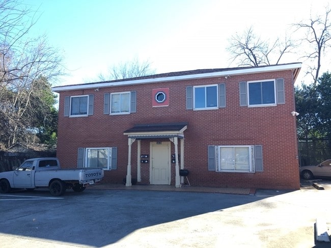
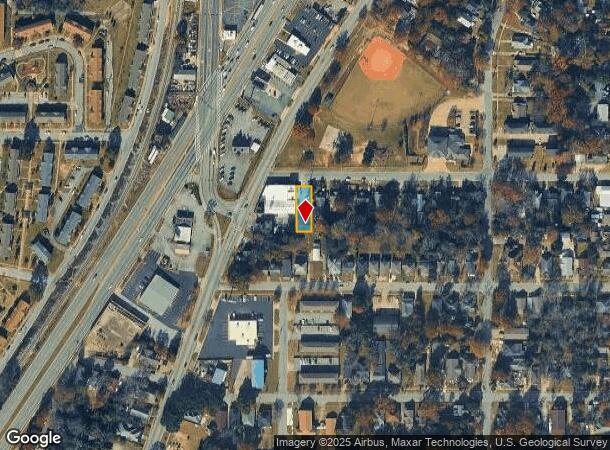
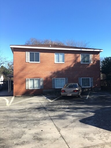
Property Record
1010 33Rd St, Columbus, GA 31904
NEARBY LISTINGS FOR SALE OR LEASE
Property Detail
1010 33Rd St
014-027-031
Multi Category
Commercialnec
2 BK F ROSE HILL COMPANY
X
Muscogee
01113C0176C
Georgia
2025
0.17 AC
2025
North Columbus
001400
Columbus GA
1,628 SF
Columbus, GA-AL
DEMOGRAPHICS near 1010 33Rd St
1 Mile
3 Mile
5 Mile
2024 Total Population
13,022
68,221
150,260
2029 Population
13,053
67,655
148,290
Pop Growth 2024-2029
+ 0.24%
(0.83%)
(1.31%)
Average Age
37
38
38
2024 Total Households
5,668
29,223
62,464
HH Growth 2024-2029
+ 0.19%
(0.85%)
(1.36%)
Median Household Inc
$30,609
$40,281
$44,406
Avg Household Size
2.20
2.20
2.30
2024 Avg HH Vehicles
1.00
1.00
2.00
Median Home Value
$80,585
$151,114
$160,857
Median Year Built
1958
1965
1972
Nearby Places
Map Layers
Map Styles
 Street
 Aerial
- Restaurants
- Banks
- Shops
- Fitness
- Groceries
PUBLIC TRANSPORTATION
AIRPORT
Columbus
DRIVE
WALK
Distance
Columbus
9 min
3.8 mi
Nearby Properties
Address
Land Use
TOTAL SIZE
Lot Size
Zoning
Address
Land Use
TOTAL SIZE
Lot Size
Zoning
81,423 SF
11.54 AC
Address
Land Use
TOTAL SIZE
Lot Size
Zoning
68,000 SF
11.21 AC
Address
Land Use
TOTAL SIZE
Lot Size
Zoning
2,744 SF
41.16 AC
Address
Land Use
TOTAL SIZE
Lot Size
Zoning
32,750 SF
4.01 AC
Address
Land Use
TOTAL SIZE
Lot Size
Zoning
174,892 SF
19.03 AC
Address
Land Use
TOTAL SIZE
Lot Size
Zoning
2.48 AC
Address
Land Use
TOTAL SIZE
Lot Size
Zoning
43,888 SF
2 AC
Address
Land Use
TOTAL SIZE
Lot Size
Zoning
55,900 SF
27.05 AC
Address
Land Use
TOTAL SIZE
Lot Size
Zoning
9,266 SF
50.07 AC
Address
Land Use
TOTAL SIZE
Lot Size
Zoning
216,360 SF
17.51 AC
Address
Land Use
TOTAL SIZE
Lot Size
Zoning
65,875 SF
2.37 AC
Address
Land Use
TOTAL SIZE
Lot Size
Zoning
14,253 SF
6.71 AC
Address
Land Use
TOTAL SIZE
Lot Size
Zoning
63,220 SF
3.49 AC
Address
Land Use
TOTAL SIZE
Lot Size
Zoning
37,202 SF
8.03 AC
Address
Land Use
TOTAL SIZE
Lot Size
Zoning
10,683 SF
588.24 AC
Address
Land Use
TOTAL SIZE
Lot Size
Zoning
56,095 SF
25.91 AC
Address
Land Use
TOTAL SIZE
Lot Size
Zoning
27,621 SF
6.33 AC
Address
Land Use
TOTAL SIZE
Lot Size
Zoning
2.31 AC
Address
Land Use
TOTAL SIZE
Lot Size
Zoning
32,238 SF
7.21 AC
Address
Land Use
TOTAL SIZE
Lot Size
Zoning
10,705 SF
0.64 AC
Address
Land Use
TOTAL SIZE
Lot Size
Zoning
64,793 SF
34.48 AC
Address
Land Use
TOTAL SIZE
Lot Size
Zoning
31,847 SF
1.21 AC
Address
Land Use
TOTAL SIZE
Lot Size
Zoning
4,334 SF
13.29 AC
Address
Land Use
TOTAL SIZE
Lot Size
Zoning
4,187 SF
12.56 AC
Address
Land Use
TOTAL SIZE
Lot Size
Zoning
1.21 AC
Address
Land Use
TOTAL SIZE
Lot Size
Zoning
34,866 SF
2.34 AC
Address
Land Use
TOTAL SIZE
Lot Size
Zoning
Address
Land Use
TOTAL SIZE
Lot Size
Zoning
18,050 SF
1.17 AC
Address
Land Use
TOTAL SIZE
Lot Size
Zoning
142,703 SF
28.48 AC
Address
Land Use
TOTAL SIZE
Lot Size
Zoning
29,640 SF
1.11 AC
The World's #1 Commercial Real Estate Marketplace
Connect with us
© 2025 CoStar Group
The information above has been obtained from sources believed reliable. While we do not doubt its accuracy we have not verified it and make no guarantee, warranty or representation about it. It is your responsibility to independently confirm its accuracy and completeness. Any projections, opinions, assumptions, or estimates used are for example only and do not represent the current or future performance of the property. The value of this transaction to you depends on tax and other factors which should be evaluated by your tax, financial, and legal advisors. You and your advisors should conduct a careful, independent investigation of the property to determine to your satisfaction the suitability of the property for your needs.