Property Record
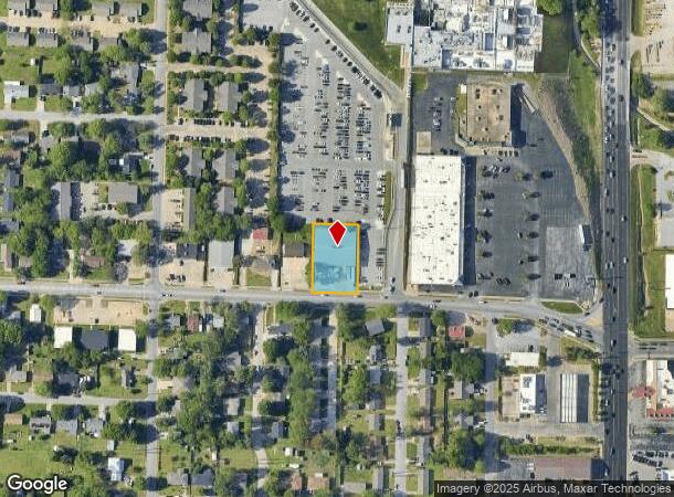
1010 Backus Ave, Springdale, AR 72764

Current Lease Availabilities
NEARBY LISTINGS FOR SALE OR LEASE
Property Detail
1010 Backus Ave
815-29738-001
Springdale Outlots
Warehouse
PT SE SE .659 A. FURTHER DESCRIBED FROM 2016-26246 AS: PART OF THE SOUTHEAST QUARTER OF THE SOUTHEAST QUARTER OF SECTION 26,
X
Washington
05143C0060G
Arkansas
2025
0.66 AC
2025
Greater Springdale
010401
Fayetteville/Springdale/Rogers
12,064 SF
Fayetteville-Springdale-Rogers, AR
DEMOGRAPHICS near 1010 Backus Ave
1 mile
3 mile
5 mile
2024 Total Population
11,192
66,873
111,636
2029 Population
12,166
73,740
123,797
Pop Growth 2024-2029
+ 8.70%
+ 10.27%
+ 10.89%
Average Age
36
34
35
2024 Total Households
3,296
20,603
37,104
HH Growth 2024-2029
+ 8.65%
+ 10.42%
+ 11.07%
Median Household Inc
$57,596
$58,756
$66,297
Avg Household Size
2.90
3.10
2.90
2024 Avg HH Vehicles
2.00
2.00
2.00
Median Home Value
$163,966
$188,110
$219,112
Median Year Built
1976
1991
1995
Nearby Places
Map Layers
Map Styles
 Street
 Aerial
Transit
 Traffic
 Biking
Places
Listings with unknown addresses are not visible on the map
- Restaurants
- Banks
- Shops
- Fitness
- Groceries
PUBLIC TRANSPORTATION
AIRPORT
Northwest Arkansas Ntl
Drive
Walk
Distance
Northwest Arkansas Ntl
32 min
16.5 mi
Nearby Properties
Address
Land Use
TOTAL SIZE
Lot Size
Zoning
Address
Land Use
TOTAL SIZE
Lot Size
Zoning
167,116 SF
41.39 AC
I1
Address
Land Use
TOTAL SIZE
Lot Size
Zoning
58,764 SF
1.56 AC
Address
Land Use
TOTAL SIZE
Lot Size
Zoning
403,089 SF
1.93 AC
Address
Land Use
TOTAL SIZE
Lot Size
Zoning
481,800 SF
40 AC
Address
Land Use
TOTAL SIZE
Lot Size
Zoning
437,349 SF
40.29 AC
Address
Land Use
TOTAL SIZE
Lot Size
Zoning
153,718 SF
Address
Land Use
TOTAL SIZE
Lot Size
Zoning
341,266 SF
17.61 AC
Address
Land Use
TOTAL SIZE
Lot Size
Zoning
196,657 SF
18.82 AC
Address
Land Use
TOTAL SIZE
Lot Size
Zoning
191,100 SF
10.03 AC
Address
Land Use
TOTAL SIZE
Lot Size
Zoning
117,690 SF
2.38 AC
Address
Land Use
TOTAL SIZE
Lot Size
Zoning
176,204 SF
7.57 AC
Address
Land Use
TOTAL SIZE
Lot Size
Zoning
292,470 SF
17.27 AC
Address
Land Use
TOTAL SIZE
Lot Size
Zoning
193,140 SF
21.31 AC
Address
Land Use
TOTAL SIZE
Lot Size
Zoning
174,333 SF
25 AC
I1I2
Address
Land Use
TOTAL SIZE
Lot Size
Zoning
134,342 SF
14.95 AC
Address
Land Use
TOTAL SIZE
Lot Size
Zoning
156,072 SF
12.43 AC
Address
Land Use
TOTAL SIZE
Lot Size
Zoning
16,698 SF
1.11 AC
Address
Land Use
TOTAL SIZE
Lot Size
Zoning
229,158 SF
21.23 AC
C2
Address
Land Use
TOTAL SIZE
Lot Size
Zoning
178,140 SF
4.39 AC
Address
Land Use
TOTAL SIZE
Lot Size
Zoning
180,412 SF
13.14 AC
Address
Land Use
TOTAL SIZE
Lot Size
Zoning
167,040 SF
19.98 AC
Address
Land Use
TOTAL SIZE
Lot Size
Zoning
117,196 SF
9.74 AC
Address
Land Use
TOTAL SIZE
Lot Size
Zoning
21,208 SF
1.89 AC
C2
Address
Land Use
TOTAL SIZE
Lot Size
Zoning
224,408 SF
9.80 AC
I1
Address
Land Use
TOTAL SIZE
Lot Size
Zoning
73,436 SF
16.01 AC
I1
Address
Land Use
TOTAL SIZE
Lot Size
Zoning
85,874 SF
2.76 AC
Address
Land Use
TOTAL SIZE
Lot Size
Zoning
206,446 SF
17.14 AC
Address
Land Use
TOTAL SIZE
Lot Size
Zoning
12,882 SF
12.33 AC
Address
Land Use
TOTAL SIZE
Lot Size
Zoning
31,150 SF
3.74 AC
C1
Address
Land Use
TOTAL SIZE
Lot Size
Zoning
182,415 SF
68.93 AC
The World's #1 Commercial Real Estate Marketplace
Connect with us
© 2026 CoStar Group
The information above has been obtained from sources believed reliable. While we do not doubt its accuracy we have not verified it and make no guarantee, warranty or representation about it. It is your responsibility to independently confirm its accuracy and completeness. Any projections, opinions, assumptions, or estimates used are for example only and do not represent the current or future performance of the property. The value of this transaction to you depends on tax and other factors which should be evaluated by your tax, financial, and legal advisors. You and your advisors should conduct a careful, independent investigation of the property to determine to your satisfaction the suitability of the property for your needs.