Property Record
1010 Branch Rd, Rincon, GA 31326
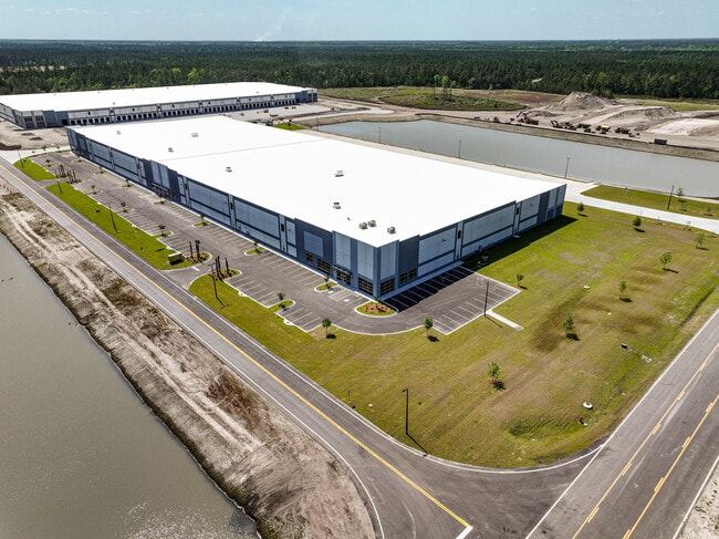

Property Detail
1010 Branch Rd
Savannah, GA
14.21 AC TRCT 4C1-2E (OUT 450F-21) 29/827
0450F023
EFFINGHAM
Governmentalpublicusegeneral
Georgia
I-1
2e
2025
14.21 AC
2025
Effingham County
030307
Savannah
248,000 SF
NEARBY LISTINGS FOR SALE OR LEASE
DEMOGRAPHICS near 1010 Branch Rd
1 mile
3 mile
5 mile
2025 Total Population
435
17,557
36,347
2030 Population
487
19,465
40,103
Pop Growth 2025-2030
+ 11.95%
+ 10.87%
+ 10.33%
Average Age
38
37
37
2025 Total Households
163
6,431
12,972
HH Growth 2025-2030
+ 11.66%
+ 10.87%
+ 10.49%
Median Household Inc
$44,999
$81,820
$85,546
Avg Household Size
2.60
2.70
2.70
2025 Avg HH Vehicles
2.00
2.00
2.00
Median Home Value
$265,254
$288,653
$289,267
Median Year Built
2002
2002
2004
Nearby Places
Map Layers
Map Styles
 Street
 Aerial
Layers
 Traffic
 Biking
Places
Listings with unknown addresses are not visible on the map
- Restaurants
- Banks
- Shops
- Fitness
- Groceries
PUBLIC TRANSPORTATION
AIRPORT
Savannah/Hilton Head International
Drive
Walk
Distance
Savannah/Hilton Head International
27 min
15.2 mi
Freight Ports
Georgia Ports - Savannah
Drive
Walk
Distance
Georgia Ports - Savannah
23 min
13.5 mi
SALE & LEASE HISTORY
LISTING DATE
SALE/LEASE

Mar 08, 2024
For Lease
Nearby Properties
Address
Land Use
TOTAL SIZE
Lot Size
Zoning
Address
Land Use
TOTAL SIZE
Lot Size
Zoning
1,500,400 SF
207.84 AC
PD
Address
Land Use
TOTAL SIZE
Lot Size
Zoning
1,561.05 AC
I-1
Address
Land Use
TOTAL SIZE
Lot Size
Zoning
1,210,040 SF
93.21 AC
PD
Address
Land Use
TOTAL SIZE
Lot Size
Zoning
1,114,920 SF
99.31 AC
I-1
Address
Land Use
TOTAL SIZE
Lot Size
Zoning
1,067,040 SF
77.66 AC
PD
Address
Land Use
TOTAL SIZE
Lot Size
Zoning
996,200 SF
54.71 AC
I-1
Address
Land Use
TOTAL SIZE
Lot Size
Zoning
1,026,000 SF
74.86 AC
I-1
Address
Land Use
TOTAL SIZE
Lot Size
Zoning
473,760 SF
247.89 AC
PD
Address
Land Use
TOTAL SIZE
Lot Size
Zoning
777,150 SF
92.46 AC
PD
Address
Land Use
TOTAL SIZE
Lot Size
Zoning
442,000 SF
45.41 AC
I-1
Address
Land Use
TOTAL SIZE
Lot Size
Zoning
790,020 SF
58.78 AC
I-1
Address
Land Use
TOTAL SIZE
Lot Size
Zoning
416,000 SF
56.60 AC
PD
Address
Land Use
TOTAL SIZE
Lot Size
Zoning
12,798 SF
32 AC
B-2
Address
Land Use
TOTAL SIZE
Lot Size
Zoning
419,038 SF
30.74 AC
PD
Address
Land Use
TOTAL SIZE
Lot Size
Zoning
204,800 SF
15.18 AC
I-1
Address
Land Use
TOTAL SIZE
Lot Size
Zoning
199.65 AC
I-1
Address
Land Use
TOTAL SIZE
Lot Size
Zoning
314,030 SF
20.38 AC
I-1
Address
Land Use
TOTAL SIZE
Lot Size
Zoning
380,940 SF
19.65 AC
I-1
Address
Land Use
TOTAL SIZE
Lot Size
Zoning
132.42 AC
PD
Address
Land Use
TOTAL SIZE
Lot Size
Zoning
121.77 AC
PD
Address
Land Use
TOTAL SIZE
Lot Size
Zoning
1,990 SF
11.44 AC
R-11
Address
Land Use
TOTAL SIZE
Lot Size
Zoning
90.18 AC
PD
Address
Land Use
TOTAL SIZE
Lot Size
Zoning
131.53 AC
I-1
Address
Land Use
TOTAL SIZE
Lot Size
Zoning
120,504 SF
16.26 AC
B-2
Address
Land Use
TOTAL SIZE
Lot Size
Zoning
136,101 SF
20.94 AC
B-2
Address
Land Use
TOTAL SIZE
Lot Size
Zoning
124,516 SF
17.79 AC
B-2
Address
Land Use
TOTAL SIZE
Lot Size
Zoning
125 AC
I-1
Address
Land Use
TOTAL SIZE
Lot Size
Zoning
97.77 AC
I-1
Address
Land Use
TOTAL SIZE
Lot Size
Zoning
117.27 AC
I-1
The World's #1 Commercial Real Estate Marketplace
Connect with us
© 2026 CoStar Group
The information above has been obtained from sources believed reliable. While we do not doubt its accuracy we have not verified it and make no guarantee, warranty or representation about it. It is your responsibility to independently confirm its accuracy and completeness. Any projections, opinions, assumptions, or estimates used are for example only and do not represent the current or future performance of the property. The value of this transaction to you depends on tax and other factors which should be evaluated by your tax, financial, and legal advisors. You and your advisors should conduct a careful, independent investigation of the property to determine to your satisfaction the suitability of the property for your needs.