Property Record
1010 Corporate Dr, Stafford, VA 22554


NEARBY LISTINGS FOR SALE OR LEASE
Property Detail
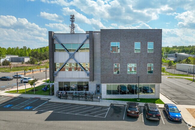
1010 Corporate Dr
13C-A4
Quantico Corporate
Officebuilding
PARCEL A4 2.7351 AC ST HWY PB 15 PG 279-282
X
Stafford
51179C0063G
Virginia
2024
2.74 AC
2025
Stafford County
010201
Washington, DC
33,099 SF
Washington-Arlington-Alexandria, DC-VA-MD-WV
DEMOGRAPHICS near 1010 Corporate Dr
1 Mile
3 Mile
5 Mile
2024 Total Population
1,616
15,261
66,855
2029 Population
1,772
16,678
72,266
Pop Growth 2024-2029
+ 9.65%
+ 9.29%
+ 8.09%
Average Age
33
32
34
2024 Total Households
433
4,667
20,915
HH Growth 2024-2029
+ 11.32%
+ 9.75%
+ 8.31%
Median Household Inc
$111,964
$104,124
$101,433
Avg Household Size
3.00
3.10
3.00
2024 Avg HH Vehicles
2.00
2.00
2.00
Median Home Value
$340,000
$343,115
$366,958
Median Year Built
2001
2000
1993
Nearby Places
Map Layers
Map Styles
 Street
 Aerial
- Restaurants
- Banks
- Shops
- Fitness
- Groceries
PUBLIC TRANSPORTATION
COMMUTER RAIL
Quantico (Fredericksburg Line - Virginia Railway Express)
DRIVE
WALK
Distance
Quantico (Fredericksburg Line - Virginia Railway Express)
11 min
5.6 mi
AIRPORT
Ronald Reagan Washington Ntl
DRIVE
WALK
Distance
Ronald Reagan Washington Ntl
49 min
33.2 mi
Freight Ports
Port of Baltimore
DRIVE
WALK
Distance
Port of Baltimore
107 min
74.4 mi
SALE & LEASE HISTORY
LISTING DATE
SALE/LEASE

Jun 01, 2020
For Sale
Jan 17, 2018
For Lease
Nearby Properties
Address
Land Use
TOTAL SIZE
Lot Size
Zoning
Address
Land Use
TOTAL SIZE
Lot Size
Zoning
470,850 SF
22,970.24 AC
A1
Address
Land Use
TOTAL SIZE
Lot Size
Zoning
122,323 SF
134.63 AC
A1
Address
Land Use
TOTAL SIZE
Lot Size
Zoning
140 SF
20.14 AC
R2
Address
Land Use
TOTAL SIZE
Lot Size
Zoning
142,920 SF
22.01 AC
R2
Address
Land Use
TOTAL SIZE
Lot Size
Zoning
143,136 SF
7.50 AC
M1
Address
Land Use
TOTAL SIZE
Lot Size
Zoning
142,128 SF
8.80 AC
M1
Address
Land Use
TOTAL SIZE
Lot Size
Zoning
17,551 SF
642.15 AC
A1
Address
Land Use
TOTAL SIZE
Lot Size
Zoning
140,976 SF
8.63 AC
M1
Address
Land Use
TOTAL SIZE
Lot Size
Zoning
270,475 SF
32.75 AC
M1
Address
Land Use
TOTAL SIZE
Lot Size
Zoning
54,000 SF
17.55 AC
R4
Address
Land Use
TOTAL SIZE
Lot Size
Zoning
90,000 SF
7.83 AC
M1
Address
Land Use
TOTAL SIZE
Lot Size
Zoning
81,000 SF
7.58 AC
M1
Address
Land Use
TOTAL SIZE
Lot Size
Zoning
57,128 SF
2.70 AC
B2
Address
Land Use
TOTAL SIZE
Lot Size
Zoning
26,599 SF
74.75 AC
A1
Address
Land Use
TOTAL SIZE
Lot Size
Zoning
152,563 SF
22.44 AC
A1
Address
Land Use
TOTAL SIZE
Lot Size
Zoning
39,498 SF
3.64 AC
B2
Address
Land Use
TOTAL SIZE
Lot Size
Zoning
48,668 SF
2.27 AC
M1
Address
Land Use
TOTAL SIZE
Lot Size
Zoning
29,510 SF
5.86 AC
R2
Address
Land Use
TOTAL SIZE
Lot Size
Zoning
29,872 SF
1.97 AC
M1
Address
Land Use
TOTAL SIZE
Lot Size
Zoning
46,934 SF
6.99 AC
M1
Address
Land Use
TOTAL SIZE
Lot Size
Zoning
44,986 SF
2.50 AC
B2
Address
Land Use
TOTAL SIZE
Lot Size
Zoning
4,417 SF
2 AC
B2
Address
Land Use
TOTAL SIZE
Lot Size
Zoning
8,000 SF
1.12 AC
B2
Address
Land Use
TOTAL SIZE
Lot Size
Zoning
140.62 AC
A1
Address
Land Use
TOTAL SIZE
Lot Size
Zoning
17,634 SF
11.56 AC
B1
Address
Land Use
TOTAL SIZE
Lot Size
Zoning
202 AC
A1
Address
Land Use
TOTAL SIZE
Lot Size
Zoning
4,436 SF
10.24 AC
B2
The World's #1 Commercial Real Estate Marketplace
Connect with us
© 2025 CoStar Group
The information above has been obtained from sources believed reliable. While we do not doubt its accuracy we have not verified it and make no guarantee, warranty or representation about it. It is your responsibility to independently confirm its accuracy and completeness. Any projections, opinions, assumptions, or estimates used are for example only and do not represent the current or future performance of the property. The value of this transaction to you depends on tax and other factors which should be evaluated by your tax, financial, and legal advisors. You and your advisors should conduct a careful, independent investigation of the property to determine to your satisfaction the suitability of the property for your needs.