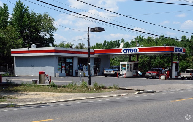
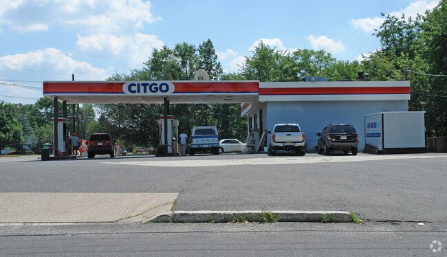
Property Record
1010 Delsea Dr, Westville, NJ 08093

NEARBY LISTINGS FOR SALE OR LEASE
Property Detail
1010 Delsea Dr
Philadelphia-Camden-Wilmington, PA-NJ-DE-MD
ALSO LOT 14 8
02-00003-0000-00013
Gloucester
Servicestation
New Jersey
X
13
34007C0082F
0.36 AC
2024
Gloucester County
2025
Philadelphia
501101
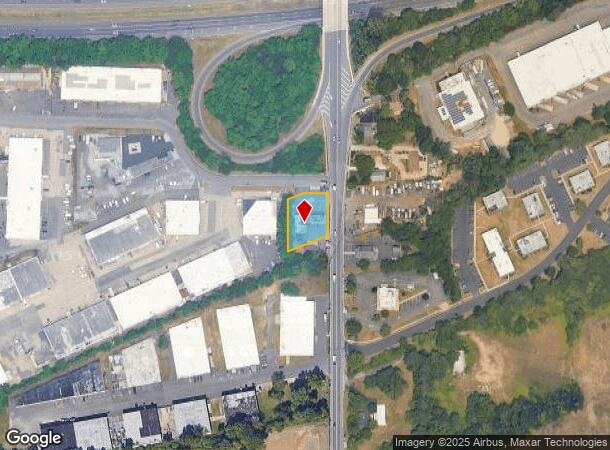
DEMOGRAPHICS near 1010 Delsea Dr
1 Mile
3 Mile
5 Mile
2024 Total Population
9,179
79,917
255,571
2029 Population
9,504
81,517
256,524
Pop Growth 2024-2029
+ 3.54%
+ 2.00%
+ 0.37%
Average Age
40
41
40
2024 Total Households
3,846
31,914
101,932
HH Growth 2024-2029
+ 3.46%
+ 2.00%
+ 0.30%
Median Household Inc
$57,187
$72,979
$74,599
Avg Household Size
2.30
2.50
2.50
2024 Avg HH Vehicles
1.00
2.00
2.00
Median Home Value
$170,804
$193,421
$233,284
Median Year Built
1960
1958
1956
Nearby Places
Map Layers
Map Styles
 Street
 Aerial
- Restaurants
- Banks
- Shops
- Fitness
- Groceries
PUBLIC TRANSPORTATION
AIRPORT
Philadelphia International
DRIVE
WALK
Distance
Philadelphia International
25 min
13.9 mi
Freight Ports
Broadway Terminal - Pier 5
DRIVE
WALK
Distance
Broadway Terminal - Pier 5
8 min
3.9 mi
Nearby Properties
Address
Land Use
TOTAL SIZE
Lot Size
Zoning
Address
Land Use
TOTAL SIZE
Lot Size
Zoning
23.41 AC
BC2
Address
Land Use
TOTAL SIZE
Lot Size
Zoning
810.21 AC
0108
Address
Land Use
TOTAL SIZE
Lot Size
Zoning
47.20 AC
I3
Address
Land Use
TOTAL SIZE
Lot Size
Zoning
1.66 AC
R01
Address
Land Use
TOTAL SIZE
Lot Size
Zoning
30.63 AC
R10
Address
Land Use
TOTAL SIZE
Lot Size
Zoning
40.92 AC
BC2
Address
Land Use
TOTAL SIZE
Lot Size
Zoning
78.64 AC
Address
Land Use
TOTAL SIZE
Lot Size
Zoning
25.77 AC
R10
Address
Land Use
TOTAL SIZE
Lot Size
Zoning
27.25 AC
Address
Land Use
TOTAL SIZE
Lot Size
Zoning
67.33 AC
BC2
Address
Land Use
TOTAL SIZE
Lot Size
Zoning
57.58 AC
C
Address
Land Use
TOTAL SIZE
Lot Size
Zoning
Address
Land Use
TOTAL SIZE
Lot Size
Zoning
32.20 AC
R-1
Address
Land Use
TOTAL SIZE
Lot Size
Zoning
132.57 AC
M2
Address
Land Use
TOTAL SIZE
Lot Size
Zoning
29.23 AC
BC3
Address
Land Use
TOTAL SIZE
Lot Size
Zoning
Address
Land Use
TOTAL SIZE
Lot Size
Zoning
15.96 AC
BC2
Address
Land Use
TOTAL SIZE
Lot Size
Zoning
Address
Land Use
TOTAL SIZE
Lot Size
Zoning
14.49 AC
BC2
Address
Land Use
TOTAL SIZE
Lot Size
Zoning
31.57 AC
RM2
Address
Land Use
TOTAL SIZE
Lot Size
Zoning
3.22 AC
PA
Address
Land Use
TOTAL SIZE
Lot Size
Zoning
8.58 AC
BC2
Address
Land Use
TOTAL SIZE
Lot Size
Zoning
100,000 SF
180.81 AC
CMX3
Address
Land Use
TOTAL SIZE
Lot Size
Zoning
1,228 SF
7.69 AC
Address
Land Use
TOTAL SIZE
Lot Size
Zoning
Address
Land Use
TOTAL SIZE
Lot Size
Zoning
1.11 AC
R4
Address
Land Use
TOTAL SIZE
Lot Size
Zoning
2.82 AC
BC2
Address
Land Use
TOTAL SIZE
Lot Size
Zoning
3.01 AC
Address
Land Use
TOTAL SIZE
Lot Size
Zoning
14.19 AC
BC2
Address
Land Use
TOTAL SIZE
Lot Size
Zoning
21.81 AC
RM2
The World's #1 Commercial Real Estate Marketplace
Connect with us
© 2025 CoStar Group
The information above has been obtained from sources believed reliable. While we do not doubt its accuracy we have not verified it and make no guarantee, warranty or representation about it. It is your responsibility to independently confirm its accuracy and completeness. Any projections, opinions, assumptions, or estimates used are for example only and do not represent the current or future performance of the property. The value of this transaction to you depends on tax and other factors which should be evaluated by your tax, financial, and legal advisors. You and your advisors should conduct a careful, independent investigation of the property to determine to your satisfaction the suitability of the property for your needs.