Property Record
1010 E Chicago St, Elgin, IL 60120
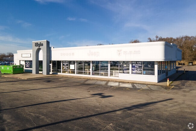
This Property Is For Sale
Property Detail
1010 E Chicago St
Chicago-Naperville-Elgin, IL-IN
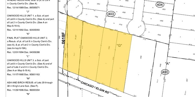
(COUNTY)(CLERKS) DIVIN OF UNSUBDIVIDED LAND IN SH SEC 18-41-09
06-18-400-080-0000
Cook
Commercialnec
Illinois
B and X Area of moderate flood hazard, usually the area between the limits of the 100-year and 500-year floods.
3
2023
4.53 AC
2025
Far Northwest
804405
Chicago
23,296 SF
NEARBY LISTINGS FOR SALE OR LEASE
DEMOGRAPHICS near 1010 E Chicago St
1 mile
3 mile
5 mile
2025 Total Population
16,511
89,698
188,583
2030 Population
16,550
90,105
189,852
Pop Growth 2025-2030
+ 0.24%
+ 0.45%
+ 0.67%
Average Age
37
39
40
2025 Total Households
5,021
29,683
64,907
HH Growth 2025-2030
+ 0.10%
+ 0.35%
+ 0.59%
Median Household Inc
$72,656
$86,314
$92,480
Avg Household Size
3.20
2.90
2.80
2025 Avg HH Vehicles
2.00
2.00
2.00
Median Home Value
$241,220
$262,620
$275,984
Median Year Built
1978
1974
1979
Nearby Places
Map Layers
Map Styles
 Street
 Aerial
Layers
 Traffic
 Biking
Places
Listings with unknown addresses are not visible on the map
- Restaurants
- Banks
- Shops
- Fitness
- Groceries
PUBLIC TRANSPORTATION
COMMUTER RAIL
Elgin Station (Milwaukee District West Line - Northeast Illinois Regional Commuter Railroad (Metra))
Drive
Walk
Distance
Elgin Station (Milwaukee District West Line - Northeast Illinois Regional Commuter Railroad (Metra))
6 min
2.2 mi
National Street Station (Milwaukee District West Line - Northeast Illinois Regional Commuter Railroad (Metra))
Drive
Walk
Distance
National Street Station (Milwaukee District West Line - Northeast Illinois Regional Commuter Railroad (Metra))
7 min
2.3 mi
AIRPORT
Chicago O'Hare International
Drive
Walk
Distance
Chicago O'Hare International
35 min
25.8 mi
Chicago Midway International
Drive
Walk
Distance
Chicago Midway International
55 min
36.1 mi
Nearby Properties
Address
Land Use
TOTAL SIZE
Lot Size
Zoning
Address
Land Use
TOTAL SIZE
Lot Size
Zoning
108.60 AC
Address
Land Use
TOTAL SIZE
Lot Size
Zoning
51,091 SF
3.52 AC
Address
Land Use
TOTAL SIZE
Lot Size
Zoning
Address
Land Use
TOTAL SIZE
Lot Size
Zoning
38.13 AC
Address
Land Use
TOTAL SIZE
Lot Size
Zoning
8,012 SF
6.56 AC
Address
Land Use
TOTAL SIZE
Lot Size
Zoning
Address
Land Use
TOTAL SIZE
Lot Size
Zoning
176,799 SF
10 AC
Address
Land Use
TOTAL SIZE
Lot Size
Zoning
38,550 SF
0.60 AC
Address
Land Use
TOTAL SIZE
Lot Size
Zoning
93,341 SF
3.67 AC
Address
Land Use
TOTAL SIZE
Lot Size
Zoning
71,725 SF
49.30 AC
Address
Land Use
TOTAL SIZE
Lot Size
Zoning
154,483 SF
10 AC
Address
Land Use
TOTAL SIZE
Lot Size
Zoning
Address
Land Use
TOTAL SIZE
Lot Size
Zoning
137,500 SF
12.51 AC
Address
Land Use
TOTAL SIZE
Lot Size
Zoning
123,844 SF
11.51 AC
Address
Land Use
TOTAL SIZE
Lot Size
Zoning
120,075 SF
10.70 AC
Address
Land Use
TOTAL SIZE
Lot Size
Zoning
167,166 SF
12.85 AC
Address
Land Use
TOTAL SIZE
Lot Size
Zoning
462,984 SF
19 AC
Address
Land Use
TOTAL SIZE
Lot Size
Zoning
Address
Land Use
TOTAL SIZE
Lot Size
Zoning
6.47 AC
Address
Land Use
TOTAL SIZE
Lot Size
Zoning
0.33 AC
Address
Land Use
TOTAL SIZE
Lot Size
Zoning
7.18 AC
Address
Land Use
TOTAL SIZE
Lot Size
Zoning
9.39 AC
Address
Land Use
TOTAL SIZE
Lot Size
Zoning
87,364 SF
1.71 AC
Address
Land Use
TOTAL SIZE
Lot Size
Zoning
102,643 SF
10.54 AC
Address
Land Use
TOTAL SIZE
Lot Size
Zoning
483,697 SF
36.05 AC
Address
Land Use
TOTAL SIZE
Lot Size
Zoning
96,190 SF
3.55 AC
Address
Land Use
TOTAL SIZE
Lot Size
Zoning
5,910 SF
66.20 AC
Address
Land Use
TOTAL SIZE
Lot Size
Zoning
100,804 SF
0.86 AC
Address
Land Use
TOTAL SIZE
Lot Size
Zoning
1,352 SF
1.27 AC
The World's #1 Commercial Real Estate Marketplace
Connect with us
© 2026 CoStar Group
The information above has been obtained from sources believed reliable. While we do not doubt its accuracy we have not verified it and make no guarantee, warranty or representation about it. It is your responsibility to independently confirm its accuracy and completeness. Any projections, opinions, assumptions, or estimates used are for example only and do not represent the current or future performance of the property. The value of this transaction to you depends on tax and other factors which should be evaluated by your tax, financial, and legal advisors. You and your advisors should conduct a careful, independent investigation of the property to determine to your satisfaction the suitability of the property for your needs.