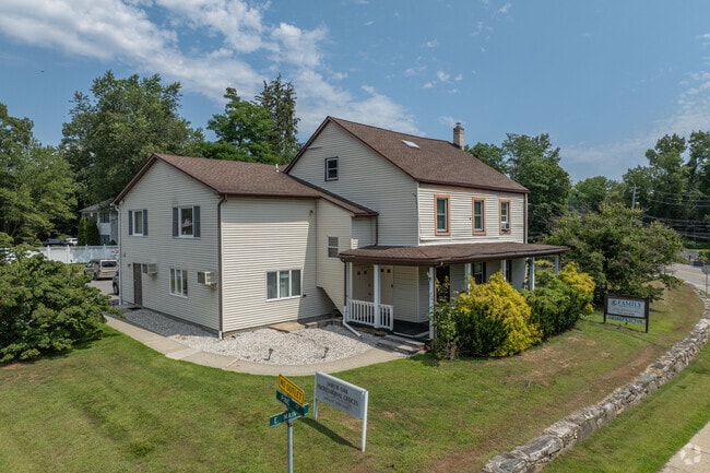
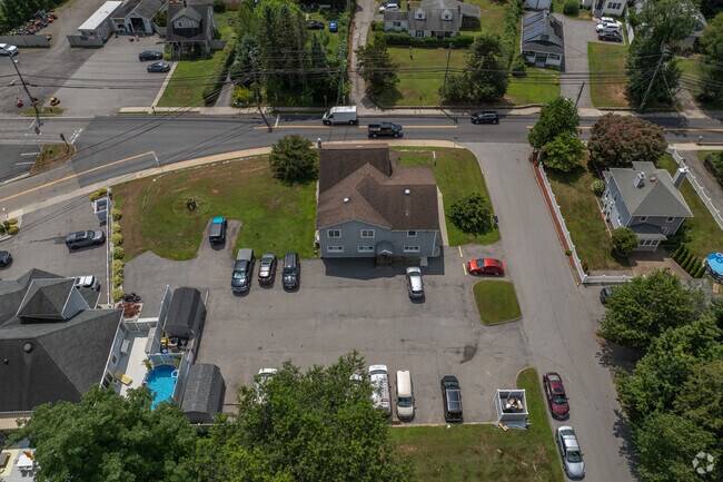
Property Record
1010 E Main St, Shrub Oak, NY 10588
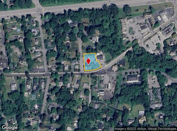
NEARBY LISTINGS FOR SALE OR LEASE
Property Detail
1010 E Main St
5400-016-006-00001-000-0043
Westchester
Commercialofficeresidentialmixeduse
New York
X
43.000
36079C0204E
0.54 AC
2025
Northwest
2024
Westchester/So Connecticut
014812
New York-Jersey City-White Plains, NY-NJ
DEMOGRAPHICS near 1010 E Main St
1 Mile
3 Mile
5 Mile
2024 Total Population
4,553
34,324
83,392
2029 Population
4,459
33,622
81,810
Pop Growth 2024-2029
(2.06%)
(2.05%)
(1.90%)
Average Age
44
43
43
2024 Total Households
1,676
12,139
29,445
HH Growth 2024-2029
(2.27%)
(2.30%)
(2.11%)
Median Household Inc
$133,817
$135,659
$130,023
Avg Household Size
2.60
2.70
2.70
2024 Avg HH Vehicles
2.00
2.00
2.00
Median Home Value
$453,317
$464,313
$453,862
Median Year Built
1971
1966
1965
Nearby Places
- Restaurants
- Banks
- Shops
- Fitness
- Groceries
PUBLIC TRANSPORTATION
COMMUTER RAIL
Peekskill Station (Hudson Line - Metro-North Commuter Railroad Company (Metro-North))
DRIVE
WALK
Distance
Peekskill Station (Hudson Line - Metro-North Commuter Railroad Company (Metro-North))
12 min
7.1 mi
AIRPORT
Westchester County
DRIVE
WALK
Distance
Westchester County
35 min
26.0 mi
New York Stewart International
DRIVE
WALK
Distance
New York Stewart International
52 min
30.4 mi
Freight Ports
NY - Red Hook Container Terminal
DRIVE
WALK
Distance
NY - Red Hook Container Terminal
78 min
54.3 mi
Nearby Properties
Address
Land Use
TOTAL SIZE
Lot Size
Zoning
Address
Land Use
TOTAL SIZE
Lot Size
Zoning
1,656 SF
80.06 AC
R
Address
Land Use
TOTAL SIZE
Lot Size
Zoning
78,331 SF
37.78 AC
R2
Address
Land Use
TOTAL SIZE
Lot Size
Zoning
88,339 SF
90.53 AC
R3
Address
Land Use
TOTAL SIZE
Lot Size
Zoning
18,865 SF
161.60 AC
PD
Address
Land Use
TOTAL SIZE
Lot Size
Zoning
878 SF
62.50 AC
R1-20
Address
Land Use
TOTAL SIZE
Lot Size
Zoning
13,520 SF
1.16 AC
CC1
Address
Land Use
TOTAL SIZE
Lot Size
Zoning
21,569 SF
61.43 AC
PD
Address
Land Use
TOTAL SIZE
Lot Size
Zoning
31,714 SF
13.88 AC
R2
Address
Land Use
TOTAL SIZE
Lot Size
Zoning
21,466 SF
2.87 AC
CC1
Address
Land Use
TOTAL SIZE
Lot Size
Zoning
13 AC
R1-40
Address
Land Use
TOTAL SIZE
Lot Size
Zoning
Address
Land Use
TOTAL SIZE
Lot Size
Zoning
1,632 SF
60.28 AC
PD
Address
Land Use
TOTAL SIZE
Lot Size
Zoning
221 SF
0.78 AC
R
Address
Land Use
TOTAL SIZE
Lot Size
Zoning
14,058 SF
7.26 AC
PD
Address
Land Use
TOTAL SIZE
Lot Size
Zoning
1,124 SF
8 AC
R1-80
Address
Land Use
TOTAL SIZE
Lot Size
Zoning
7,183 SF
5 AC
R1
Address
Land Use
TOTAL SIZE
Lot Size
Zoning
2,092 SF
120.03 AC
R3
Address
Land Use
TOTAL SIZE
Lot Size
Zoning
12,759 SF
17.16 AC
R2
Address
Land Use
TOTAL SIZE
Lot Size
Zoning
5,363 SF
4.82 AC
R2
Address
Land Use
TOTAL SIZE
Lot Size
Zoning
4,402 SF
5.38 AC
R2
Address
Land Use
TOTAL SIZE
Lot Size
Zoning
1,504 SF
45.28 AC
R1-80
Address
Land Use
TOTAL SIZE
Lot Size
Zoning
7,848 SF
5.79 AC
R2
Address
Land Use
TOTAL SIZE
Lot Size
Zoning
6,186 SF
14.13 AC
R2
Address
Land Use
TOTAL SIZE
Lot Size
Zoning
8,834 SF
2.58 AC
CC1
Address
Land Use
TOTAL SIZE
Lot Size
Zoning
240 SF
25 AC
PD
Address
Land Use
TOTAL SIZE
Lot Size
Zoning
9,992 SF
15.01 AC
R2
Address
Land Use
TOTAL SIZE
Lot Size
Zoning
92.25 AC
R2
Address
Land Use
TOTAL SIZE
Lot Size
Zoning
8,700 SF
2.78 AC
CN
Address
Land Use
TOTAL SIZE
Lot Size
Zoning
65.07 AC
CD
Address
Land Use
TOTAL SIZE
Lot Size
Zoning
10,370 SF
11.33 AC
R3
The World's #1 Commercial Real Estate Marketplace
Connect with us
© 2025 CoStar Group
The information above has been obtained from sources believed reliable. While we do not doubt its accuracy we have not verified it and make no guarantee, warranty or representation about it. It is your responsibility to independently confirm its accuracy and completeness. Any projections, opinions, assumptions, or estimates used are for example only and do not represent the current or future performance of the property. The value of this transaction to you depends on tax and other factors which should be evaluated by your tax, financial, and legal advisors. You and your advisors should conduct a careful, independent investigation of the property to determine to your satisfaction the suitability of the property for your needs.