Property Record
1010 Loop Rd, Auburndale, FL 33823
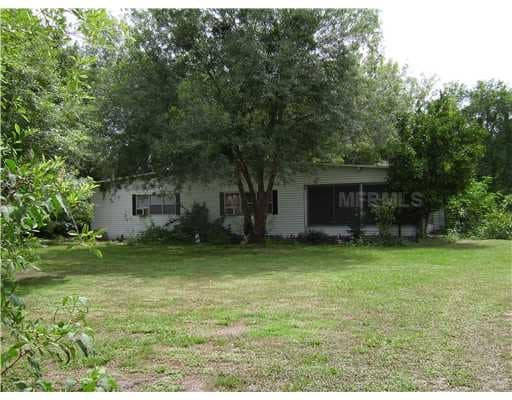

Property Detail
1010 Loop Rd
25-28-06-000000-041070
S 150 FT OF N 535 FT OF E1/2 OF SE1/4 OF NE1/4 OF SW1/4 LESS W 75 FT & LESS R/W OF LOOP RD ON E-SIDE
Multifamilydwelling
Polk
R3
Florida
A Areas with a 1% annual chance of flooding and a 26% chance of flooding over the life of a 30-year mortgage.
0.79 AC
2024
Polk County
2025
Tampa/St Petersburg
011606
Lakeland-Winter Haven, FL
2,052 SF
NEARBY LISTINGS FOR SALE OR LEASE
DEMOGRAPHICS near 1010 Loop Rd
1 mile
3 mile
5 mile
2025 Total Population
3,048
17,750
63,694
2030 Population
3,521
20,371
72,987
Pop Growth 2025-2030
+ 15.52%
+ 14.77%
+ 14.59%
Average Age
47
44
40
2025 Total Households
1,262
7,147
23,934
HH Growth 2025-2030
+ 15.77%
+ 15.14%
+ 14.91%
Median Household Inc
$59,133
$60,699
$63,075
Avg Household Size
2.20
2.40
2.50
2025 Avg HH Vehicles
1.00
2.00
2.00
Median Home Value
$95,559
$180,009
$223,086
Median Year Built
1992
1990
1987
Nearby Places
Map Layers
Map Styles
 Street
 Aerial
Transit
 Traffic
 Biking
Places
Listings with unknown addresses are not visible on the map
- Restaurants
- Banks
- Shops
- Fitness
- Groceries
PUBLIC TRANSPORTATION
COMMUTER RAIL
Lakeland (Silver Star - Amtrak)
Drive
Walk
Distance
Lakeland (Silver Star - Amtrak)
14 min
8.3 mi
Freight Ports
Port of Tampa Bay
Drive
Walk
Distance
Port of Tampa Bay
59 min
42.3 mi
Nearby Properties
Address
Land Use
TOTAL SIZE
Lot Size
Zoning
Address
Land Use
TOTAL SIZE
Lot Size
Zoning
831,600 SF
51.22 AC
Address
Land Use
TOTAL SIZE
Lot Size
Zoning
811,392 SF
47.70 AC
Address
Land Use
TOTAL SIZE
Lot Size
Zoning
718,026 SF
49.37 AC
RE2
Address
Land Use
TOTAL SIZE
Lot Size
Zoning
275,220 SF
94.53 AC
Address
Land Use
TOTAL SIZE
Lot Size
Zoning
188,553 SF
29.12 AC
Address
Land Use
TOTAL SIZE
Lot Size
Zoning
316,800 SF
9.47 AC
Address
Land Use
TOTAL SIZE
Lot Size
Zoning
259,200 SF
8.17 AC
Address
Land Use
TOTAL SIZE
Lot Size
Zoning
135,247 SF
22.49 AC
C4
Address
Land Use
TOTAL SIZE
Lot Size
Zoning
91,962 SF
19.46 AC
R4
Address
Land Use
TOTAL SIZE
Lot Size
Zoning
210,150 SF
6.23 AC
Address
Land Use
TOTAL SIZE
Lot Size
Zoning
126,384 SF
4.67 AC
CH
Address
Land Use
TOTAL SIZE
Lot Size
Zoning
100,000 SF
58.51 AC
RE2
Address
Land Use
TOTAL SIZE
Lot Size
Zoning
198,000 SF
5.93 AC
Address
Land Use
TOTAL SIZE
Lot Size
Zoning
147,180 SF
11.44 AC
C4
Address
Land Use
TOTAL SIZE
Lot Size
Zoning
66,880 SF
3.80 AC
Address
Land Use
TOTAL SIZE
Lot Size
Zoning
77,279 SF
12.12 AC
Address
Land Use
TOTAL SIZE
Lot Size
Zoning
113,410 SF
19.78 AC
C4
Address
Land Use
TOTAL SIZE
Lot Size
Zoning
Address
Land Use
TOTAL SIZE
Lot Size
Zoning
66,000 SF
8.33 AC
Address
Land Use
TOTAL SIZE
Lot Size
Zoning
80,160 SF
2.79 AC
C4
Address
Land Use
TOTAL SIZE
Lot Size
Zoning
30,898 SF
7.27 AC
Address
Land Use
TOTAL SIZE
Lot Size
Zoning
54,204 SF
9.09 AC
Address
Land Use
TOTAL SIZE
Lot Size
Zoning
70,370 SF
4.86 AC
GI
Address
Land Use
TOTAL SIZE
Lot Size
Zoning
17,688 SF
3.16 AC
C3
Address
Land Use
TOTAL SIZE
Lot Size
Zoning
178,950 SF
23.99 AC
PUD
Address
Land Use
TOTAL SIZE
Lot Size
Zoning
35,397 SF
1.90 AC
Address
Land Use
TOTAL SIZE
Lot Size
Zoning
6,032 SF
2.26 AC
Address
Land Use
TOTAL SIZE
Lot Size
Zoning
78,000 SF
3.06 AC
C4
Address
Land Use
TOTAL SIZE
Lot Size
Zoning
17,760 SF
2.62 AC
Address
Land Use
TOTAL SIZE
Lot Size
Zoning
20,038 SF
7.92 AC
The World's #1 Commercial Real Estate Marketplace
Connect with us
© 2026 CoStar Group
The information above has been obtained from sources believed reliable. While we do not doubt its accuracy we have not verified it and make no guarantee, warranty or representation about it. It is your responsibility to independently confirm its accuracy and completeness. Any projections, opinions, assumptions, or estimates used are for example only and do not represent the current or future performance of the property. The value of this transaction to you depends on tax and other factors which should be evaluated by your tax, financial, and legal advisors. You and your advisors should conduct a careful, independent investigation of the property to determine to your satisfaction the suitability of the property for your needs.