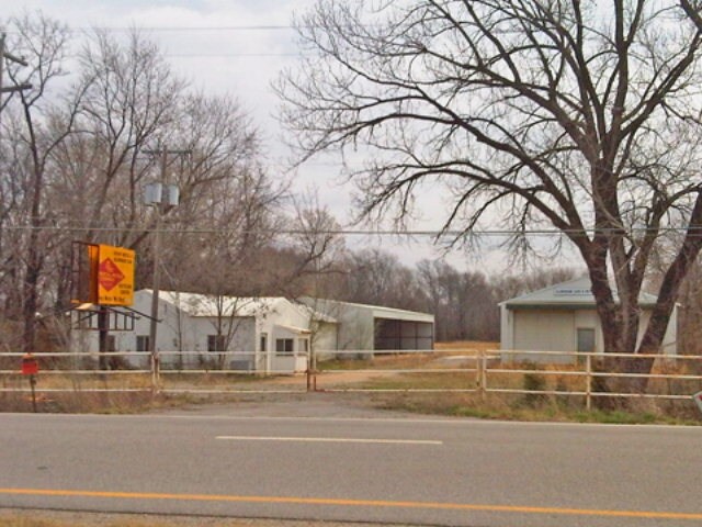
Property Record
1010 N Highway 69, Frontenac, KS 66763

NEARBY LISTINGS FOR SALE OR LEASE
Property Detail
1010 N Highway 69
Pittsburg, KS
S05, T30, R25, ACRES 3, BEG 1848.59' S AND 50' E NW COR SW1/4, TH ELY 698.41, S 223.06, WLY 704.25, N 147.23, TO POB.
203-05-0-00-01-031.03-0
Crawford
Warehouse
Kansas
2025
3 AC
2025
Kansas Area
956900
Other Market Areas
2,143 SF
DEMOGRAPHICS near 1010 N Highway 69
1 Mile
3 Mile
5 Mile
2024 Total Population
2,035
9,944
25,188
2029 Population
2,032
9,991
25,276
Pop Growth 2024-2029
(0.15%)
+ 0.47%
+ 0.35%
Average Age
41
38
36
2024 Total Households
815
4,043
10,021
HH Growth 2024-2029
(0.12%)
+ 0.52%
+ 0.38%
Median Household Inc
$53,225
$38,242
$40,867
Avg Household Size
2.50
2.40
2.30
2024 Avg HH Vehicles
2.00
2.00
2.00
Median Home Value
$147,868
$98,386
$113,251
Median Year Built
1982
1971
1971
Nearby Places
Map Layers
Map Styles
 Street
 Aerial
- Restaurants
- Banks
- Shops
- Fitness
- Groceries
Nearby Properties
Address
Land Use
TOTAL SIZE
Lot Size
Zoning
Address
Land Use
TOTAL SIZE
Lot Size
Zoning
232,664 SF
16.10 AC
CP2
Address
Land Use
TOTAL SIZE
Lot Size
Zoning
89,822 SF
5.60 AC
R2
Address
Land Use
TOTAL SIZE
Lot Size
Zoning
5,512 SF
530.50 AC
A0
Address
Land Use
TOTAL SIZE
Lot Size
Zoning
43,756 SF
2 AC
R1C
Address
Land Use
TOTAL SIZE
Lot Size
Zoning
49,748 SF
10.30 AC
R1B
Address
Land Use
TOTAL SIZE
Lot Size
Zoning
31,930 SF
4.80 AC
Address
Land Use
TOTAL SIZE
Lot Size
Zoning
42,938 SF
2.19 AC
R2
Address
Land Use
TOTAL SIZE
Lot Size
Zoning
86,906 SF
3.10 AC
R1C
Address
Land Use
TOTAL SIZE
Lot Size
Zoning
184,784 SF
33.98 AC
IP3
Address
Land Use
TOTAL SIZE
Lot Size
Zoning
27,044 SF
5.36 AC
Address
Land Use
TOTAL SIZE
Lot Size
Zoning
5,200 SF
13.02 AC
Address
Land Use
TOTAL SIZE
Lot Size
Zoning
1,829 SF
139.70 AC
Address
Land Use
TOTAL SIZE
Lot Size
Zoning
41,806 SF
3.31 AC
CP2
Address
Land Use
TOTAL SIZE
Lot Size
Zoning
297,339 SF
29.30 AC
Address
Land Use
TOTAL SIZE
Lot Size
Zoning
12,795 SF
1.20 AC
CP0
Address
Land Use
TOTAL SIZE
Lot Size
Zoning
1,300 SF
29.30 AC
Address
Land Use
TOTAL SIZE
Lot Size
Zoning
1,760 SF
17.93 AC
Address
Land Use
TOTAL SIZE
Lot Size
Zoning
12,025 SF
1.06 AC
R1C
Address
Land Use
TOTAL SIZE
Lot Size
Zoning
186,597 SF
13.80 AC
CP2
Address
Land Use
TOTAL SIZE
Lot Size
Zoning
12,417 SF
1.10 AC
Address
Land Use
TOTAL SIZE
Lot Size
Zoning
12,300 SF
1.70 AC
Address
Land Use
TOTAL SIZE
Lot Size
Zoning
19,600 SF
3.40 AC
Address
Land Use
TOTAL SIZE
Lot Size
Zoning
31,875 SF
19.15 AC
IP3
Address
Land Use
TOTAL SIZE
Lot Size
Zoning
4,742 SF
1.90 AC
Address
Land Use
TOTAL SIZE
Lot Size
Zoning
9,240 SF
0.59 AC
R2
Address
Land Use
TOTAL SIZE
Lot Size
Zoning
102,396 SF
11.14 AC
Address
Land Use
TOTAL SIZE
Lot Size
Zoning
5.90 AC
Address
Land Use
TOTAL SIZE
Lot Size
Zoning
11,521 SF
22.20 AC
Address
Land Use
TOTAL SIZE
Lot Size
Zoning
419.80 AC
Address
Land Use
TOTAL SIZE
Lot Size
Zoning
60,157 SF
14.20 AC
The World's #1 Commercial Real Estate Marketplace
Connect with us
© 2025 CoStar Group
The information above has been obtained from sources believed reliable. While we do not doubt its accuracy we have not verified it and make no guarantee, warranty or representation about it. It is your responsibility to independently confirm its accuracy and completeness. Any projections, opinions, assumptions, or estimates used are for example only and do not represent the current or future performance of the property. The value of this transaction to you depends on tax and other factors which should be evaluated by your tax, financial, and legal advisors. You and your advisors should conduct a careful, independent investigation of the property to determine to your satisfaction the suitability of the property for your needs.