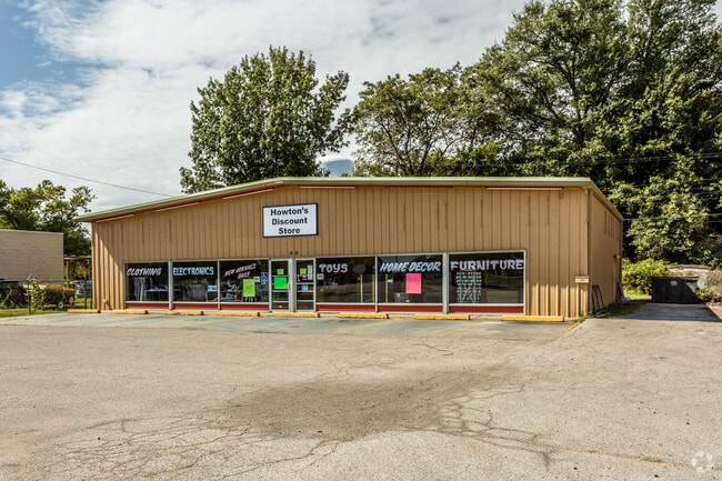
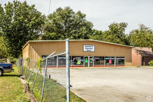
Property Record
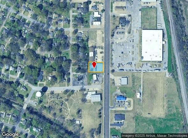
1010 N Missouri St, West Memphis, AR 72301
NEARBY LISTINGS FOR SALE OR LEASE
Property Detail
1010 N Missouri St
Memphis, TN-MS-AR
Worthington Park
393-330000-000
PLAT BK 1 PG 255
Storebuilding
Crittenden
X
Arkansas
05035C0345E
17
2025
0.34 AC
2025
Crittenden County
030201
Memphis
3,570 SF
DEMOGRAPHICS near 1010 N Missouri St
1 Mile
3 Mile
5 Mile
2024 Total Population
5,919
29,219
37,226
2029 Population
5,704
28,450
36,178
Pop Growth 2024-2029
(3.63%)
(2.63%)
(2.82%)
Average Age
38
38
38
2024 Total Households
2,400
11,555
14,567
HH Growth 2024-2029
(3.75%)
(2.65%)
(2.83%)
Median Household Inc
$39,931
$40,821
$44,757
Avg Household Size
2.30
2.40
2.50
2024 Avg HH Vehicles
2.00
2.00
2.00
Median Home Value
$95,099
$125,721
$141,363
Median Year Built
1964
1979
1982
Nearby Places
Map Layers
Map Styles
 Street
 Aerial
- Restaurants
- Banks
- Shops
- Fitness
- Groceries
PUBLIC TRANSPORTATION
COMMUTER RAIL
Central Station (Riverfront Loop - Memphis Area Transit Authority Trolley (MataTrolley))
DRIVE
WALK
Distance
Central Station (Riverfront Loop - Memphis Area Transit Authority Trolley (MataTrolley))
13 min
9.1 mi
AIRPORT
Memphis International
DRIVE
WALK
Distance
Memphis International
26 min
18.2 mi
SALE & LEASE HISTORY
LISTING DATE
SALE/LEASE

Oct 05, 2017
For Lease
Dec 20, 2017
For Lease
Nearby Properties
Address
Land Use
TOTAL SIZE
Lot Size
Zoning
Address
Land Use
TOTAL SIZE
Lot Size
Zoning
148,005 SF
134.67 AC
Address
Land Use
TOTAL SIZE
Lot Size
Zoning
847,384 SF
77.14 AC
Address
Land Use
TOTAL SIZE
Lot Size
Zoning
69,600 SF
38.09 AC
Address
Land Use
TOTAL SIZE
Lot Size
Zoning
3,960 SF
14.54 AC
Address
Land Use
TOTAL SIZE
Lot Size
Zoning
46,927 SF
7.52 AC
Address
Land Use
TOTAL SIZE
Lot Size
Zoning
665,000 SF
46.40 AC
Address
Land Use
TOTAL SIZE
Lot Size
Zoning
209,064 SF
26.97 AC
Address
Land Use
TOTAL SIZE
Lot Size
Zoning
79,208 SF
3.98 AC
Address
Land Use
TOTAL SIZE
Lot Size
Zoning
72,051 SF
1.98 AC
Address
Land Use
TOTAL SIZE
Lot Size
Zoning
87,608 SF
10.02 AC
Address
Land Use
TOTAL SIZE
Lot Size
Zoning
28,600 SF
7 AC
Address
Land Use
TOTAL SIZE
Lot Size
Zoning
70,994 SF
3.06 AC
Address
Land Use
TOTAL SIZE
Lot Size
Zoning
7,482 SF
7.17 AC
Address
Land Use
TOTAL SIZE
Lot Size
Zoning
194,110 SF
125.33 AC
Address
Land Use
TOTAL SIZE
Lot Size
Zoning
328,229 SF
20 AC
Address
Land Use
TOTAL SIZE
Lot Size
Zoning
10,220 SF
11.74 AC
Address
Land Use
TOTAL SIZE
Lot Size
Zoning
12,088 SF
98.07 AC
Address
Land Use
TOTAL SIZE
Lot Size
Zoning
46,035 SF
2.31 AC
Address
Land Use
TOTAL SIZE
Lot Size
Zoning
148,342 SF
9.87 AC
Address
Land Use
TOTAL SIZE
Lot Size
Zoning
2,728 SF
10.54 AC
Address
Land Use
TOTAL SIZE
Lot Size
Zoning
43,781 SF
1.65 AC
Address
Land Use
TOTAL SIZE
Lot Size
Zoning
44,648 SF
5.74 AC
Address
Land Use
TOTAL SIZE
Lot Size
Zoning
43,570 SF
1.80 AC
Address
Land Use
TOTAL SIZE
Lot Size
Zoning
64,791 SF
3.57 AC
Address
Land Use
TOTAL SIZE
Lot Size
Zoning
23,900 SF
11.23 AC
Address
Land Use
TOTAL SIZE
Lot Size
Zoning
52,902 SF
Address
Land Use
TOTAL SIZE
Lot Size
Zoning
3,456 SF
6.09 AC
Address
Land Use
TOTAL SIZE
Lot Size
Zoning
8,178 SF
6.06 AC
Address
Land Use
TOTAL SIZE
Lot Size
Zoning
8,178 SF
3.99 AC
Address
Land Use
TOTAL SIZE
Lot Size
Zoning
12,000 SF
10.35 AC
The World's #1 Commercial Real Estate Marketplace
Connect with us
© 2025 CoStar Group
The information above has been obtained from sources believed reliable. While we do not doubt its accuracy we have not verified it and make no guarantee, warranty or representation about it. It is your responsibility to independently confirm its accuracy and completeness. Any projections, opinions, assumptions, or estimates used are for example only and do not represent the current or future performance of the property. The value of this transaction to you depends on tax and other factors which should be evaluated by your tax, financial, and legal advisors. You and your advisors should conduct a careful, independent investigation of the property to determine to your satisfaction the suitability of the property for your needs.