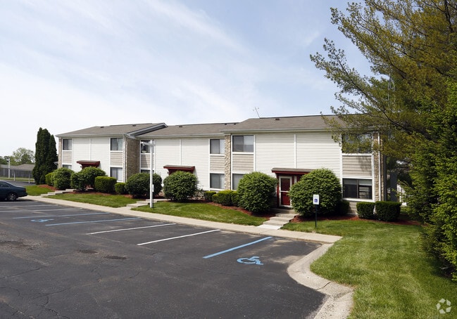
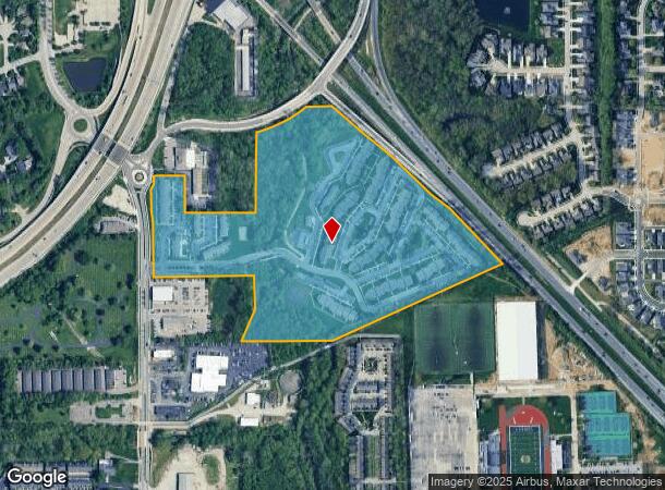
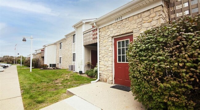
Property Record
1010 N Rangeline Rd, Carmel, IN 46032

NEARBY LISTINGS FOR SALE OR LEASE
Property Detail
1010 N Rangeline Rd
29-10-19-000-023.000-018
ACREAGE 31.70, SECTION 19, TOWNSHIP 18, RANGE 4
Apartment
Hamilton
AE
Indiana
18057C0226G
31.70 AC
2023
Carmel
2024
Indianapolis
111012
Indianapolis-Carmel-Greenwood, IN
318,922 SF
DEMOGRAPHICS near 1010 N Rangeline Rd
1 Mile
3 Mile
5 Mile
2024 Total Population
8,491
73,825
163,154
2029 Population
9,592
83,026
183,633
Pop Growth 2024-2029
+ 12.97%
+ 12.46%
+ 12.55%
Average Age
40
40
39
2024 Total Households
3,745
28,959
62,490
HH Growth 2024-2029
+ 12.90%
+ 12.70%
+ 12.43%
Median Household Inc
$79,260
$104,034
$105,037
Avg Household Size
2.20
2.50
2.60
2024 Avg HH Vehicles
2.00
2.00
2.00
Median Home Value
$358,666
$370,185
$372,304
Median Year Built
1993
1997
1999
Nearby Places
Map Layers
Map Styles
 Street
 Aerial
- Restaurants
- Banks
- Shops
- Fitness
- Groceries
PUBLIC TRANSPORTATION
AIRPORT
Indianapolis International
DRIVE
WALK
Distance
Indianapolis International
54 min
32.3 mi
Freight Ports
Port of Toledo
DRIVE
WALK
Distance
Port of Toledo
262 min
215.8 mi
Nearby Properties
Address
Land Use
TOTAL SIZE
Lot Size
Zoning
Address
Land Use
TOTAL SIZE
Lot Size
Zoning
435,973 SF
Address
Land Use
TOTAL SIZE
Lot Size
Zoning
342,574 SF
5.64 AC
Address
Land Use
TOTAL SIZE
Lot Size
Zoning
337,250 SF
18.54 AC
Address
Land Use
TOTAL SIZE
Lot Size
Zoning
504,699 SF
40 AC
Address
Land Use
TOTAL SIZE
Lot Size
Zoning
417,894 SF
15.22 AC
Address
Land Use
TOTAL SIZE
Lot Size
Zoning
272,700 SF
2.10 AC
Address
Land Use
TOTAL SIZE
Lot Size
Zoning
317,335 SF
4.22 AC
Address
Land Use
TOTAL SIZE
Lot Size
Zoning
359,968 SF
13.65 AC
Address
Land Use
TOTAL SIZE
Lot Size
Zoning
412,120 SF
12.16 AC
Address
Land Use
TOTAL SIZE
Lot Size
Zoning
298,290 SF
2.80 AC
Address
Land Use
TOTAL SIZE
Lot Size
Zoning
393,106 SF
13.37 AC
Address
Land Use
TOTAL SIZE
Lot Size
Zoning
115,160 SF
2.35 AC
Address
Land Use
TOTAL SIZE
Lot Size
Zoning
236,320 SF
20.74 AC
Address
Land Use
TOTAL SIZE
Lot Size
Zoning
261,003 SF
1.92 AC
Address
Land Use
TOTAL SIZE
Lot Size
Zoning
280,428 SF
12.81 AC
Address
Land Use
TOTAL SIZE
Lot Size
Zoning
261,335 SF
4.28 AC
Address
Land Use
TOTAL SIZE
Lot Size
Zoning
357,660 SF
22.37 AC
Address
Land Use
TOTAL SIZE
Lot Size
Zoning
83,446 SF
67.68 AC
Address
Land Use
TOTAL SIZE
Lot Size
Zoning
245,922 SF
19.03 AC
Address
Land Use
TOTAL SIZE
Lot Size
Zoning
331,800 SF
1.54 AC
Address
Land Use
TOTAL SIZE
Lot Size
Zoning
153,184 SF
1.17 AC
Address
Land Use
TOTAL SIZE
Lot Size
Zoning
210,424 SF
14.10 AC
Address
Land Use
TOTAL SIZE
Lot Size
Zoning
360,178 SF
36 AC
Address
Land Use
TOTAL SIZE
Lot Size
Zoning
188,239 SF
11.15 AC
Address
Land Use
TOTAL SIZE
Lot Size
Zoning
297,641 SF
70.35 AC
Address
Land Use
TOTAL SIZE
Lot Size
Zoning
228,713 SF
7.06 AC
Address
Land Use
TOTAL SIZE
Lot Size
Zoning
229,856 SF
7 AC
Address
Land Use
TOTAL SIZE
Lot Size
Zoning
157,967 SF
Address
Land Use
TOTAL SIZE
Lot Size
Zoning
212,140 SF
5.47 AC
The World's #1 Commercial Real Estate Marketplace
Connect with us
© 2026 CoStar Group
The information above has been obtained from sources believed reliable. While we do not doubt its accuracy we have not verified it and make no guarantee, warranty or representation about it. It is your responsibility to independently confirm its accuracy and completeness. Any projections, opinions, assumptions, or estimates used are for example only and do not represent the current or future performance of the property. The value of this transaction to you depends on tax and other factors which should be evaluated by your tax, financial, and legal advisors. You and your advisors should conduct a careful, independent investigation of the property to determine to your satisfaction the suitability of the property for your needs.