Property Record
1010 N Ridge Rd, Wichita, KS 67212

NEARBY LISTINGS FOR SALE OR LEASE
-
-
View all Wichita listings for sale on LoopNet.com
Property Detail
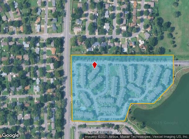
1010 N Ridge Rd
Wichita, KS
Silver Springs Add
135-15-0-34-01-001.00
LOT 1 BLOCK 1 SILVER SPRINGS ADD.
Apartment
Sedgwick
AE
Kansas
20173C0333G
1
2024
13.19 AC
2025
West Wichita
009301
Wichita
46,007 SF
DEMOGRAPHICS near 1010 N Ridge Rd
1 Mile
3 Mile
5 Mile
2024 Total Population
10,104
70,162
160,458
2029 Population
10,232
71,038
163,103
Pop Growth 2024-2029
+ 1.27%
+ 1.25%
+ 1.65%
Average Age
37
41
39
2024 Total Households
4,949
29,518
64,519
HH Growth 2024-2029
+ 1.29%
+ 1.28%
+ 1.73%
Median Household Inc
$45,330
$60,411
$62,843
Avg Household Size
2.00
2.30
2.40
2024 Avg HH Vehicles
2.00
2.00
2.00
Median Home Value
$155,354
$171,203
$174,445
Median Year Built
1980
1980
1977
Nearby Places
Map Layers
Map Styles
 Street
 Aerial
- Restaurants
- Banks
- Shops
- Fitness
- Groceries
PUBLIC TRANSPORTATION
AIRPORT
Wichita Dwight D Eisenhower Ntl
DRIVE
WALK
Distance
Wichita Dwight D Eisenhower Ntl
8 min
3.5 mi
Freight Ports
Tulsa Port Of Catoosa
DRIVE
WALK
Distance
Tulsa Port Of Catoosa
210 min
196.6 mi
Nearby Properties
Address
Land Use
TOTAL SIZE
Lot Size
Zoning
Address
Land Use
TOTAL SIZE
Lot Size
Zoning
1,675,141 SF
1,753.52 AC
LI
Address
Land Use
TOTAL SIZE
Lot Size
Zoning
216,196 SF
65.60 AC
SF-5
Address
Land Use
TOTAL SIZE
Lot Size
Zoning
303,559 SF
123.23 AC
SF-5
Address
Land Use
TOTAL SIZE
Lot Size
Zoning
203,580 SF
15.51 AC
B
Address
Land Use
TOTAL SIZE
Lot Size
Zoning
108,283 SF
14.80 AC
SF-5
Address
Land Use
TOTAL SIZE
Lot Size
Zoning
192,027 SF
117.94 AC
SF-20,GC,L
Address
Land Use
TOTAL SIZE
Lot Size
Zoning
172,486 SF
25.68 AC
SF-5
Address
Land Use
TOTAL SIZE
Lot Size
Zoning
113,253 SF
21.17 AC
SF-5
Address
Land Use
TOTAL SIZE
Lot Size
Zoning
167,923 SF
18.01 AC
SF-5
Address
Land Use
TOTAL SIZE
Lot Size
Zoning
55,930 SF
10.28 AC
LI
Address
Land Use
TOTAL SIZE
Lot Size
Zoning
99,933 SF
9.98 AC
SF-5
Address
Land Use
TOTAL SIZE
Lot Size
Zoning
143,704 SF
19.22 AC
SF-5
Address
Land Use
TOTAL SIZE
Lot Size
Zoning
68,468 SF
7.17 AC
B,SF-5,GO
Address
Land Use
TOTAL SIZE
Lot Size
Zoning
136,717 SF
11.18 AC
SF-5
Address
Land Use
TOTAL SIZE
Lot Size
Zoning
79,278 SF
5.24 AC
GO
Address
Land Use
TOTAL SIZE
Lot Size
Zoning
193,680 SF
4.31 AC
LI
Address
Land Use
TOTAL SIZE
Lot Size
Zoning
56,519 SF
84.45 AC
SF-20,LI
Address
Land Use
TOTAL SIZE
Lot Size
Zoning
79,775 SF
7.94 AC
SF-5
Address
Land Use
TOTAL SIZE
Lot Size
Zoning
173,604 SF
21.29 AC
LC
Address
Land Use
TOTAL SIZE
Lot Size
Zoning
58,392 SF
6.34 AC
LI
Address
Land Use
TOTAL SIZE
Lot Size
Zoning
65,504 SF
6.81 AC
SF-5
Address
Land Use
TOTAL SIZE
Lot Size
Zoning
62,321 SF
13.21 AC
SF-5
Address
Land Use
TOTAL SIZE
Lot Size
Zoning
14,834 SF
1.46 AC
GO
Address
Land Use
TOTAL SIZE
Lot Size
Zoning
51,845 SF
5.51 AC
SF-5
Address
Land Use
TOTAL SIZE
Lot Size
Zoning
49,970 SF
110.38 AC
LI
Address
Land Use
TOTAL SIZE
Lot Size
Zoning
50,496 SF
6.18 AC
SF-5
Address
Land Use
TOTAL SIZE
Lot Size
Zoning
56,627 SF
14.01 AC
SF-5
Address
Land Use
TOTAL SIZE
Lot Size
Zoning
45,170 SF
3.61 AC
LC
Address
Land Use
TOTAL SIZE
Lot Size
Zoning
52,382 SF
5.53 AC
B
Address
Land Use
TOTAL SIZE
Lot Size
Zoning
47,158 SF
211.18 AC
SF-20,LC
The World's #1 Commercial Real Estate Marketplace
Connect with us
© 2026 CoStar Group
The information above has been obtained from sources believed reliable. While we do not doubt its accuracy we have not verified it and make no guarantee, warranty or representation about it. It is your responsibility to independently confirm its accuracy and completeness. Any projections, opinions, assumptions, or estimates used are for example only and do not represent the current or future performance of the property. The value of this transaction to you depends on tax and other factors which should be evaluated by your tax, financial, and legal advisors. You and your advisors should conduct a careful, independent investigation of the property to determine to your satisfaction the suitability of the property for your needs.