Property Record
1010 Waltham St, Lexington, MA 02421
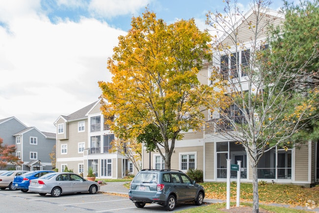

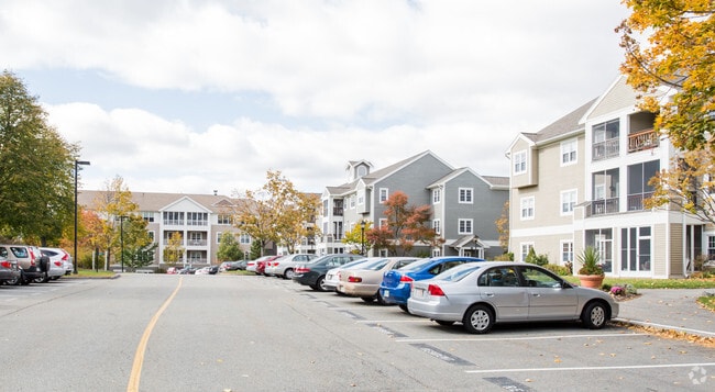
Property Detail
1010 Waltham St
LEXI-000005-000000-000016A
Middlesex
Charitableorganization
Massachusetts
RD
16a
A Areas with a 1% annual chance of flooding and a 26% chance of flooding over the life of a 30-year mortgage.
25.73 AC
0
Follen Heights
2025
Boston
358300
Boston-Cambridge-Newton, MA-NH
25,000 SF
NEARBY LISTINGS FOR SALE OR LEASE
DEMOGRAPHICS near 1010 Waltham St
1 mile
3 mile
5 mile
2025 Total Population
13,303
96,104
297,566
2030 Population
13,846
99,765
308,418
Pop Growth 2025-2030
+ 4.08%
+ 3.81%
+ 3.65%
Average Age
42
42
41
2025 Total Households
5,532
36,067
118,138
HH Growth 2025-2030
+ 4.12%
+ 3.97%
+ 3.75%
Median Household Inc
$128,914
$144,449
$143,204
Avg Household Size
2.30
2.50
2.40
2025 Avg HH Vehicles
2.00
2.00
2.00
Median Home Value
$808,783
$887,358
$940,439
Median Year Built
1978
1960
1954
Nearby Places
Map Layers
Map Styles
 Street
 Aerial
Layers
 Traffic
 Biking
Places
Listings with unknown addresses are not visible on the map
- Restaurants
- Banks
- Shops
- Fitness
- Groceries
PUBLIC TRANSPORTATION
COMMUTER RAIL
Waltham (Fitchburg/South Acton Line - Massachusetts Bay Transportation Authority Commuter Rail (Purple Line))
Drive
Walk
Distance
Waltham (Fitchburg/South Acton Line - Massachusetts Bay Transportation Authority Commuter Rail (Purple Line))
8 min
3.3 mi
Waverley (Fitchburg/South Acton Line - Massachusetts Bay Transportation Authority Commuter Rail (Purple Line))
Drive
Walk
Distance
Waverley (Fitchburg/South Acton Line - Massachusetts Bay Transportation Authority Commuter Rail (Purple Line))
8 min
3.9 mi
AIRPORT
General Edward Lawrence Logan International
Drive
Walk
Distance
General Edward Lawrence Logan International
27 min
15.1 mi
Freight Ports
Port of Boston
Drive
Walk
Distance
Port of Boston
27 min
15.2 mi
Nearby Properties
Address
Land Use
TOTAL SIZE
Lot Size
Zoning
Address
Land Use
TOTAL SIZE
Lot Size
Zoning
776,099 SF
35.70 AC
Address
Land Use
TOTAL SIZE
Lot Size
Zoning
561,437 SF
33.53 AC
Address
Land Use
TOTAL SIZE
Lot Size
Zoning
165,986 SF
4.32 AC
Address
Land Use
TOTAL SIZE
Lot Size
Zoning
472,329 SF
22.11 AC
CD
Address
Land Use
TOTAL SIZE
Lot Size
Zoning
190,308 SF
17.46 AC
CD
Address
Land Use
TOTAL SIZE
Lot Size
Zoning
105,982 SF
4.50 AC
Address
Land Use
TOTAL SIZE
Lot Size
Zoning
198,051 SF
11.56 AC
CR
Address
Land Use
TOTAL SIZE
Lot Size
Zoning
387,965 SF
3.90 AC
Address
Land Use
TOTAL SIZE
Lot Size
Zoning
336,306 SF
7.54 AC
Address
Land Use
TOTAL SIZE
Lot Size
Zoning
79.60 AC
SD
Address
Land Use
TOTAL SIZE
Lot Size
Zoning
293,084 SF
5.01 AC
1
Address
Land Use
TOTAL SIZE
Lot Size
Zoning
73.10 AC
SA
Address
Land Use
TOTAL SIZE
Lot Size
Zoning
238,065 SF
1.79 AC
Address
Land Use
TOTAL SIZE
Lot Size
Zoning
272,445 SF
6.40 AC
Address
Land Use
TOTAL SIZE
Lot Size
Zoning
282,014 SF
15.57 AC
Address
Land Use
TOTAL SIZE
Lot Size
Zoning
269,692 SF
15.37 AC
Address
Land Use
TOTAL SIZE
Lot Size
Zoning
344,469 SF
54.49 AC
Address
Land Use
TOTAL SIZE
Lot Size
Zoning
442,743 SF
27.11 AC
Address
Land Use
TOTAL SIZE
Lot Size
Zoning
164,072 SF
43.80 AC
Address
Land Use
TOTAL SIZE
Lot Size
Zoning
212,684 SF
54.49 AC
Address
Land Use
TOTAL SIZE
Lot Size
Zoning
30.69 AC
Address
Land Use
TOTAL SIZE
Lot Size
Zoning
75.78 AC
SD
Address
Land Use
TOTAL SIZE
Lot Size
Zoning
342,677 SF
56.46 AC
ND
Address
Land Use
TOTAL SIZE
Lot Size
Zoning
21.99 AC
Address
Land Use
TOTAL SIZE
Lot Size
Zoning
11.25 AC
PD-6
Address
Land Use
TOTAL SIZE
Lot Size
Zoning
124,950 SF
1.69 AC
Address
Land Use
TOTAL SIZE
Lot Size
Zoning
224,892 SF
20.52 AC
Address
Land Use
TOTAL SIZE
Lot Size
Zoning
286,462 SF
15.94 AC
Address
Land Use
TOTAL SIZE
Lot Size
Zoning
210,423 SF
26.39 AC
The World's #1 Commercial Real Estate Marketplace
Connect with us
© 2026 CoStar Group
The information above has been obtained from sources believed reliable. While we do not doubt its accuracy we have not verified it and make no guarantee, warranty or representation about it. It is your responsibility to independently confirm its accuracy and completeness. Any projections, opinions, assumptions, or estimates used are for example only and do not represent the current or future performance of the property. The value of this transaction to you depends on tax and other factors which should be evaluated by your tax, financial, and legal advisors. You and your advisors should conduct a careful, independent investigation of the property to determine to your satisfaction the suitability of the property for your needs.