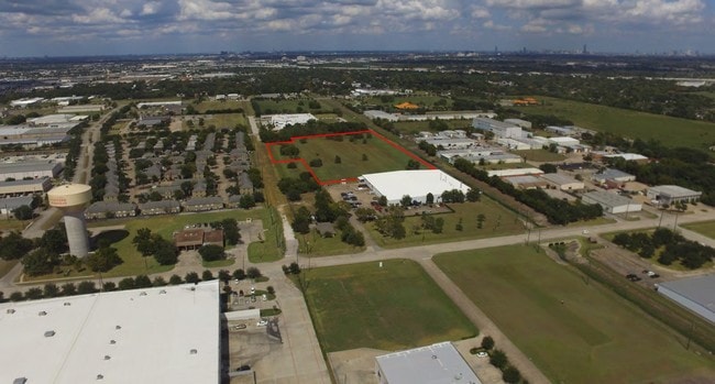
Property Record
10101 Fountaingate Dr, Stafford, TX 77477
NEARBY LISTINGS FOR SALE OR LEASE
Property Detail
10101 Fountaingate Dr
Houston-The Woodlands-Sugar Land, TX
G H Ball
0541-00-000-1700-910
0541 G H BALL, BLOCK 1, ACRES 7.852, REDI CARPET PROPERTIES STAFFORD, UNRESTRICTED RESERVE A, PART IN ABSTRACT 0404 (JANE DEES)
Commercialnec
Fort Bend
X
Texas
48201C0845M
58
2024
7.85 AC
2025
E Fort Bend Co/Sugar Land
671800
Houston
DEMOGRAPHICS near 10101 Fountaingate Dr
1 Mile
3 Mile
5 Mile
2024 Total Population
5,842
120,035
405,691
2029 Population
6,568
131,584
441,206
Pop Growth 2024-2029
+ 12.43%
+ 9.62%
+ 8.75%
Average Age
37
37
38
2024 Total Households
2,399
43,116
141,612
HH Growth 2024-2029
+ 13.30%
+ 10.02%
+ 9.15%
Median Household Inc
$71,436
$50,241
$52,637
Avg Household Size
2.40
2.70
2.80
2024 Avg HH Vehicles
2.00
2.00
2.00
Median Home Value
$222,644
$202,399
$214,900
Median Year Built
1994
1985
1981
Nearby Places
- Restaurants
- Banks
- Shops
- Fitness
- Groceries
PUBLIC TRANSPORTATION
AIRPORT
William P Hobby
DRIVE
WALK
Distance
William P Hobby
36 min
21.6 mi
George Bush Intcntl/Houston
DRIVE
WALK
Distance
George Bush Intcntl/Houston
49 min
38.1 mi
Freight Ports
Port of Houston
DRIVE
WALK
Distance
Port of Houston
38 min
23.8 mi
SALE & LEASE HISTORY
LISTING DATE
SALE/LEASE

Oct 18, 2016
For Sale
Feb 10, 2017
For Sale
Nearby Properties
Address
Land Use
TOTAL SIZE
Lot Size
Zoning
Address
Land Use
TOTAL SIZE
Lot Size
Zoning
7.46 AC
Address
Land Use
TOTAL SIZE
Lot Size
Zoning
257,051 SF
64.85 AC
Address
Land Use
TOTAL SIZE
Lot Size
Zoning
109,083 SF
20.81 AC
Address
Land Use
TOTAL SIZE
Lot Size
Zoning
12.98 AC
Address
Land Use
TOTAL SIZE
Lot Size
Zoning
11.58 AC
Address
Land Use
TOTAL SIZE
Lot Size
Zoning
12.08 AC
Address
Land Use
TOTAL SIZE
Lot Size
Zoning
627,632 SF
24.12 AC
Address
Land Use
TOTAL SIZE
Lot Size
Zoning
552,900 SF
27.86 AC
Address
Land Use
TOTAL SIZE
Lot Size
Zoning
816,006 SF
40.26 AC
Address
Land Use
TOTAL SIZE
Lot Size
Zoning
967,659 SF
75.03 AC
Address
Land Use
TOTAL SIZE
Lot Size
Zoning
422,123 SF
39.85 AC
Address
Land Use
TOTAL SIZE
Lot Size
Zoning
344,620 SF
53.65 AC
STHQZ
Address
Land Use
TOTAL SIZE
Lot Size
Zoning
32,520 SF
34.98 AC
Address
Land Use
TOTAL SIZE
Lot Size
Zoning
35.85 AC
Address
Land Use
TOTAL SIZE
Lot Size
Zoning
188,178 SF
18.49 AC
Address
Land Use
TOTAL SIZE
Lot Size
Zoning
85,273 SF
11.63 AC
Y
Address
Land Use
TOTAL SIZE
Lot Size
Zoning
428,538 SF
45.50 AC
Address
Land Use
TOTAL SIZE
Lot Size
Zoning
93,310 SF
13.41 AC
Address
Land Use
TOTAL SIZE
Lot Size
Zoning
14,038 SF
23.83 AC
Address
Land Use
TOTAL SIZE
Lot Size
Zoning
76,385 SF
17.48 AC
Address
Land Use
TOTAL SIZE
Lot Size
Zoning
176,377 SF
40.41 AC
SM
Address
Land Use
TOTAL SIZE
Lot Size
Zoning
Address
Land Use
TOTAL SIZE
Lot Size
Zoning
76,306 SF
15.84 AC
Address
Land Use
TOTAL SIZE
Lot Size
Zoning
127,458 SF
14.21 AC
Address
Land Use
TOTAL SIZE
Lot Size
Zoning
12.22 AC
Address
Land Use
TOTAL SIZE
Lot Size
Zoning
88,682 SF
10.52 AC
ASY
Address
Land Use
TOTAL SIZE
Lot Size
Zoning
183,015 SF
9.91 AC
Address
Land Use
TOTAL SIZE
Lot Size
Zoning
382,505 SF
21.68 AC
Address
Land Use
TOTAL SIZE
Lot Size
Zoning
154,586 SF
10.93 AC
SY
Address
Land Use
TOTAL SIZE
Lot Size
Zoning
1,712 SF
17.93 AC
SM
The World's #1 Commercial Real Estate Marketplace
Connect with us
© 2025 CoStar Group
The information above has been obtained from sources believed reliable. While we do not doubt its accuracy we have not verified it and make no guarantee, warranty or representation about it. It is your responsibility to independently confirm its accuracy and completeness. Any projections, opinions, assumptions, or estimates used are for example only and do not represent the current or future performance of the property. The value of this transaction to you depends on tax and other factors which should be evaluated by your tax, financial, and legal advisors. You and your advisors should conduct a careful, independent investigation of the property to determine to your satisfaction the suitability of the property for your needs.