Property Record
10101 Highway 73, Conifer, CO 80433


Property Detail
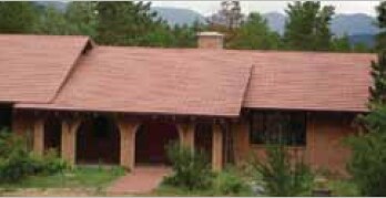
10101 Highway 73
61-142-00-008
SECTION 14 TOWNSHIP 06 RANGE 71 QTR NW SIZE: 1972440 VALUE: 45.281 KEY=095
Agriculturalland
Jefferson
A2
Colorado
A Areas with a 1% annual chance of flooding and a 26% chance of flooding over the life of a 30-year mortgage.
45.28 AC
2025
West Denver
2025
Denver
012037
Denver-Aurora-Centennial, CO
6,342 SF
NEARBY LISTINGS FOR SALE OR LEASE
DEMOGRAPHICS near 10101 Highway 73
1 mile
3 mile
5 mile
2025 Total Population
925
5,876
14,949
2030 Population
918
5,853
14,950
Pop Growth 2025-2030
(0.76%)
(0.39%)
+ 0.01%
Average Age
46
46
46
2025 Total Households
369
2,357
6,039
HH Growth 2025-2030
(1.08%)
(0.47%)
(0.08%)
Median Household Inc
$130,833
$132,575
$136,696
Avg Household Size
2.50
2.50
2.40
2025 Avg HH Vehicles
3.00
3.00
3.00
Median Home Value
$815,957
$801,765
$815,633
Median Year Built
1978
1979
1979
Nearby Places
Map Layers
Map Styles
 Street
 Aerial
Transit
 Traffic
 Biking
Places
Listings with unknown addresses are not visible on the map
- Restaurants
- Banks
- Shops
- Fitness
- Groceries
Nearby Properties
Address
Land Use
TOTAL SIZE
Lot Size
Zoning
Address
Land Use
TOTAL SIZE
Lot Size
Zoning
483.04 AC
A2
Address
Land Use
TOTAL SIZE
Lot Size
Zoning
159,469 SF
104.55 AC
A2
Address
Land Use
TOTAL SIZE
Lot Size
Zoning
205.11 AC
A2
Address
Land Use
TOTAL SIZE
Lot Size
Zoning
87,394 SF
7.32 AC
Address
Land Use
TOTAL SIZE
Lot Size
Zoning
173.19 AC
CO
Address
Land Use
TOTAL SIZE
Lot Size
Zoning
99,925 SF
40 AC
A2
Address
Land Use
TOTAL SIZE
Lot Size
Zoning
68,855 SF
6.65 AC
PD
Address
Land Use
TOTAL SIZE
Lot Size
Zoning
55,831 SF
3.35 AC
C1
Address
Land Use
TOTAL SIZE
Lot Size
Zoning
65,199 SF
1.78 AC
Address
Land Use
TOTAL SIZE
Lot Size
Zoning
62,164 SF
6.07 AC
Address
Land Use
TOTAL SIZE
Lot Size
Zoning
12,076 SF
499.18 AC
A2
Address
Land Use
TOTAL SIZE
Lot Size
Zoning
262.19 AC
CO
Address
Land Use
TOTAL SIZE
Lot Size
Zoning
2,728 SF
80 AC
A2
Address
Land Use
TOTAL SIZE
Lot Size
Zoning
26,752 SF
1.67 AC
Address
Land Use
TOTAL SIZE
Lot Size
Zoning
50,801 SF
19.26 AC
R1
Address
Land Use
TOTAL SIZE
Lot Size
Zoning
35,890 SF
3.04 AC
Address
Land Use
TOTAL SIZE
Lot Size
Zoning
389.03 AC
A2
Address
Land Use
TOTAL SIZE
Lot Size
Zoning
19,979 SF
15.09 AC
PD
Address
Land Use
TOTAL SIZE
Lot Size
Zoning
14,822 SF
2.99 AC
PD
Address
Land Use
TOTAL SIZE
Lot Size
Zoning
17,509 SF
0.59 AC
Address
Land Use
TOTAL SIZE
Lot Size
Zoning
9,364 SF
9.44 AC
A1
Address
Land Use
TOTAL SIZE
Lot Size
Zoning
9,554 SF
1.50 AC
RC
Address
Land Use
TOTAL SIZE
Lot Size
Zoning
5,597 SF
1.61 AC
PD
Address
Land Use
TOTAL SIZE
Lot Size
Zoning
120 AC
CO
Address
Land Use
TOTAL SIZE
Lot Size
Zoning
7,820 SF
0.33 AC
Address
Land Use
TOTAL SIZE
Lot Size
Zoning
5,926 SF
0.36 AC
Address
Land Use
TOTAL SIZE
Lot Size
Zoning
4,345 SF
0.76 AC
PD
Address
Land Use
TOTAL SIZE
Lot Size
Zoning
7,200 SF
1.28 AC
C1
Address
Land Use
TOTAL SIZE
Lot Size
Zoning
9,832 SF
1.61 AC
PD
Address
Land Use
TOTAL SIZE
Lot Size
Zoning
3,232 SF
1.05 AC
PD
The World's #1 Commercial Real Estate Marketplace
Connect with us
© 2026 CoStar Group
The information above has been obtained from sources believed reliable. While we do not doubt its accuracy we have not verified it and make no guarantee, warranty or representation about it. It is your responsibility to independently confirm its accuracy and completeness. Any projections, opinions, assumptions, or estimates used are for example only and do not represent the current or future performance of the property. The value of this transaction to you depends on tax and other factors which should be evaluated by your tax, financial, and legal advisors. You and your advisors should conduct a careful, independent investigation of the property to determine to your satisfaction the suitability of the property for your needs.