Property Record
10102 Johnston Rd, Charlotte, NC 28210
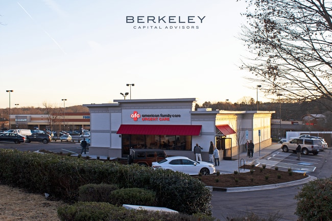


Property Detail
10102 Johnston Rd
221-191-57
L2 M27-309
Commercialnec
Mecklenburg
B-4
North Carolina
B and X Area of moderate flood hazard, usually the area between the limits of the 100-year and 500-year floods.
2
2024
1.09 AC
2025
Outer Southeast
005829
Charlotte
3,634 SF
Charlotte-Concord-Gastonia, NC-SC
NEARBY LISTINGS FOR SALE OR LEASE
DEMOGRAPHICS near 10102 Johnston Rd
1 mile
3 mile
5 mile
2025 Total Population
12,843
76,512
211,867
2030 Population
13,736
82,395
228,377
Pop Growth 2025-2030
+ 6.95%
+ 7.69%
+ 7.79%
Average Age
39
40
39
2025 Total Households
5,840
33,090
86,671
HH Growth 2025-2030
+ 7.11%
+ 7.77%
+ 7.87%
Median Household Inc
$69,894
$92,723
$107,218
Avg Household Size
2.20
2.30
2.40
2025 Avg HH Vehicles
2.00
2.00
2.00
Median Home Value
$479,767
$533,405
$582,206
Median Year Built
1986
1988
1993
Nearby Places
Map Layers
Map Styles
 Street
 Aerial
Layers
 Traffic
 Biking
Places
Listings with unknown addresses are not visible on the map
- Restaurants
- Banks
- Shops
- Fitness
- Groceries
PUBLIC TRANSPORTATION
AIRPORT
Charlotte/Douglas International
Drive
Walk
Distance
Charlotte/Douglas International
23 min
12.5 mi
Concord-Padgett Regional
Drive
Walk
Distance
Concord-Padgett Regional
44 min
35.5 mi
SALE & LEASE HISTORY
LISTING DATE
SALE/LEASE

Jun 22, 2017
For Lease
Jan 02, 2020
For Sale
Nearby Properties
Address
Land Use
TOTAL SIZE
Lot Size
Zoning
Address
Land Use
TOTAL SIZE
Lot Size
Zoning
922,476 SF
49.91 AC
BP
Address
Land Use
TOTAL SIZE
Lot Size
Zoning
605,976 SF
46.31 AC
R17MF
Address
Land Use
TOTAL SIZE
Lot Size
Zoning
244,692 SF
264.29 AC
I2
Address
Land Use
TOTAL SIZE
Lot Size
Zoning
654,693 SF
51.50 AC
O1
Address
Land Use
TOTAL SIZE
Lot Size
Zoning
646,209 SF
72.24 AC
CC
Address
Land Use
TOTAL SIZE
Lot Size
Zoning
306,928 SF
53.98 AC
Address
Land Use
TOTAL SIZE
Lot Size
Zoning
720,470 SF
5.45 AC
Address
Land Use
TOTAL SIZE
Lot Size
Zoning
430,352 SF
40.09 AC
R12MFCD
Address
Land Use
TOTAL SIZE
Lot Size
Zoning
425,591 SF
31.58 AC
MX1
Address
Land Use
TOTAL SIZE
Lot Size
Zoning
361,910 SF
3.60 AC
Address
Land Use
TOTAL SIZE
Lot Size
Zoning
465,462 SF
23.76 AC
CC
Address
Land Use
TOTAL SIZE
Lot Size
Zoning
326,013 SF
25.59 AC
RMF
Address
Land Use
TOTAL SIZE
Lot Size
Zoning
217,826 SF
82.89 AC
R3
Address
Land Use
TOTAL SIZE
Lot Size
Zoning
305,449 SF
17.90 AC
R17MFCD
Address
Land Use
TOTAL SIZE
Lot Size
Zoning
539,429 SF
5.37 AC
Address
Land Use
TOTAL SIZE
Lot Size
Zoning
480,041 SF
4.76 AC
Address
Land Use
TOTAL SIZE
Lot Size
Zoning
3,183 SF
3.82 AC
Address
Land Use
TOTAL SIZE
Lot Size
Zoning
381,729 SF
22.37 AC
R17MF
Address
Land Use
TOTAL SIZE
Lot Size
Zoning
698,101 SF
5 AC
Address
Land Use
TOTAL SIZE
Lot Size
Zoning
357,068 SF
28.04 AC
R15MFCD
Address
Land Use
TOTAL SIZE
Lot Size
Zoning
321,129 SF
23.59 AC
MX2
Address
Land Use
TOTAL SIZE
Lot Size
Zoning
452,964 SF
9.19 AC
OCCD
Address
Land Use
TOTAL SIZE
Lot Size
Zoning
324,998 SF
16.60 AC
OICD
Address
Land Use
TOTAL SIZE
Lot Size
Zoning
279,674 SF
18.28 AC
CC
Address
Land Use
TOTAL SIZE
Lot Size
Zoning
518,080 SF
5.44 AC
Address
Land Use
TOTAL SIZE
Lot Size
Zoning
312,194 SF
24.88 AC
R12MFCD
Address
Land Use
TOTAL SIZE
Lot Size
Zoning
364,274 SF
3.50 AC
CC
Address
Land Use
TOTAL SIZE
Lot Size
Zoning
293,128 SF
22.70 AC
MX2
Address
Land Use
TOTAL SIZE
Lot Size
Zoning
497,462 SF
5.64 AC
BPCD
Address
Land Use
TOTAL SIZE
Lot Size
Zoning
497,462 SF
6.32 AC
BPCD
The World's #1 Commercial Real Estate Marketplace
Connect with us
© 2026 CoStar Group
The information above has been obtained from sources believed reliable. While we do not doubt its accuracy we have not verified it and make no guarantee, warranty or representation about it. It is your responsibility to independently confirm its accuracy and completeness. Any projections, opinions, assumptions, or estimates used are for example only and do not represent the current or future performance of the property. The value of this transaction to you depends on tax and other factors which should be evaluated by your tax, financial, and legal advisors. You and your advisors should conduct a careful, independent investigation of the property to determine to your satisfaction the suitability of the property for your needs.