Property Record
10105 224Th St E, Graham, WA 98338
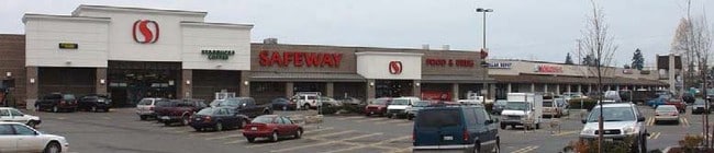

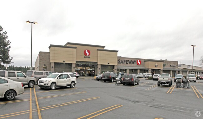

Property Detail
10105 224Th St E
Seattle-Tacoma-Bellevue, WA
SECTION 09 TOWNSHIP 18 RANGE 04 QUARTER 44 SAFEWAY BSP: L 1 EASE OF REC OUT OF 04-18-09-4-043 SEG 2020-0286 JP 02/05/20 JP
602719-0010
PIERCE
Storebuilding
Washington
RAC
1
2024
3.60 AC
2025
Spanaway
073124
Seattle/Puget Sound
44,626 SF
NEARBY LISTINGS FOR SALE OR LEASE
DEMOGRAPHICS near 10105 224Th St E
1 mile
3 mile
5 mile
2025 Total Population
2,733
45,852
108,499
2030 Population
2,752
46,347
110,017
Pop Growth 2025-2030
+ 0.70%
+ 1.08%
+ 1.40%
Average Age
40
37
37
2025 Total Households
911
14,767
35,438
HH Growth 2025-2030
+ 0.77%
+ 1.08%
+ 1.40%
Median Household Inc
$114,666
$113,279
$115,003
Avg Household Size
2.90
3.00
3.00
2025 Avg HH Vehicles
3.00
2.00
2.00
Median Home Value
$459,423
$506,596
$507,597
Median Year Built
1994
2000
1998
Nearby Places
Map Layers
Map Styles
 Street
 Aerial
Layers
 Traffic
 Biking
Places
Listings with unknown addresses are not visible on the map
- Restaurants
- Banks
- Shops
- Fitness
- Groceries
PUBLIC TRANSPORTATION
AIRPORT
Seattle-Tacoma International
Drive
Walk
Distance
Seattle-Tacoma International
54 min
32.5 mi
Freight Ports
Port of Tacoma
Drive
Walk
Distance
Port of Tacoma
32 min
17.7 mi
SALE & LEASE HISTORY
LISTING DATE
SALE/LEASE

Sep 25, 2016
For Lease
Nearby Properties
Address
Land Use
TOTAL SIZE
Lot Size
Zoning
Address
Land Use
TOTAL SIZE
Lot Size
Zoning
782,773 SF
53.33 AC
Address
Land Use
TOTAL SIZE
Lot Size
Zoning
753,069 SF
40.94 AC
Address
Land Use
TOTAL SIZE
Lot Size
Zoning
611,206 SF
30.76 AC
Address
Land Use
TOTAL SIZE
Lot Size
Zoning
305,680 SF
14.48 AC
Address
Land Use
TOTAL SIZE
Lot Size
Zoning
341,699 SF
54.72 AC
MPC
Address
Land Use
TOTAL SIZE
Lot Size
Zoning
153,138 SF
9.11 AC
CC
Address
Land Use
TOTAL SIZE
Lot Size
Zoning
218,262 SF
3.58 AC
MUD
Address
Land Use
TOTAL SIZE
Lot Size
Zoning
241,111 SF
16.67 AC
R10
Address
Land Use
TOTAL SIZE
Lot Size
Zoning
375,000 SF
26.29 AC
EC
Address
Land Use
TOTAL SIZE
Lot Size
Zoning
106,599 SF
20.88 AC
MSF
Address
Land Use
TOTAL SIZE
Lot Size
Zoning
69,447 SF
11.58 AC
NMHR
Address
Land Use
TOTAL SIZE
Lot Size
Zoning
118,205 SF
4.85 AC
CC
Address
Land Use
TOTAL SIZE
Lot Size
Zoning
282,007 SF
14.20 AC
R10
Address
Land Use
TOTAL SIZE
Lot Size
Zoning
92,841 SF
12.36 AC
CC
Address
Land Use
TOTAL SIZE
Lot Size
Zoning
83,601 SF
3.18 AC
MHR
Address
Land Use
TOTAL SIZE
Lot Size
Zoning
81,168 SF
15 AC
MSF
Address
Land Use
TOTAL SIZE
Lot Size
Zoning
156,323 SF
4.17 AC
MUD
Address
Land Use
TOTAL SIZE
Lot Size
Zoning
69,748 SF
4.94 AC
MSF
Address
Land Use
TOTAL SIZE
Lot Size
Zoning
82,882 SF
20.87 AC
R10
Address
Land Use
TOTAL SIZE
Lot Size
Zoning
47,442 SF
19.03 AC
R10
Address
Land Use
TOTAL SIZE
Lot Size
Zoning
163,600 SF
20.10 AC
EC
Address
Land Use
TOTAL SIZE
Lot Size
Zoning
126,030 SF
5.88 AC
MHR
Address
Land Use
TOTAL SIZE
Lot Size
Zoning
107,586 SF
0.70 AC
MUD
Address
Land Use
TOTAL SIZE
Lot Size
Zoning
58,754 SF
25.09 AC
SF
Address
Land Use
TOTAL SIZE
Lot Size
Zoning
9,964 SF
36.23 AC
EC
Address
Land Use
TOTAL SIZE
Lot Size
Zoning
37.28 AC
EC
Address
Land Use
TOTAL SIZE
Lot Size
Zoning
24,022 SF
5 AC
MUD
Address
Land Use
TOTAL SIZE
Lot Size
Zoning
59,468 SF
17.99 AC
R10
Address
Land Use
TOTAL SIZE
Lot Size
Zoning
42,946 SF
9.55 AC
R10
Address
Land Use
TOTAL SIZE
Lot Size
Zoning
34,480 SF
1.86 AC
MUD
The World's #1 Commercial Real Estate Marketplace
Connect with us
© 2026 CoStar Group
The information above has been obtained from sources believed reliable. While we do not doubt its accuracy we have not verified it and make no guarantee, warranty or representation about it. It is your responsibility to independently confirm its accuracy and completeness. Any projections, opinions, assumptions, or estimates used are for example only and do not represent the current or future performance of the property. The value of this transaction to you depends on tax and other factors which should be evaluated by your tax, financial, and legal advisors. You and your advisors should conduct a careful, independent investigation of the property to determine to your satisfaction the suitability of the property for your needs.