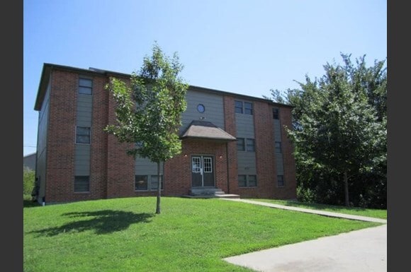
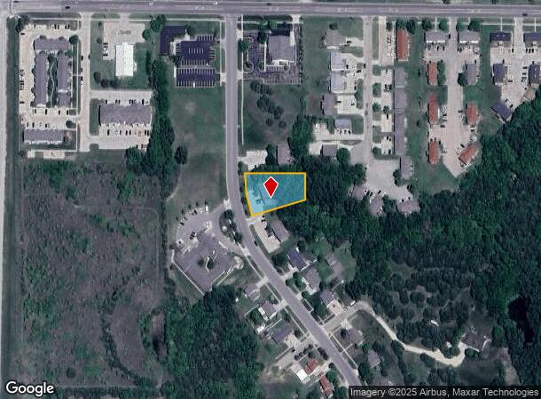
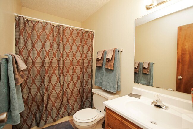
Property Record
1011 Caroline Ave, Junction City, KS 66441
NEARBY LISTINGS FOR SALE OR LEASE
-
-
View all Junction City listings for sale on LoopNet.com
Property Detail
1011 Caroline Ave
Junction City, KS
St Marys #3
115-15-0-10-01-016.01-0
ST MARYS #3, POB 90 S NW COR LOT 1 BLK 2 E 208 S 89 SW 194 NWLY 151 TO POB SECTION 15 TOWNSHIP 12 RANGE 05
Apartmenthouse5plusunits
Geary
X
Kansas
20061C0088D
1
2024
0.57 AC
2025
I-70 Corridor
000401
Other Market Areas
3,776 SF
DEMOGRAPHICS near 1011 Caroline Ave
1 Mile
3 Mile
5 Mile
2024 Total Population
6,181
21,449
28,188
2029 Population
5,971
20,941
27,403
Pop Growth 2024-2029
(3.40%)
(2.37%)
(2.78%)
Average Age
36
35
33
2024 Total Households
2,412
8,496
10,867
HH Growth 2024-2029
(3.32%)
(2.44%)
(2.70%)
Median Household Inc
$62,431
$54,750
$52,299
Avg Household Size
2.40
2.40
2.50
2024 Avg HH Vehicles
2.00
2.00
2.00
Median Home Value
$170,981
$153,922
$150,458
Median Year Built
1984
1979
1984
Nearby Places
Map Layers
Map Styles
 Street
 Aerial
- Restaurants
- Banks
- Shops
- Fitness
- Groceries
PUBLIC TRANSPORTATION
AIRPORT
Manhattan Regional
DRIVE
WALK
Distance
Manhattan Regional
25 min
17.5 mi
Freight Ports
Tulsa Port Of Catoosa
DRIVE
WALK
Distance
Tulsa Port Of Catoosa
327 min
255.1 mi
Nearby Properties
Address
Land Use
TOTAL SIZE
Lot Size
Zoning
Address
Land Use
TOTAL SIZE
Lot Size
Zoning
402,268 SF
157.50 AC
A
Address
Land Use
TOTAL SIZE
Lot Size
Zoning
67,133 SF
15.71 AC
RG
Address
Land Use
TOTAL SIZE
Lot Size
Zoning
177,550 SF
68.20 AC
A
Address
Land Use
TOTAL SIZE
Lot Size
Zoning
228,233 SF
19.18 AC
Address
Land Use
TOTAL SIZE
Lot Size
Zoning
60,167 SF
15.68 AC
Address
Land Use
TOTAL SIZE
Lot Size
Zoning
126,667 SF
3.17 AC
RM
Address
Land Use
TOTAL SIZE
Lot Size
Zoning
28,589 SF
85 AC
IL
Address
Land Use
TOTAL SIZE
Lot Size
Zoning
78,174 SF
35.10 AC
RM
Address
Land Use
TOTAL SIZE
Lot Size
Zoning
18,321 SF
0.67 AC
Address
Land Use
TOTAL SIZE
Lot Size
Zoning
16,850 SF
0.59 AC
CCS
Address
Land Use
TOTAL SIZE
Lot Size
Zoning
11,679 SF
49.73 AC
Address
Land Use
TOTAL SIZE
Lot Size
Zoning
62,043 SF
3.17 AC
CS
Address
Land Use
TOTAL SIZE
Lot Size
Zoning
34,700 SF
1.51 AC
RM
Address
Land Use
TOTAL SIZE
Lot Size
Zoning
17,388 SF
0.44 AC
Address
Land Use
TOTAL SIZE
Lot Size
Zoning
16,320 SF
6.78 AC
Address
Land Use
TOTAL SIZE
Lot Size
Zoning
8,828 SF
6.30 AC
RS
Address
Land Use
TOTAL SIZE
Lot Size
Zoning
56,611 SF
9.20 AC
CR
Address
Land Use
TOTAL SIZE
Lot Size
Zoning
56,546 SF
7.39 AC
RG
Address
Land Use
TOTAL SIZE
Lot Size
Zoning
20,898 SF
5.87 AC
CR
Address
Land Use
TOTAL SIZE
Lot Size
Zoning
29,248 SF
6.20 AC
RS
Address
Land Use
TOTAL SIZE
Lot Size
Zoning
15,452 SF
0.42 AC
Address
Land Use
TOTAL SIZE
Lot Size
Zoning
184,351 SF
29.28 AC
IL
Address
Land Use
TOTAL SIZE
Lot Size
Zoning
58,662 SF
3.34 AC
Address
Land Use
TOTAL SIZE
Lot Size
Zoning
16,235 SF
5.90 AC
Address
Land Use
TOTAL SIZE
Lot Size
Zoning
36,456 SF
2.72 AC
CS
Address
Land Use
TOTAL SIZE
Lot Size
Zoning
93,469 SF
12.98 AC
Address
Land Use
TOTAL SIZE
Lot Size
Zoning
35,825 SF
6.14 AC
RS
Address
Land Use
TOTAL SIZE
Lot Size
Zoning
43,404 SF
2.80 AC
Address
Land Use
TOTAL SIZE
Lot Size
Zoning
35,160 SF
2.30 AC
RS
Address
Land Use
TOTAL SIZE
Lot Size
Zoning
13,920 SF
1.47 AC
CCS
The World's #1 Commercial Real Estate Marketplace
Connect with us
© 2025 CoStar Group
The information above has been obtained from sources believed reliable. While we do not doubt its accuracy we have not verified it and make no guarantee, warranty or representation about it. It is your responsibility to independently confirm its accuracy and completeness. Any projections, opinions, assumptions, or estimates used are for example only and do not represent the current or future performance of the property. The value of this transaction to you depends on tax and other factors which should be evaluated by your tax, financial, and legal advisors. You and your advisors should conduct a careful, independent investigation of the property to determine to your satisfaction the suitability of the property for your needs.