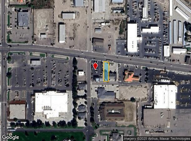
Property Record
1011 E Main St, Burley, ID 83318


NEARBY LISTINGS FOR SALE OR LEASE
Property Detail
1011 E Main St
Other Market Areas
Bennetts Addn
Burley, ID
BENNETTS ADDN T 10064 PT OF LOT 8 PAPA MURPHY'S PIZZA
RPBBN01001008B
Cassia
Commercialnec
Idaho
2025
8
2024
0.18 AC
950400
Idaho South Area
DEMOGRAPHICS near 1011 E Main St
1 Mile
3 Mile
5 Mile
2024 Total Population
6,634
20,374
25,229
2029 Population
7,285
22,246
27,488
Pop Growth 2024-2029
+ 9.81%
+ 9.19%
+ 8.95%
Average Age
35
36
37
2024 Total Households
2,337
7,075
8,750
HH Growth 2024-2029
+ 9.88%
+ 9.19%
+ 8.90%
Median Household Inc
$50,525
$58,288
$59,045
Avg Household Size
2.70
2.80
2.80
2024 Avg HH Vehicles
2.00
2.00
2.00
Median Home Value
$115,333
$211,391
$235,932
Median Year Built
1971
1975
1975
Nearby Places
Map Layers
Map Styles
 Street
 Aerial
- Restaurants
- Banks
- Shops
- Fitness
- Groceries
SALE & LEASE HISTORY
LISTING DATE
SALE/LEASE

Apr 03, 2025
For Sale
Nearby Properties
Address
Land Use
TOTAL SIZE
Lot Size
Zoning
Address
Land Use
TOTAL SIZE
Lot Size
Zoning
11.55 AC
Address
Land Use
TOTAL SIZE
Lot Size
Zoning
32.68 AC
Address
Land Use
TOTAL SIZE
Lot Size
Zoning
Address
Land Use
TOTAL SIZE
Lot Size
Zoning
24.96 AC
Address
Land Use
TOTAL SIZE
Lot Size
Zoning
Address
Land Use
TOTAL SIZE
Lot Size
Zoning
163,069 SF
13.79 AC
Address
Land Use
TOTAL SIZE
Lot Size
Zoning
27.59 AC
Address
Land Use
TOTAL SIZE
Lot Size
Zoning
Address
Land Use
TOTAL SIZE
Lot Size
Zoning
81,334 SF
6.92 AC
Address
Land Use
TOTAL SIZE
Lot Size
Zoning
45,704 SF
1.72 AC
Address
Land Use
TOTAL SIZE
Lot Size
Zoning
3.19 AC
Address
Land Use
TOTAL SIZE
Lot Size
Zoning
45,672 SF
4.43 AC
4
Address
Land Use
TOTAL SIZE
Lot Size
Zoning
46.25 AC
Address
Land Use
TOTAL SIZE
Lot Size
Zoning
5.59 AC
Address
Land Use
TOTAL SIZE
Lot Size
Zoning
2.07 AC
Address
Land Use
TOTAL SIZE
Lot Size
Zoning
16.64 AC
Address
Land Use
TOTAL SIZE
Lot Size
Zoning
7.05 AC
Address
Land Use
TOTAL SIZE
Lot Size
Zoning
33,732 SF
3 AC
4
Address
Land Use
TOTAL SIZE
Lot Size
Zoning
0.57 AC
Address
Land Use
TOTAL SIZE
Lot Size
Zoning
10,088 SF
2.54 AC
Address
Land Use
TOTAL SIZE
Lot Size
Zoning
77,650 SF
8.28 AC
Address
Land Use
TOTAL SIZE
Lot Size
Zoning
8.68 AC
Address
Land Use
TOTAL SIZE
Lot Size
Zoning
24,600 SF
8.72 AC
Address
Land Use
TOTAL SIZE
Lot Size
Zoning
4.45 AC
The World's #1 Commercial Real Estate Marketplace
Connect with us
© 2026 CoStar Group
The information above has been obtained from sources believed reliable. While we do not doubt its accuracy we have not verified it and make no guarantee, warranty or representation about it. It is your responsibility to independently confirm its accuracy and completeness. Any projections, opinions, assumptions, or estimates used are for example only and do not represent the current or future performance of the property. The value of this transaction to you depends on tax and other factors which should be evaluated by your tax, financial, and legal advisors. You and your advisors should conduct a careful, independent investigation of the property to determine to your satisfaction the suitability of the property for your needs.