Property Record
1011 Middletown Ave, Northford, CT 06472


NEARBY LISTINGS FOR SALE OR LEASE
-
-
-
-
No Photo
-
-
View all Northford listings for sale on LoopNet.com
Property Detail
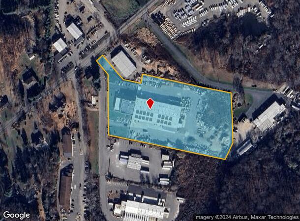
1011 Middletown Ave
Commercialbuilding
New Haven
X
Connecticut
09009C0314J
6.80 AC
2025
Branford
2025
Westchester/So Connecticut
186200
New Haven-Milford, CT
48,020 SF
NBRA-000056D-000000-000015-000002
DEMOGRAPHICS near 1011 Middletown Ave
1 Mile
3 Mile
5 Mile
2024 Total Population
2,497
21,761
78,946
2029 Population
2,504
21,716
78,830
Pop Growth 2024-2029
+ 0.28%
(0.21%)
(0.15%)
Average Age
44
45
43
2024 Total Households
896
8,427
31,400
HH Growth 2024-2029
+ 0.22%
(0.27%)
(0.21%)
Median Household Inc
$108,823
$100,368
$95,573
Avg Household Size
2.70
2.50
2.40
2024 Avg HH Vehicles
3.00
2.00
2.00
Median Home Value
$364,191
$323,207
$297,621
Median Year Built
1971
1969
1967
Nearby Places
Map Layers
Map Styles
 Street
 Aerial
- Restaurants
- Banks
- Shops
- Fitness
- Groceries
PUBLIC TRANSPORTATION
COMMUTER RAIL
DRIVE
WALK
Distance
15 min
7.4 mi
DRIVE
WALK
Distance
16 min
7.7 mi
AIRPORT
Tweed/New Haven
DRIVE
WALK
Distance
Tweed/New Haven
22 min
9.8 mi
Freight Ports
Port of New Haven
DRIVE
WALK
Distance
Port of New Haven
17 min
8.2 mi
Nearby Properties
Address
Land Use
TOTAL SIZE
Lot Size
Zoning
Address
Land Use
TOTAL SIZE
Lot Size
Zoning
100 AC
LO15
Address
Land Use
TOTAL SIZE
Lot Size
Zoning
268,989 SF
22.59 AC
R20
Address
Land Use
TOTAL SIZE
Lot Size
Zoning
50.70 AC
R40
Address
Land Use
TOTAL SIZE
Lot Size
Zoning
36,520 SF
4.64 AC
IL30
Address
Land Use
TOTAL SIZE
Lot Size
Zoning
134,029 SF
27.54 AC
R20
Address
Land Use
TOTAL SIZE
Lot Size
Zoning
97,898 SF
11.40 AC
R20
Address
Land Use
TOTAL SIZE
Lot Size
Zoning
3.84 AC
CB40
Address
Land Use
TOTAL SIZE
Lot Size
Zoning
9.80 AC
CA20
Address
Land Use
TOTAL SIZE
Lot Size
Zoning
15,432 SF
5.67 AC
CB40
Address
Land Use
TOTAL SIZE
Lot Size
Zoning
20.01 AC
R20
Address
Land Use
TOTAL SIZE
Lot Size
Zoning
91,455 SF
14.20 AC
RU-2
Address
Land Use
TOTAL SIZE
Lot Size
Zoning
7.21 AC
IL30
Address
Land Use
TOTAL SIZE
Lot Size
Zoning
64,827 SF
24.94 AC
R40
Address
Land Use
TOTAL SIZE
Lot Size
Zoning
60,678 SF
21.50 AC
R40
Address
Land Use
TOTAL SIZE
Lot Size
Zoning
88,351 SF
5.77 AC
IL30
Address
Land Use
TOTAL SIZE
Lot Size
Zoning
56,211 SF
7.15 AC
R20
Address
Land Use
TOTAL SIZE
Lot Size
Zoning
11.09 AC
CA20
Address
Land Use
TOTAL SIZE
Lot Size
Zoning
51.31 AC
R40
Address
Land Use
TOTAL SIZE
Lot Size
Zoning
53,901 SF
5.76 AC
R12
Address
Land Use
TOTAL SIZE
Lot Size
Zoning
135,052 SF
4.57 AC
IL30
Address
Land Use
TOTAL SIZE
Lot Size
Zoning
216,179 SF
23.57 AC
R20
Address
Land Use
TOTAL SIZE
Lot Size
Zoning
5,440 SF
19.17 AC
R40P
Address
Land Use
TOTAL SIZE
Lot Size
Zoning
53,581 SF
17.20 AC
R40
Address
Land Use
TOTAL SIZE
Lot Size
Zoning
78,394 SF
4 AC
D
Address
Land Use
TOTAL SIZE
Lot Size
Zoning
21,991 SF
0.80 AC
O12
Address
Land Use
TOTAL SIZE
Lot Size
Zoning
3.90 AC
IL80
Address
Land Use
TOTAL SIZE
Lot Size
Zoning
243,672 SF
18.85 AC
I3
Address
Land Use
TOTAL SIZE
Lot Size
Zoning
2.20 AC
O12
Address
Land Use
TOTAL SIZE
Lot Size
Zoning
187,910 SF
20.80 AC
IG80
Address
Land Use
TOTAL SIZE
Lot Size
Zoning
65,827 SF
25.16 AC
R80
The World's #1 Commercial Real Estate Marketplace
Connect with us
© 2026 CoStar Group
The information above has been obtained from sources believed reliable. While we do not doubt its accuracy we have not verified it and make no guarantee, warranty or representation about it. It is your responsibility to independently confirm its accuracy and completeness. Any projections, opinions, assumptions, or estimates used are for example only and do not represent the current or future performance of the property. The value of this transaction to you depends on tax and other factors which should be evaluated by your tax, financial, and legal advisors. You and your advisors should conduct a careful, independent investigation of the property to determine to your satisfaction the suitability of the property for your needs.